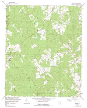
Bradley Topo Map South Carolina
To zoom in, hover over the map of Bradley
USGS Topo Quad 34082a2 - 1:24,000 scale
| Topo Map Name: | Bradley |
| USGS Topo Quad ID: | 34082a2 |
| Print Size: | ca. 21 1/4" wide x 27" high |
| Southeast Coordinates: | 34° N latitude / 82.125° W longitude |
| Map Center Coordinates: | 34.0625° N latitude / 82.1875° W longitude |
| U.S. State: | SC |
| Filename: | o34082a2.jpg |
| Download Map JPG Image: | Bradley topo map 1:24,000 scale |
| Map Type: | Topographic |
| Topo Series: | 7.5´ |
| Map Scale: | 1:24,000 |
| Source of Map Images: | United States Geological Survey (USGS) |
| Alternate Map Versions: |
Bradley SC 1950 Download PDF Buy paper map Bradley SC 1978, updated 1979 Download PDF Buy paper map Bradley SC 2011 Download PDF Buy paper map Bradley SC 2014 Download PDF Buy paper map |
| FStopo: | US Forest Service topo Bradley is available: Download FStopo PDF Download FStopo TIF |
1:24,000 Topo Quads surrounding Bradley
> Back to 34082a1 at 1:100,000 scale
> Back to 34082a1 at 1:250,000 scale
> Back to U.S. Topo Maps home
Bradley topo map: Gazetteer
Bradley: Bridges
Cothran Bridge elevation 128m 419′Bradley: Dams
South Carolina Noname 24011 D-1266 Dam elevation 145m 475′South Carolina Noname 24017 D-1271 Dam elevation 133m 436′
Bradley: Populated Places
Aix (historical) elevation 162m 531′Bradley elevation 178m 583′
Breezewood elevation 192m 629′
Callison elevation 155m 508′
Laco (historical) elevation 157m 515′
Rushville elevation 177m 580′
Verdery elevation 181m 593′
Whitehall elevation 170m 557′
Bradley: Springs
Powder Spring elevation 130m 426′Bradley: Streams
Beaverdam Branch elevation 133m 436′Big Cowhead Creek elevation 136m 446′
Chiles Branch elevation 131m 429′
Church Branch elevation 140m 459′
Coleman Branch elevation 131m 429′
Cunning Ford Creek elevation 128m 419′
Little Cowhead Creek elevation 138m 452′
Stillhouse Branch elevation 128m 419′
Bradley digital topo map on disk
Buy this Bradley topo map showing relief, roads, GPS coordinates and other geographical features, as a high-resolution digital map file on DVD:
South Carolina, Western North Carolina & Northeastern Georgia
Buy digital topo maps: South Carolina, Western North Carolina & Northeastern Georgia


