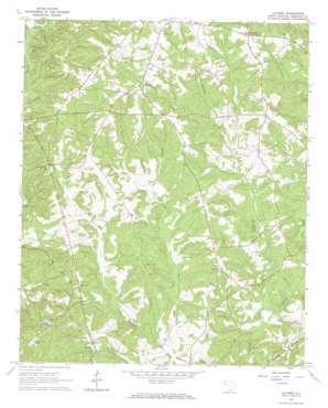
Latimer Topo Map South Carolina
To zoom in, hover over the map of Latimer
USGS Topo Quad 34082b5 - 1:24,000 scale
| Topo Map Name: | Latimer |
| USGS Topo Quad ID: | 34082b5 |
| Print Size: | ca. 21 1/4" wide x 27" high |
| Southeast Coordinates: | 34.125° N latitude / 82.5° W longitude |
| Map Center Coordinates: | 34.1875° N latitude / 82.5625° W longitude |
| U.S. State: | SC |
| Filename: | o34082b5.jpg |
| Download Map JPG Image: | Latimer topo map 1:24,000 scale |
| Map Type: | Topographic |
| Topo Series: | 7.5´ |
| Map Scale: | 1:24,000 |
| Source of Map Images: | United States Geological Survey (USGS) |
| Alternate Map Versions: |
Latimer SC 1964, updated 1966 Download PDF Buy paper map Latimer SC 2011 Download PDF Buy paper map Latimer SC 2014 Download PDF Buy paper map |
1:24,000 Topo Quads surrounding Latimer
> Back to 34082a1 at 1:100,000 scale
> Back to 34082a1 at 1:250,000 scale
> Back to U.S. Topo Maps home
Latimer topo map: Gazetteer
Latimer: Dams
Featherstone Pond Dam D-3028 elevation 175m 574′Latimer Pond Dam D-3033 elevation 154m 505′
Latimer: Populated Places
Brownlee Crossroads elevation 195m 639′Latimer elevation 174m 570′
Monterey (historical) elevation 177m 580′
Latimer: Streams
Baskin Branch elevation 149m 488′Gill Creek elevation 131m 429′
Morrow Creek elevation 130m 426′
Shanklin Creek elevation 124m 406′
Wilder Creek elevation 148m 485′
Wilson Creek elevation 140m 459′
Latimer digital topo map on disk
Buy this Latimer topo map showing relief, roads, GPS coordinates and other geographical features, as a high-resolution digital map file on DVD:
South Carolina, Western North Carolina & Northeastern Georgia
Buy digital topo maps: South Carolina, Western North Carolina & Northeastern Georgia


