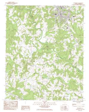
Woodruff Topo Map South Carolina
To zoom in, hover over the map of Woodruff
USGS Topo Quad 34082f1 - 1:24,000 scale
| Topo Map Name: | Woodruff |
| USGS Topo Quad ID: | 34082f1 |
| Print Size: | ca. 21 1/4" wide x 27" high |
| Southeast Coordinates: | 34.625° N latitude / 82° W longitude |
| Map Center Coordinates: | 34.6875° N latitude / 82.0625° W longitude |
| U.S. State: | SC |
| Filename: | o34082f1.jpg |
| Download Map JPG Image: | Woodruff topo map 1:24,000 scale |
| Map Type: | Topographic |
| Topo Series: | 7.5´ |
| Map Scale: | 1:24,000 |
| Source of Map Images: | United States Geological Survey (USGS) |
| Alternate Map Versions: |
Woodruff SC 1983, updated 1983 Download PDF Buy paper map Woodruff SC 2011 Download PDF Buy paper map Woodruff SC 2014 Download PDF Buy paper map |
1:24,000 Topo Quads surrounding Woodruff
> Back to 34082e1 at 1:100,000 scale
> Back to 34082a1 at 1:250,000 scale
> Back to U.S. Topo Maps home
Woodruff topo map: Gazetteer
Woodruff: Bridges
Allens Bridge elevation 171m 561′Harris Bridge elevation 166m 544′
Kilgore Bridge elevation 164m 538′
Nesbits Bridge elevation 170m 557′
Woodruff: Crossings
Interchange 16 elevation 205m 672′McKees Ferry (historical) elevation 169m 554′
Woodruff: Dams
Beaverdam Warrior WCD Im Dam D-3022 elevation 197m 646′G Lanford Pond Dam D-3385 elevation 200m 656′
Ingraham Pond Dam D-3012 elevation 195m 639′
M H Martin Pond Dam D-3386 elevation 201m 659′
Martins Last Pond Dam D-2967 elevation 211m 692′
South Carolina Noname 30021 D-3014 Dam elevation 207m 679′
South Carolina Noname 30023 D-3010 Dam elevation 208m 682′
South Carolina Noname 30024 D-3013 Dam elevation 209m 685′
Workman Incorporated Pond Dam D-3390 elevation 196m 643′
Woodruff: Mines
Gray Court Quarry elevation 232m 761′Woodruff: Populated Places
Martin Crossroads elevation 214m 702′Woodruff elevation 240m 787′
Youngs elevation 224m 734′
Woodruff: Post Offices
Woodruff Post Office elevation 238m 780′Youngs Post Office (historical) elevation 223m 731′
Woodruff: Rapids
Wofford Shoals elevation 177m 580′Woodruff: Reservoirs
G Lanford Pond elevation 200m 656′M H Martin Pond elevation 201m 659′
Martins Last Pond elevation 211m 692′
Workman Incorporated Pond elevation 196m 643′
Woodruff: Streams
Arnold Creek elevation 177m 580′Boggy Creek elevation 164m 538′
Brock Page Creek elevation 164m 538′
Buzzard Spring Branch elevation 177m 580′
Dildine Creek elevation 168m 551′
Durbin Creek elevation 168m 551′
Lick Creek elevation 171m 561′
Little Durbin Creek elevation 181m 593′
South Durbin Creek elevation 177m 580′
Wallace Branch elevation 194m 636′
Woodruff digital topo map on disk
Buy this Woodruff topo map showing relief, roads, GPS coordinates and other geographical features, as a high-resolution digital map file on DVD:
South Carolina, Western North Carolina & Northeastern Georgia
Buy digital topo maps: South Carolina, Western North Carolina & Northeastern Georgia


