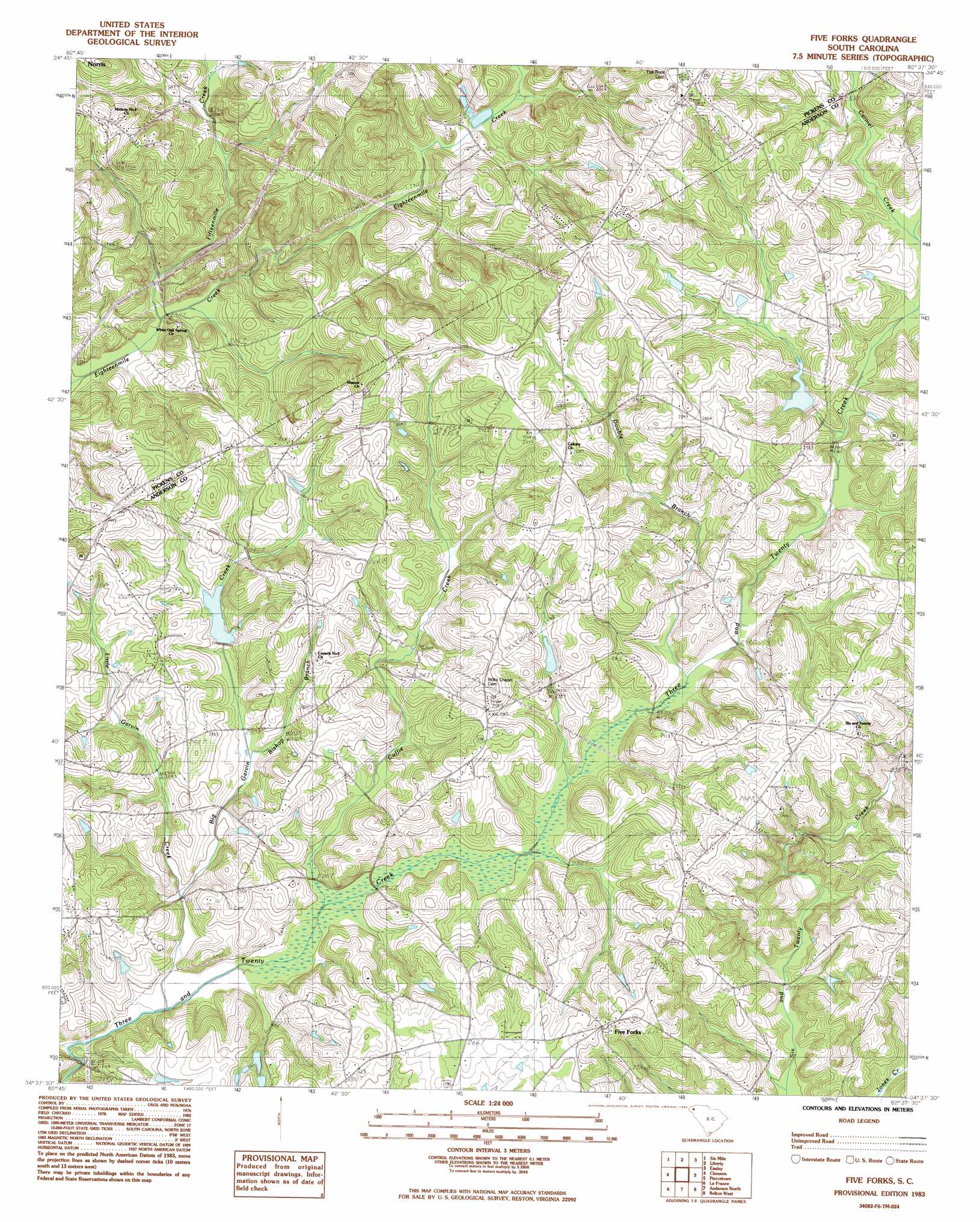
Five Forks Topo Map South Carolina
To zoom in, hover over the map of Five Forks
USGS Topo Quad 34082f6 - 1:24,000 scale
| Topo Map Name: | Five Forks |
| USGS Topo Quad ID: | 34082f6 |
| Print Size: | ca. 21 1/4" wide x 27" high |
| Southeast Coordinates: | 34.625° N latitude / 82.625° W longitude |
| Map Center Coordinates: | 34.6875° N latitude / 82.6875° W longitude |
| U.S. State: | SC |
| Filename: | o34082f6.jpg |
| Download Map JPG Image: | Five Forks topo map 1:24,000 scale |
| Map Type: | Topographic |
| Topo Series: | 7.5´ |
| Map Scale: | 1:24,000 |
| Source of Map Images: | United States Geological Survey (USGS) |
| Alternate Map Versions: |
Five Forks SC 1983, updated 1983 Download PDF Buy paper map Five Forks SC 2011 Download PDF Buy paper map Five Forks SC 2014 Download PDF Buy paper map |
1:24,000 Topo Quads surrounding Five Forks
Salem |
Sunset |
Pickens |
Dacusville |
Paris Mountain |
Old Pickens |
Six Mile |
Liberty |
Easley |
Greenville |
Seneca |
Clemson |
Five Forks |
Piercetown |
Pelzer |
Fair Play |
La France |
Anderson North |
Belton West |
Belton East |
Reed Creek |
Hartwell Ne |
Anderson South |
Saylors Crossroads |
Honea Path |
> Back to 34082e1 at 1:100,000 scale
> Back to 34082a1 at 1:250,000 scale
> Back to U.S. Topo Maps home
Five Forks topo map: Gazetteer
Five Forks: Dams
Clemson University Pond Dam D-3113 elevation 251m 823′F Revves Pond Dam D-3264 elevation 261m 856′
H T Double Pond Dam D-3271 elevation 275m 902′
South Carolina Noname 04014 D-3124 Dam elevation 242m 793′
South Carolina Noname 04020 D-3121 Dam elevation 258m 846′
South Carolina Noname 04031 D-3114 Dam elevation 253m 830′
Five Forks: Populated Places
Five Forks elevation 272m 892′Five Forks: Post Offices
Hickory Flat Post Office (historical) elevation 249m 816′Majors Post Office (historical) elevation 288m 944′
Septus Post Office (historical) elevation 272m 892′
Five Forks: Reservoirs
Gillespie Lake elevation 249m 816′Three and Twenty Creek Watershed Five Lake elevation 242m 793′
Five Forks: Streams
Big Garvin Creek elevation 219m 718′Carmel Creek elevation 248m 813′
Cuffie Creek elevation 224m 734′
Double Branch elevation 233m 764′
Fifteenmile Creek elevation 238m 780′
Little Garvin Creek elevation 227m 744′
Pickens Creek elevation 252m 826′
Five Forks digital topo map on disk
Buy this Five Forks topo map showing relief, roads, GPS coordinates and other geographical features, as a high-resolution digital map file on DVD:
South Carolina, Western North Carolina & Northeastern Georgia
Buy digital topo maps: South Carolina, Western North Carolina & Northeastern Georgia