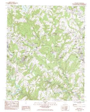
Wellford Topo Map South Carolina
To zoom in, hover over the map of Wellford
USGS Topo Quad 34082h1 - 1:24,000 scale
| Topo Map Name: | Wellford |
| USGS Topo Quad ID: | 34082h1 |
| Print Size: | ca. 21 1/4" wide x 27" high |
| Southeast Coordinates: | 34.875° N latitude / 82° W longitude |
| Map Center Coordinates: | 34.9375° N latitude / 82.0625° W longitude |
| U.S. State: | SC |
| Filename: | o34082h1.jpg |
| Download Map JPG Image: | Wellford topo map 1:24,000 scale |
| Map Type: | Topographic |
| Topo Series: | 7.5´ |
| Map Scale: | 1:24,000 |
| Source of Map Images: | United States Geological Survey (USGS) |
| Alternate Map Versions: |
Wellford SC 1983, updated 1983 Download PDF Buy paper map Wellford SC 2011 Download PDF Buy paper map Wellford SC 2014 Download PDF Buy paper map |
1:24,000 Topo Quads surrounding Wellford
> Back to 34082e1 at 1:100,000 scale
> Back to 34082a1 at 1:250,000 scale
> Back to U.S. Topo Maps home
Wellford topo map: Gazetteer
Wellford: Bridges
Anderson Bridge elevation 195m 639′Wellford: Crossings
Interchange 17 elevation 284m 931′Interchange 19 elevation 248m 813′
Interchange 63 elevation 262m 859′
Interchange 66 elevation 251m 823′
Interchange 68 elevation 247m 810′
Interchange 69 elevation 270m 885′
Interchange 70 elevation 248m 813′
Wellford: Dams
Berry Shoals Pond Dam D-3345 elevation 215m 705′E Cauldwell Pond Dam D-3353 elevation 237m 777′
South Carolina Noname 42002 D-3346 Dam elevation 221m 725′
South Carolina Noname 42015 D-3347 Dam elevation 214m 702′
South Carolina Noname 42016 D-3348 Dam elevation 198m 649′
South Carolina Noname 42019 D-3354 Dam elevation 215m 705′
Startex Mill Pond Number One Dam D-3342 elevation 236m 774′
Wellford: Populated Places
Ashley elevation 229m 751′Brookhaven elevation 213m 698′
Brookside Village elevation 243m 797′
Calvert elevation 259m 849′
Cambridge elevation 239m 784′
Clevedale elevation 232m 761′
Cold Spring elevation 254m 833′
Cunningham elevation 277m 908′
Fairforest elevation 256m 839′
Fairmont elevation 211m 692′
Fairmont Mills elevation 242m 793′
Forest Park elevation 249m 816′
Fort Prince Farms elevation 272m 892′
Fox Hunt elevation 246m 807′
Franklin Village elevation 262m 859′
Gary Creek elevation 266m 872′
Greenridge elevation 249m 816′
Hadden Crossroads elevation 263m 862′
Hadden Heights elevation 251m 823′
Holly Tree elevation 254m 833′
Jackson Mill elevation 256m 839′
Lake Ridge elevation 224m 734′
Larkin elevation 250m 820′
Mount Zion elevation 273m 895′
Palmetto West Mobile Home Park elevation 251m 823′
Pine Grove elevation 230m 754′
Pinebrook elevation 230m 754′
Pinnacle Heights elevation 266m 872′
River Edge elevation 209m 685′
Shoresbrook elevation 254m 833′
Sigsbee elevation 272m 892′
Snoddy elevation 241m 790′
Startex elevation 248m 813′
Twin Lakes elevation 223m 731′
Valley Dale Park elevation 207m 679′
Water Oaks elevation 228m 748′
Wellford elevation 268m 879′
Wellford Estates elevation 252m 826′
Wellington West elevation 223m 731′
West Forest elevation 260m 853′
Westhaven elevation 259m 849′
Westview Heights elevation 271m 889′
Woodfield elevation 255m 836′
Wellford: Rapids
Berry Shoals elevation 218m 715′Wellford: Reservoirs
Berry Shoals Pond elevation 215m 705′Lake Cooley elevation 240m 787′
Shoals Lake elevation 218m 715′
Shores Brook Lake (historical) elevation 229m 751′
Silver Lake elevation 221m 725′
Twin Lakes elevation 198m 649′
Wessons Lake elevation 253m 830′
Wellford: Streams
Frey Creek elevation 212m 695′Grays Creek elevation 228m 748′
Jimmies Creek elevation 204m 669′
Jordan Creek elevation 233m 764′
Wellford digital topo map on disk
Buy this Wellford topo map showing relief, roads, GPS coordinates and other geographical features, as a high-resolution digital map file on DVD:
South Carolina, Western North Carolina & Northeastern Georgia
Buy digital topo maps: South Carolina, Western North Carolina & Northeastern Georgia


