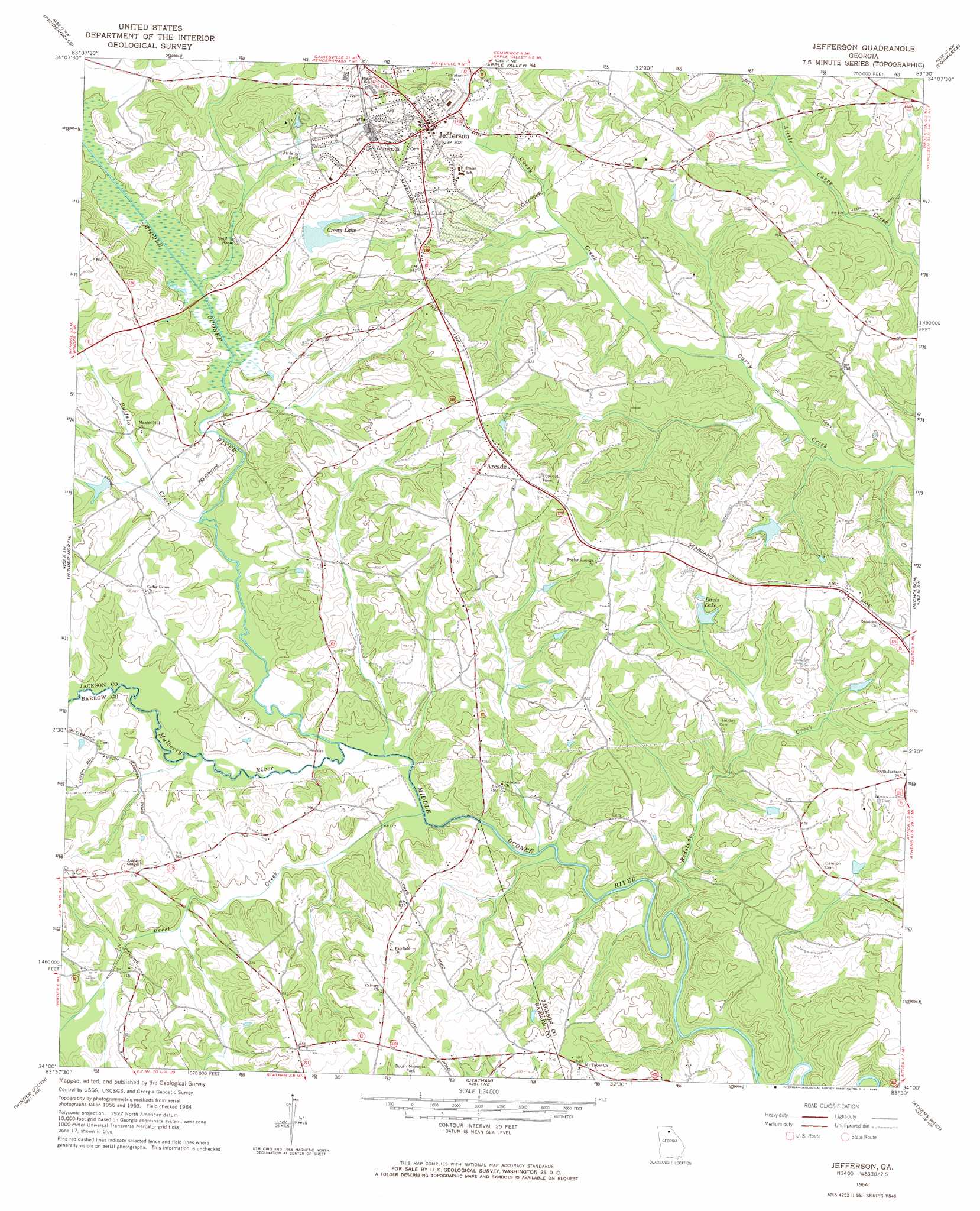
Jefferson Topo Map Georgia
To zoom in, hover over the map of Jefferson
USGS Topo Quad 34083a5 - 1:24,000 scale
| Topo Map Name: | Jefferson |
| USGS Topo Quad ID: | 34083a5 |
| Print Size: | ca. 21 1/4" wide x 27" high |
| Southeast Coordinates: | 34° N latitude / 83.5° W longitude |
| Map Center Coordinates: | 34.0625° N latitude / 83.5625° W longitude |
| U.S. State: | GA |
| Filename: | o34083a5.jpg |
| Download Map JPG Image: | Jefferson topo map 1:24,000 scale |
| Map Type: | Topographic |
| Topo Series: | 7.5´ |
| Map Scale: | 1:24,000 |
| Source of Map Images: | United States Geological Survey (USGS) |
| Alternate Map Versions: |
Jefferson GA 1964, updated 1965 Download PDF Buy paper map Jefferson GA 2011 Download PDF Buy paper map Jefferson GA 2014 Download PDF Buy paper map |
1:24,000 Topo Quads surrounding Jefferson
Gainesville |
Gillsville |
Maysville |
Homer |
Ashland |
Chestnut Mountain |
Pendergrass |
Apple Valley |
Commerce |
Ila |
Auburn |
Winder North |
Jefferson |
Nicholson |
Hull |
Bold Springs |
Winder South |
Statham |
Athens West |
Athens East |
Between |
Monroe |
High Shoals |
Watkinsville |
Barnett Shoals |
> Back to 34083a1 at 1:100,000 scale
> Back to 34082a1 at 1:250,000 scale
> Back to U.S. Topo Maps home
Jefferson topo map: Gazetteer
Jefferson: Bridges
Double Bridges elevation 207m 679′Joseph A Johnson Bridge elevation 213m 698′
Long Bridge elevation 213m 698′
Jefferson: Dams
Crowes Lake Dam elevation 229m 751′Davis Lake Dam elevation 239m 784′
Johnsons Lake Dam elevation 223m 731′
Rives Lake Dam elevation 221m 725′
Terry Dam elevation 230m 754′
Weaver Lake Dam elevation 238m 780′
Williamsons Lake Dam elevation 243m 797′
Jefferson: Populated Places
Arcade elevation 267m 875′Jefferson elevation 229m 751′
Red Stone elevation 256m 839′
Talasee (historical) elevation 232m 761′
Jefferson: Post Offices
Jefferson Post Office elevation 232m 761′Jefferson: Reservoirs
Crowes Lake elevation 226m 741′Crows Lake elevation 229m 751′
Davis Lake elevation 239m 784′
Johnsons Lake elevation 223m 731′
Rives Lake elevation 221m 725′
Terry Lake elevation 230m 754′
Weaver Lake elevation 238m 780′
Williamsons Lake elevation 243m 797′
Jefferson: Streams
Beech Creek elevation 207m 679′Buffalo Creek elevation 207m 679′
Mulberry River elevation 207m 679′
Redstone Creek elevation 203m 666′
Jefferson digital topo map on disk
Buy this Jefferson topo map showing relief, roads, GPS coordinates and other geographical features, as a high-resolution digital map file on DVD:
South Carolina, Western North Carolina & Northeastern Georgia
Buy digital topo maps: South Carolina, Western North Carolina & Northeastern Georgia