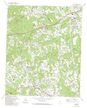
Auburn Topo Map Georgia
To zoom in, hover over the map of Auburn
USGS Topo Quad 34083a7 - 1:24,000 scale
| Topo Map Name: | Auburn |
| USGS Topo Quad ID: | 34083a7 |
| Print Size: | ca. 21 1/4" wide x 27" high |
| Southeast Coordinates: | 34° N latitude / 83.75° W longitude |
| Map Center Coordinates: | 34.0625° N latitude / 83.8125° W longitude |
| U.S. State: | GA |
| Filename: | o34083a7.jpg |
| Download Map JPG Image: | Auburn topo map 1:24,000 scale |
| Map Type: | Topographic |
| Topo Series: | 7.5´ |
| Map Scale: | 1:24,000 |
| Source of Map Images: | United States Geological Survey (USGS) |
| Alternate Map Versions: |
Auburn GA 1964, updated 1965 Download PDF Buy paper map Auburn GA 1964, updated 1974 Download PDF Buy paper map Auburn GA 1964, updated 1990 Download PDF Buy paper map Auburn GA 1993, updated 1993 Download PDF Buy paper map Auburn GA 2011 Download PDF Buy paper map Auburn GA 2014 Download PDF Buy paper map |
1:24,000 Topo Quads surrounding Auburn
> Back to 34083a1 at 1:100,000 scale
> Back to 34082a1 at 1:250,000 scale
> Back to U.S. Topo Maps home
Auburn topo map: Gazetteer
Auburn: Crossings
Exit 48 elevation 285m 935′Exit 49 elevation 280m 918′
Auburn: Dams
Coleman Mill Dam elevation 268m 879′Cruce Dam elevation 253m 830′
Oglesby Dam elevation 258m 846′
Auburn: Parks
Hoschton Recreation Park elevation 252m 826′Auburn: Populated Places
Algernon (historical) elevation 249m 816′Auburn elevation 320m 1049′
Braselton elevation 277m 908′
Cains Courthouse (historical) elevation 310m 1017′
Carl elevation 329m 1079′
Cedar Hill elevation 306m 1003′
Grapevine (historical) elevation 304m 997′
Hoschton elevation 275m 902′
Thompsons Mill elevation 255m 836′
Auburn: Reservoirs
Cruce Lake elevation 253m 830′Lake Upper Mulberry River Eleven elevation 268m 879′
Oglesby Lake elevation 258m 846′
Auburn: Streams
Beaver Dam Creek elevation 234m 767′Duncan Creek elevation 239m 784′
Little Mulberry River elevation 231m 757′
Little Mulberry River elevation 265m 869′
Lollis Creek elevation 256m 839′
Rock Creek elevation 237m 777′
Wheeler Creek elevation 249m 816′
Auburn: Summits
Pool Mountain elevation 335m 1099′Auburn digital topo map on disk
Buy this Auburn topo map showing relief, roads, GPS coordinates and other geographical features, as a high-resolution digital map file on DVD:
South Carolina, Western North Carolina & Northeastern Georgia
Buy digital topo maps: South Carolina, Western North Carolina & Northeastern Georgia


