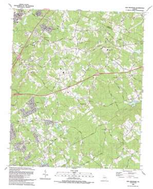
Hog Mountain Topo Map Georgia
To zoom in, hover over the map of Hog Mountain
USGS Topo Quad 34083a8 - 1:24,000 scale
| Topo Map Name: | Hog Mountain |
| USGS Topo Quad ID: | 34083a8 |
| Print Size: | ca. 21 1/4" wide x 27" high |
| Southeast Coordinates: | 34° N latitude / 83.875° W longitude |
| Map Center Coordinates: | 34.0625° N latitude / 83.9375° W longitude |
| U.S. State: | GA |
| Filename: | o34083a8.jpg |
| Download Map JPG Image: | Hog Mountain topo map 1:24,000 scale |
| Map Type: | Topographic |
| Topo Series: | 7.5´ |
| Map Scale: | 1:24,000 |
| Source of Map Images: | United States Geological Survey (USGS) |
| Alternate Map Versions: |
Hog Mountain GA 1964, updated 1965 Download PDF Buy paper map Hog Mountain GA 1964, updated 1974 Download PDF Buy paper map Hog Mountain GA 1964, updated 1987 Download PDF Buy paper map Hog Mountain GA 1992, updated 1993 Download PDF Buy paper map Hog Mountain GA 2011 Download PDF Buy paper map Hog Mountain GA 2014 Download PDF Buy paper map |
1:24,000 Topo Quads surrounding Hog Mountain
> Back to 34083a1 at 1:100,000 scale
> Back to 34082a1 at 1:250,000 scale
> Back to U.S. Topo Maps home
Hog Mountain topo map: Gazetteer
Hog Mountain: Crossings
Exit 1 elevation 333m 1092′Exit 46 elevation 315m 1033′
Exit 47 elevation 364m 1194′
Hog Mountain: Dams
Crowe Lake Dam elevation 353m 1158′Harrison Dam elevation 302m 990′
Hogan Lake Dam elevation 335m 1099′
Suwanee Creek Lake Dam elevation 316m 1036′
Hog Mountain: Parks
Fort Daniel Monument elevation 361m 1184′Hog Mountain: Populated Places
Cain Manor elevation 348m 1141′Gravel Springs elevation 355m 1164′
Habersham Hills elevation 331m 1085′
Hog Mountain elevation 359m 1177′
Myrdell Estates elevation 359m 1177′
Pebble Brook elevation 350m 1148′
Pine Ridge Point elevation 354m 1161′
Ridgewood elevation 324m 1062′
Rock Creek Estates elevation 340m 1115′
Saddlewood elevation 313m 1026′
Sardis Estates elevation 349m 1145′
Somerset Hills elevation 359m 1177′
Springlake Estates elevation 359m 1177′
The Circles elevation 334m 1095′
Timberwood Estates elevation 351m 1151′
Woodbriar East elevation 348m 1141′
Woodhaven Downs elevation 334m 1095′
Woodland Springs elevation 308m 1010′
Hog Mountain: Post Offices
Lawrenceville North Post Office elevation 318m 1043′Hog Mountain: Reservoirs
Crowe Lake elevation 353m 1158′Hogan Lake elevation 335m 1099′
Partial Lake elevation 331m 1085′
Suwanee Creek Lake elevation 316m 1036′
Hog Mountain: Streams
Little Ivy Creek elevation 307m 1007′Hog Mountain digital topo map on disk
Buy this Hog Mountain topo map showing relief, roads, GPS coordinates and other geographical features, as a high-resolution digital map file on DVD:
South Carolina, Western North Carolina & Northeastern Georgia
Buy digital topo maps: South Carolina, Western North Carolina & Northeastern Georgia


