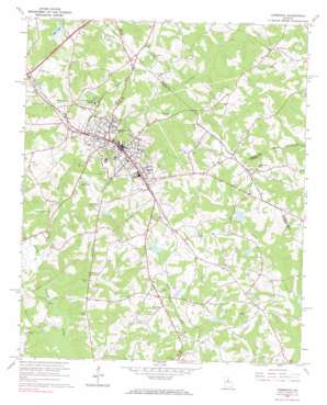
Commerce Topo Map Georgia
To zoom in, hover over the map of Commerce
USGS Topo Quad 34083b4 - 1:24,000 scale
| Topo Map Name: | Commerce |
| USGS Topo Quad ID: | 34083b4 |
| Print Size: | ca. 21 1/4" wide x 27" high |
| Southeast Coordinates: | 34.125° N latitude / 83.375° W longitude |
| Map Center Coordinates: | 34.1875° N latitude / 83.4375° W longitude |
| U.S. State: | GA |
| Filename: | o34083b4.jpg |
| Download Map JPG Image: | Commerce topo map 1:24,000 scale |
| Map Type: | Topographic |
| Topo Series: | 7.5´ |
| Map Scale: | 1:24,000 |
| Source of Map Images: | United States Geological Survey (USGS) |
| Alternate Map Versions: |
Commerce GA 1964, updated 1965 Download PDF Buy paper map Commerce GA 1964, updated 1965 Download PDF Buy paper map Commerce GA 2011 Download PDF Buy paper map Commerce GA 2014 Download PDF Buy paper map |
1:24,000 Topo Quads surrounding Commerce
> Back to 34083a1 at 1:100,000 scale
> Back to 34082a1 at 1:250,000 scale
> Back to U.S. Topo Maps home
Commerce topo map: Gazetteer
Commerce: Airports
Doug Bolton Field elevation 262m 859′Commerce: Dams
Hills Lake Dam elevation 225m 738′Hoods Lake Dam elevation 264m 866′
Iveys Lake Dam elevation 253m 830′
Marlow Lake Dam elevation 233m 764′
Sanders Lake Dam elevation 246m 807′
Sandy Creek Structure 12 Dam elevation 226m 741′
Sandy Creek Structure 15 Dam elevation 238m 780′
Sandy Creek Structure 18 Dam elevation 238m 780′
Sandy Creek Structure 23 Dam elevation 231m 757′
Commerce: Parks
Commerce City Park elevation 262m 859′Commerce Commercial Historic District elevation 280m 918′
Commerce: Populated Places
Commerce elevation 278m 912′Five Points elevation 239m 784′
Commerce: Reservoirs
Hills Lake elevation 225m 738′Hoods Lake elevation 264m 866′
Iveys Lake elevation 253m 830′
Marlow Lake elevation 233m 764′
Reservoir 12 elevation 226m 741′
Reservoir 15 elevation 238m 780′
Reservoir 18 elevation 238m 780′
Reservoir 23 elevation 231m 757′
Sanders Lake elevation 246m 807′
Commerce: Streams
Borders Creek elevation 207m 679′Parks Creek elevation 207m 679′
Riley Branch elevation 226m 741′
Turkey Creek elevation 219m 718′
Commerce digital topo map on disk
Buy this Commerce topo map showing relief, roads, GPS coordinates and other geographical features, as a high-resolution digital map file on DVD:
South Carolina, Western North Carolina & Northeastern Georgia
Buy digital topo maps: South Carolina, Western North Carolina & Northeastern Georgia


