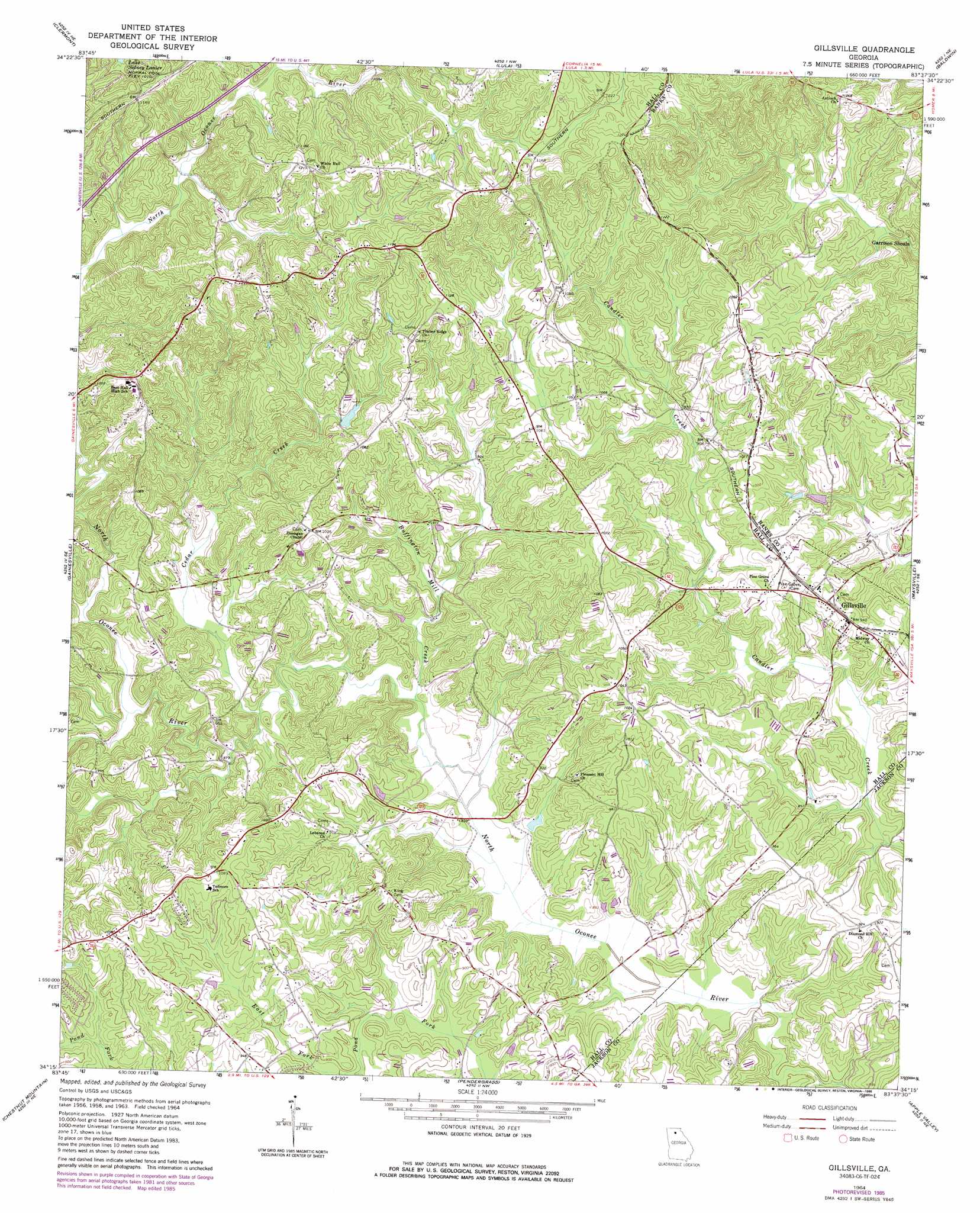
Gillsville Topo Map Georgia
To zoom in, hover over the map of Gillsville
USGS Topo Quad 34083c6 - 1:24,000 scale
| Topo Map Name: | Gillsville |
| USGS Topo Quad ID: | 34083c6 |
| Print Size: | ca. 21 1/4" wide x 27" high |
| Southeast Coordinates: | 34.25° N latitude / 83.625° W longitude |
| Map Center Coordinates: | 34.3125° N latitude / 83.6875° W longitude |
| U.S. State: | GA |
| Filename: | o34083c6.jpg |
| Download Map JPG Image: | Gillsville topo map 1:24,000 scale |
| Map Type: | Topographic |
| Topo Series: | 7.5´ |
| Map Scale: | 1:24,000 |
| Source of Map Images: | United States Geological Survey (USGS) |
| Alternate Map Versions: |
Gillsville GA 1964, updated 1965 Download PDF Buy paper map Gillsville GA 1964, updated 1975 Download PDF Buy paper map Gillsville GA 1964, updated 1985 Download PDF Buy paper map Gillsville GA 2011 Download PDF Buy paper map Gillsville GA 2014 Download PDF Buy paper map |
1:24,000 Topo Quads surrounding Gillsville
Dahlonega |
Cleveland |
Leaf |
Clarkesville |
Ayersville |
Murrayville |
Clermont |
Lula |
Baldwin |
Russell Lake |
Chestatee |
Gainesville |
Gillsville |
Maysville |
Homer |
Flowery Branch |
Chestnut Mountain |
Pendergrass |
Apple Valley |
Commerce |
Hog Mountain |
Auburn |
Winder North |
Jefferson |
Nicholson |
> Back to 34083a1 at 1:100,000 scale
> Back to 34082a1 at 1:250,000 scale
> Back to U.S. Topo Maps home
Gillsville topo map: Gazetteer
Gillsville: Beaches
Garrison Shoals elevation 270m 885′Gillsville: Dams
Gilbert Dam elevation 276m 905′Grove River Structure Number 15 Dam elevation 269m 882′
Miller Lake Dam elevation 304m 997′
Gillsville: Parks
Gillsville Historic District elevation 288m 944′Gillsville: Populated Places
Dunagan elevation 312m 1023′Gillsville elevation 287m 941′
Jarrett elevation 286m 938′
Gillsville: Reservoirs
Miller Lake elevation 304m 997′Reservoir 15 elevation 269m 882′
Gillsville: Streams
Buffington Mill Creek elevation 253m 830′Cedar Creek elevation 261m 856′
Gillsville digital topo map on disk
Buy this Gillsville topo map showing relief, roads, GPS coordinates and other geographical features, as a high-resolution digital map file on DVD:
South Carolina, Western North Carolina & Northeastern Georgia
Buy digital topo maps: South Carolina, Western North Carolina & Northeastern Georgia