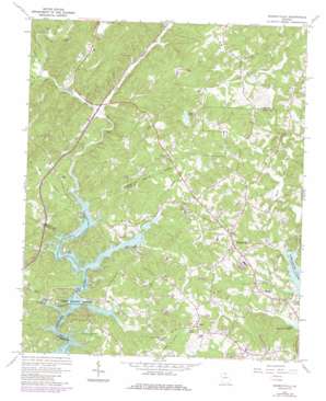
Murrayville Topo Map Georgia
To zoom in, hover over the map of Murrayville
USGS Topo Quad 34083d8 - 1:24,000 scale
| Topo Map Name: | Murrayville |
| USGS Topo Quad ID: | 34083d8 |
| Print Size: | ca. 21 1/4" wide x 27" high |
| Southeast Coordinates: | 34.375° N latitude / 83.875° W longitude |
| Map Center Coordinates: | 34.4375° N latitude / 83.9375° W longitude |
| U.S. State: | GA |
| Filename: | o34083d8.jpg |
| Download Map JPG Image: | Murrayville topo map 1:24,000 scale |
| Map Type: | Topographic |
| Topo Series: | 7.5´ |
| Map Scale: | 1:24,000 |
| Source of Map Images: | United States Geological Survey (USGS) |
| Alternate Map Versions: |
Murrayville GA 1964, updated 1965 Download PDF Buy paper map Murrayville GA 1964, updated 1972 Download PDF Buy paper map Murrayville GA 1964, updated 1986 Download PDF Buy paper map Murrayville GA 2011 Download PDF Buy paper map Murrayville GA 2014 Download PDF Buy paper map |
1:24,000 Topo Quads surrounding Murrayville
> Back to 34083a1 at 1:100,000 scale
> Back to 34082a1 at 1:250,000 scale
> Back to U.S. Topo Maps home
Murrayville topo map: Gazetteer
Murrayville: Bridges
Brierpatch Bridge (historical) elevation 334m 1095′Toto Creek Bridge elevation 328m 1076′
Wilkie Bridge elevation 326m 1069′
Murrayville: Capes
Toto Creek Access Point elevation 334m 1095′Murrayville: Crossings
Grant Ford (historical) elevation 326m 1069′Wilkie Ford (historical) elevation 326m 1069′
Murrayville: Dams
Calhoun Dam (historical) elevation 334m 1095′Ponys Lake Dam elevation 351m 1151′
Ponys Lake Dam elevation 350m 1148′
Woodmen Youth Camp Dam elevation 348m 1141′
Murrayville: Mines
Calhoun Gold Mine elevation 408m 1338′Dahlonega Quarry elevation 406m 1332′
Turkey Hill Mine elevation 453m 1486′
Murrayville: Parks
Lumpkin Company Park elevation 347m 1138′Murrayville: Populated Places
Albert (historical) elevation 395m 1295′Bark Camp Place elevation 394m 1292′
Belvedere Acres elevation 393m 1289′
Big Oak elevation 388m 1272′
Broadnax elevation 366m 1200′
Cool Springs Forest elevation 381m 1250′
Elrod elevation 357m 1171′
Halfway (historical) elevation 371m 1217′
Indian Hills elevation 356m 1167′
Lake Shore elevation 361m 1184′
Leisure Lake elevation 342m 1122′
Marlow elevation 386m 1266′
Mountain View elevation 342m 1122′
Murrayville elevation 393m 1289′
New Bridge (historical) elevation 331m 1085′
North Forest elevation 373m 1223′
Price elevation 396m 1299′
Sardis Heights elevation 389m 1276′
Timberidge elevation 367m 1204′
Wahoo Forest elevation 341m 1118′
Wahoo Valley elevation 348m 1141′
Welchell elevation 348m 1141′
Murrayville: Reservoirs
Pine Lake elevation 380m 1246′Ponys Lake elevation 350m 1148′
Ponys Lake elevation 348m 1141′
Woodmen Youth Camp Lake elevation 348m 1141′
Murrayville: Streams
Bells Branch elevation 336m 1102′Bull Creek elevation 346m 1135′
Cane Branch elevation 326m 1069′
Cane Creek elevation 335m 1099′
Gin Branch elevation 326m 1069′
Little Yellow Creek elevation 328m 1076′
Long Branch elevation 328m 1076′
Ralston Branch elevation 335m 1099′
Split Oak Creek elevation 333m 1092′
Toto Creek elevation 328m 1076′
Town Creek elevation 334m 1095′
Yellow Creek elevation 326m 1069′
Murrayville: Summits
Turkey Hill elevation 458m 1502′Murrayville digital topo map on disk
Buy this Murrayville topo map showing relief, roads, GPS coordinates and other geographical features, as a high-resolution digital map file on DVD:
South Carolina, Western North Carolina & Northeastern Georgia
Buy digital topo maps: South Carolina, Western North Carolina & Northeastern Georgia


