Oakway Topo Map South Carolina
To zoom in, hover over the map of Oakway
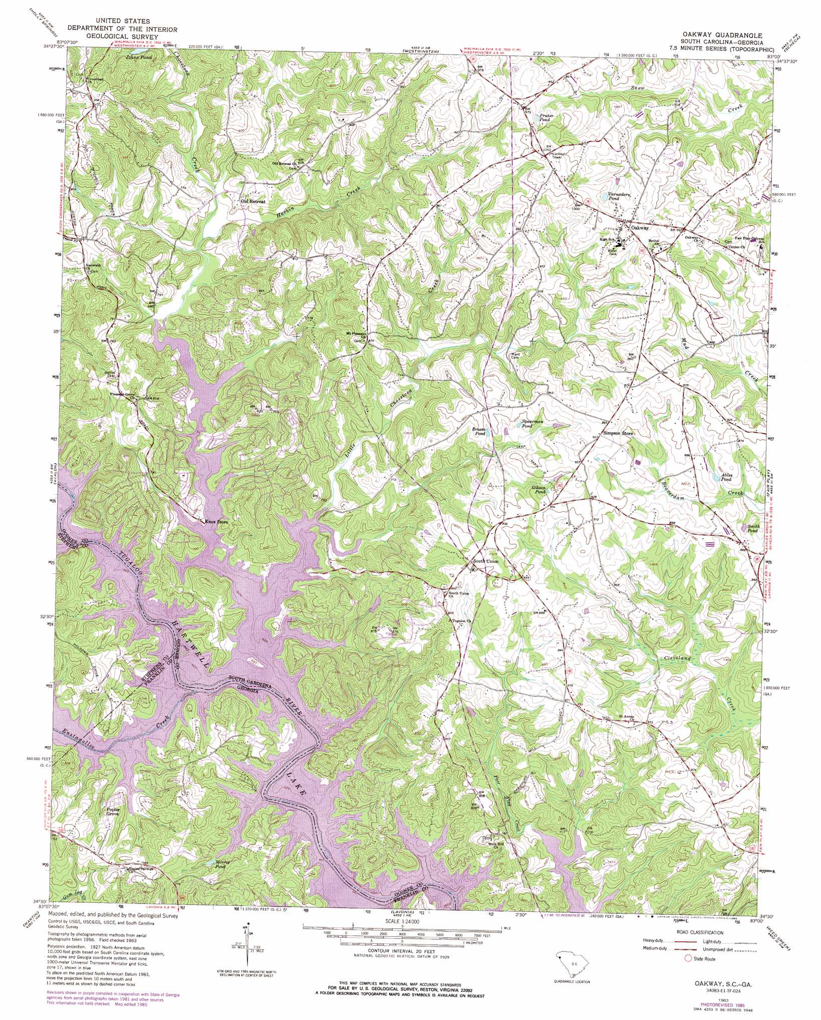
USGS Topo Quad 34083e1 - 1:24,000 scale
| Topo Map Name: | Oakway |
| USGS Topo Quad ID: | 34083e1 |
| Print Size: | ca. 21 1/4" wide x 27" high |
| Southeast Coordinates: | 34.5° N latitude / 83° W longitude |
| Map Center Coordinates: | 34.5625° N latitude / 83.0625° W longitude |
| U.S. States: | SC, GA |
| Filename: | o34083e1.jpg |
| Download Map JPG Image: | Oakway topo map 1:24,000 scale |
| Map Type: | Topographic |
| Topo Series: | 7.5´ |
| Map Scale: | 1:24,000 |
| Source of Map Images: | United States Geological Survey (USGS) |
| Alternate Map Versions: |
Oakway SC 1963, updated 1964 Download PDF Buy paper map Oakway SC 1963, updated 1975 Download PDF Buy paper map Oakway SC 1963, updated 1986 Download PDF Buy paper map Oakway SC 2011 Download PDF Buy paper map Oakway SC 2014 Download PDF Buy paper map |
1:24,000 Topo Quads surrounding Oakway
Rainy Mountain |
Whetstone |
Walhalla |
Old Pickens |
Six Mile |
Tugaloo Lake |
Holly Springs |
Westminster |
Seneca |
Clemson |
Toccoa |
Avalon |
Oakway |
Fair Play |
La France |
Red Hill |
Martin |
Lavonia |
Reed Creek |
Hartwell Ne |
Ashland |
Carnesville |
Royston |
Hartwell |
Hartwell Dam |
> Back to 34083e1 at 1:100,000 scale
> Back to 34082a1 at 1:250,000 scale
> Back to U.S. Topo Maps home
Oakway topo map: Gazetteer
Oakway: Bars
Harris Shoal (historical) elevation 201m 659′Harris Shoal (historical) elevation 201m 659′
Oakway: Crossings
Shelor Ferry (historical) elevation 201m 659′Shelor Ferry (historical) elevation 201m 659′
Stribling Ferry (historical) elevation 201m 659′
Stribling Ferry (historical) elevation 201m 659′
Oakway: Populated Places
Fairplay Shores elevation 207m 679′Oakway elevation 296m 971′
Poplar Grove elevation 211m 692′
Port Bass elevation 220m 721′
South Union elevation 275m 902′
Oakway: Reservoirs
Ables Pond elevation 251m 823′Broom Pond elevation 264m 866′
Gibson Pond elevation 269m 882′
Morris Pond elevation 205m 672′
Prater Pond elevation 290m 951′
Smith Pond elevation 249m 816′
Spearman Pond elevation 267m 875′
Varnadore Pond elevation 282m 925′
Oakway: Streams
Choestoea Creek elevation 201m 659′Harbin Creek elevation 206m 675′
Little Choestoea Creek elevation 201m 659′
Oakway digital topo map on disk
Buy this Oakway topo map showing relief, roads, GPS coordinates and other geographical features, as a high-resolution digital map file on DVD:
South Carolina, Western North Carolina & Northeastern Georgia
Buy digital topo maps: South Carolina, Western North Carolina & Northeastern Georgia