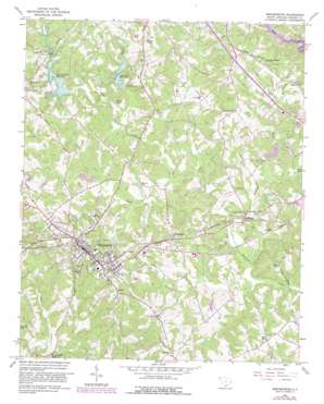
Westminster Topo Map South Carolina
To zoom in, hover over the map of Westminster
USGS Topo Quad 34083f1 - 1:24,000 scale
| Topo Map Name: | Westminster |
| USGS Topo Quad ID: | 34083f1 |
| Print Size: | ca. 21 1/4" wide x 27" high |
| Southeast Coordinates: | 34.625° N latitude / 83° W longitude |
| Map Center Coordinates: | 34.6875° N latitude / 83.0625° W longitude |
| U.S. State: | SC |
| Filename: | o34083f1.jpg |
| Download Map JPG Image: | Westminster topo map 1:24,000 scale |
| Map Type: | Topographic |
| Topo Series: | 7.5´ |
| Map Scale: | 1:24,000 |
| Source of Map Images: | United States Geological Survey (USGS) |
| Alternate Map Versions: |
Westminster SC 1963, updated 1964 Download PDF Buy paper map Westminster SC 1963, updated 1981 Download PDF Buy paper map Westminster SC 2011 Download PDF Buy paper map Westminster SC 2014 Download PDF Buy paper map |
1:24,000 Topo Quads surrounding Westminster
> Back to 34083e1 at 1:100,000 scale
> Back to 34082a1 at 1:250,000 scale
> Back to U.S. Topo Maps home
Westminster topo map: Gazetteer
Westminster: Dams
Adams Pond Dam D-1654 elevation 268m 879′Coneross Creek D-1654 Dam elevation 268m 879′
Coneross Creek WCD Dam Number 21 D-1656 elevation 247m 810′
Coneross Creek WCD Dam Number Eight D-1653 elevation 269m 882′
County Country Club Pond Dam D-1658 elevation 257m 843′
Duke Power Dam elevation 234m 767′
Freeman Pond Dam D-1662 elevation 242m 793′
Johns Pond Dam D-1663 elevation 233m 764′
Webbs Pond Dam D-1657 elevation 251m 823′
Westminster: Populated Places
Avondale elevation 261m 856′Brock elevation 285m 935′
Clearmont elevation 282m 925′
Conneross (historical) elevation 273m 895′
Eastminster elevation 276m 905′
Five Points elevation 308m 1010′
Hicks Store elevation 286m 938′
Jason elevation 279m 915′
Johns Mill elevation 213m 698′
Oconee Estates elevation 282m 925′
Phinney elevation 279m 915′
Poplar Springs Ridge elevation 263m 862′
Retreat elevation 290m 951′
Richland elevation 248m 813′
Ridgeland Estates elevation 259m 849′
Westminster elevation 284m 931′
Westminster: Post Offices
Westminster Post Office elevation 287m 941′Westminster: Reservoirs
Adams Pond elevation 268m 879′Adams Pond elevation 255m 836′
Coneross Creek Reservoir elevation 268m 879′
Coneross Watershed 21 Reservoir elevation 247m 810′
Coneross Watershed 9-A Reservoir elevation 263m 862′
Freeman Pond elevation 239m 784′
Johns Pond elevation 233m 764′
Marritt Pond elevation 250m 820′
Negro Fork Reservoir elevation 254m 833′
Peters Pond elevation 254m 833′
Reids Pond elevation 278m 912′
Webb Pond elevation 251m 823′
Webbs Pond elevation 256m 839′
Westminster: Streams
Colonels Fork Creek elevation 235m 770′Halfway Branch elevation 255m 836′
Negro Fork elevation 247m 810′
Richland Creek elevation 229m 751′
White Fork elevation 268m 879′
Westminster digital topo map on disk
Buy this Westminster topo map showing relief, roads, GPS coordinates and other geographical features, as a high-resolution digital map file on DVD:
South Carolina, Western North Carolina & Northeastern Georgia
Buy digital topo maps: South Carolina, Western North Carolina & Northeastern Georgia


