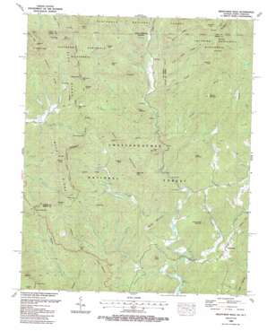
Hightower Bald Topo Map Georgia
To zoom in, hover over the map of Hightower Bald
USGS Topo Quad 34083h5 - 1:24,000 scale
| Topo Map Name: | Hightower Bald |
| USGS Topo Quad ID: | 34083h5 |
| Print Size: | ca. 21 1/4" wide x 27" high |
| Southeast Coordinates: | 34.875° N latitude / 83.5° W longitude |
| Map Center Coordinates: | 34.9375° N latitude / 83.5625° W longitude |
| U.S. States: | GA, NC |
| Filename: | o34083h5.jpg |
| Download Map JPG Image: | Hightower Bald topo map 1:24,000 scale |
| Map Type: | Topographic |
| Topo Series: | 7.5´ |
| Map Scale: | 1:24,000 |
| Source of Map Images: | United States Geological Survey (USGS) |
| Alternate Map Versions: |
Hightower Bald GA 1935 Download PDF Buy paper map Hightower Bald GA 1946, updated 1956 Download PDF Buy paper map Hightower Bald GA 1946, updated 1965 Download PDF Buy paper map Hightower Bald GA 1946, updated 1968 Download PDF Buy paper map Hightower Bald GA 1946, updated 1968 Download PDF Buy paper map Hightower Bald GA 1947, updated 1947 Download PDF Buy paper map Hightower Bald GA 1988, updated 1988 Download PDF Buy paper map Hightower Bald GA 2011 Download PDF Buy paper map Hightower Bald GA 2014 Download PDF Buy paper map |
| FStopo: | US Forest Service topo Hightower Bald is available: Download FStopo PDF Download FStopo TIF |
1:24,000 Topo Quads surrounding Hightower Bald
> Back to 34083e1 at 1:100,000 scale
> Back to 34082a1 at 1:250,000 scale
> Back to U.S. Topo Maps home
Hightower Bald topo map: Gazetteer
Hightower Bald: Dams
Hightower Creek Watershed Number 13 Dam elevation 758m 2486′Shoal Branch Watershed Number 11 Dam elevation 764m 2506′
Hightower Bald: Gaps
Bear Gap elevation 1351m 4432′Blue Ridge Gap elevation 925m 3034′
Bly Gap elevation 1176m 3858′
Bull Gap elevation 1092m 3582′
Coffee Gap elevation 855m 2805′
Cowart Gap elevation 880m 2887′
Dicks Creek Gap elevation 815m 2673′
Diggins Gap elevation 1015m 3330′
Hightower Gap elevation 1092m 3582′
Parks Gap elevation 950m 3116′
Plumorchard Gap elevation 953m 3126′
Rich Cove Gap elevation 1059m 3474′
Turkey Gap elevation 800m 2624′
Hightower Bald: Parks
Coleman River Scenic Area elevation 678m 2224′Hightower Bald: Populated Places
Blalock elevation 608m 1994′Persimmon elevation 608m 1994′
Tate City elevation 756m 2480′
Hightower Bald: Reservoirs
Hightower Creek Watershed Number 13 Lake elevation 758m 2486′Shoal Branch Watershed Number 11 Lake elevation 764m 2506′
Hightower Bald: Ridges
Bearpen Ridge elevation 1175m 3854′Bearpen Ridge elevation 1096m 3595′
Buckhorn Ridge elevation 934m 3064′
Flat Gap Ridge elevation 1093m 3585′
Pot Gap Ridge elevation 913m 2995′
Shook Ridge elevation 980m 3215′
Hightower Bald: Streams
Beech Creek elevation 754m 2473′Beech Creek elevation 777m 2549′
Big Branch elevation 583m 1912′
Big John Creek elevation 670m 2198′
Bull Branch elevation 775m 2542′
Burnt Cabin Branch elevation 759m 2490′
Burnt Cabin Branch elevation 765m 2509′
Carter Branch elevation 689m 2260′
Charlies Creek elevation 694m 2276′
Charlies Creek elevation 694m 2276′
Coleman River elevation 608m 1994′
Coleman River elevation 605m 1984′
Cow Branch elevation 634m 2080′
Denton Creek elevation 743m 2437′
Dickenson Branch elevation 576m 1889′
Fall Branch elevation 738m 2421′
Fall Branch elevation 738m 2421′
Firescald Branch elevation 689m 2260′
Flat Branch elevation 690m 2263′
Flat Branch elevation 764m 2506′
Hannah Branch elevation 694m 2276′
Holden Branch elevation 753m 2470′
Jack Branch elevation 758m 2486′
Jack Branch elevation 687m 2253′
Little Persimmon Creek elevation 594m 1948′
Louing Creek elevation 585m 1919′
Mill Creek elevation 717m 2352′
Nicholson Branch elevation 637m 2089′
Persimmon Creek elevation 567m 1860′
Plumorchard Creek elevation 583m 1912′
Popcorn Creek elevation 571m 1873′
Racepath Branch elevation 580m 1902′
Ridgepole Creek elevation 863m 2831′
Sassafras Branch elevation 779m 2555′
Sautee Branch elevation 655m 2148′
Shoal Branch elevation 675m 2214′
Shook Branch elevation 725m 2378′
Shook Branch elevation 706m 2316′
Tate Branch elevation 704m 2309′
York Branch elevation 702m 2303′
Hightower Bald: Summits
As Knob elevation 1053m 3454′Black Mountain elevation 1039m 3408′
Buzzard Knob elevation 1135m 3723′
Buzzard Rock Mountain elevation 794m 2604′
Cedar Cliff Knob elevation 998m 3274′
Chestnut Knob elevation 1003m 3290′
Chestnut Mountain elevation 1186m 3891′
Day Knob elevation 759m 2490′
Dicks Knob elevation 1409m 4622′
Diggins Knob elevation 1107m 3631′
Hightower Bald elevation 1338m 4389′
Little Bald elevation 1527m 5009′
Little Bald Knob elevation 1048m 3438′
Newt Knob elevation 1094m 3589′
Parks Mountain elevation 1059m 3474′
Peter Knob elevation 770m 2526′
Poplar Cove Mountain elevation 930m 3051′
Potato Hill elevation 773m 2536′
Rich Knob elevation 1197m 3927′
River Mountain elevation 942m 3090′
Rock Mountain elevation 834m 2736′
Rocky Knob elevation 1088m 3569′
Russell Mountain elevation 760m 2493′
Sharp Top elevation 1309m 4294′
Steeltrap Knob elevation 1216m 3989′
Straw Mountain elevation 958m 3143′
Towns Mountain elevation 1039m 3408′
Turkey Mountain elevation 894m 2933′
Turkey Mountain elevation 905m 2969′
Wheeler Knob elevation 1068m 3503′
Hightower Bald digital topo map on disk
Buy this Hightower Bald topo map showing relief, roads, GPS coordinates and other geographical features, as a high-resolution digital map file on DVD:
South Carolina, Western North Carolina & Northeastern Georgia
Buy digital topo maps: South Carolina, Western North Carolina & Northeastern Georgia


