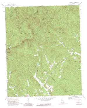
Nimblewill Topo Map Georgia
To zoom in, hover over the map of Nimblewill
USGS Topo Quad 34084e2 - 1:24,000 scale
| Topo Map Name: | Nimblewill |
| USGS Topo Quad ID: | 34084e2 |
| Print Size: | ca. 21 1/4" wide x 27" high |
| Southeast Coordinates: | 34.5° N latitude / 84.125° W longitude |
| Map Center Coordinates: | 34.5625° N latitude / 84.1875° W longitude |
| U.S. State: | GA |
| Filename: | o34084e2.jpg |
| Download Map JPG Image: | Nimblewill topo map 1:24,000 scale |
| Map Type: | Topographic |
| Topo Series: | 7.5´ |
| Map Scale: | 1:24,000 |
| Source of Map Images: | United States Geological Survey (USGS) |
| Alternate Map Versions: |
Nimblewill GA 1971, updated 1973 Download PDF Buy paper map Nimblewill GA 1971, updated 1979 Download PDF Buy paper map Nimblewill GA 1971, updated 1991 Download PDF Buy paper map Nimblewill GA 1997, updated 2000 Download PDF Buy paper map Nimblewill GA 2011 Download PDF Buy paper map Nimblewill GA 2014 Download PDF Buy paper map |
| FStopo: | US Forest Service topo Nimblewill is available: Download FStopo PDF Download FStopo TIF |
1:24,000 Topo Quads surrounding Nimblewill
> Back to 34084e1 at 1:100,000 scale
> Back to 34084a1 at 1:250,000 scale
> Back to U.S. Topo Maps home
Nimblewill topo map: Gazetteer
Nimblewill: Dams
Amicalola Creek Watershed Dam Number Four elevation 455m 1492′Amicalola Creek Watershed Dam Number Three elevation 474m 1555′
Amicalola Creek Watershed Dam Number Two elevation 466m 1528′
Amicalola Lake Dam elevation 775m 2542′
Etowah Number 32 Dam elevation 518m 1699′
Etowah Number 32 Lake Dam elevation 486m 1594′
Nimblewill: Falls
Amicalola Falls elevation 758m 2486′Cochrans Falls elevation 715m 2345′
Nimblewill: Gaps
Nimblewill Gap elevation 929m 3047′Nimblewill: Parks
Amicalola Falls State Park elevation 564m 1850′Nimblewill: Populated Places
Afton elevation 442m 1450′Emma elevation 487m 1597′
Nimblewill elevation 532m 1745′
Wier (historical) elevation 486m 1594′
Nimblewill: Reservoirs
Amicalola Lake elevation 775m 2542′Etowah 32 Lake elevation 518m 1699′
Etowah Number 32 Lake elevation 486m 1594′
Lake Laurel elevation 470m 1541′
Rome Kraft Company Lake elevation 474m 1555′
Wehunt Lake elevation 455m 1492′
Nimblewill: Streams
Beaverdam Creek elevation 620m 2034′Chester Creek elevation 559m 1833′
Gab Creek elevation 431m 1414′
Lance Creek elevation 530m 1738′
Poverty Creek elevation 445m 1459′
Nimblewill: Summits
Amicalola Mountain elevation 1020m 3346′Black Mountain elevation 1100m 3608′
Bull Mountain elevation 716m 2349′
Frosty Mountain elevation 1033m 3389′
Grogan Mountain elevation 597m 1958′
Little Mountain elevation 556m 1824′
Sheep Wallow Mountain elevation 586m 1922′
Nimblewill digital topo map on disk
Buy this Nimblewill topo map showing relief, roads, GPS coordinates and other geographical features, as a high-resolution digital map file on DVD:


