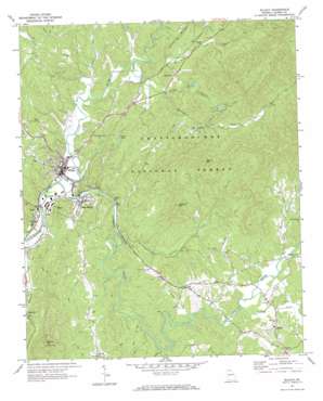
Ellijay Topo Map Georgia
To zoom in, hover over the map of Ellijay
USGS Topo Quad 34084f4 - 1:24,000 scale
| Topo Map Name: | Ellijay |
| USGS Topo Quad ID: | 34084f4 |
| Print Size: | ca. 21 1/4" wide x 27" high |
| Southeast Coordinates: | 34.625° N latitude / 84.375° W longitude |
| Map Center Coordinates: | 34.6875° N latitude / 84.4375° W longitude |
| U.S. State: | GA |
| Filename: | o34084f4.jpg |
| Download Map JPG Image: | Ellijay topo map 1:24,000 scale |
| Map Type: | Topographic |
| Topo Series: | 7.5´ |
| Map Scale: | 1:24,000 |
| Source of Map Images: | United States Geological Survey (USGS) |
| Alternate Map Versions: |
Ellijay GA 1971, updated 1973 Download PDF Buy paper map Ellijay GA 2011 Download PDF Buy paper map Ellijay GA 2014 Download PDF Buy paper map |
| FStopo: | US Forest Service topo Ellijay is available: Download FStopo PDF Download FStopo TIF |
1:24,000 Topo Quads surrounding Ellijay
> Back to 34084e1 at 1:100,000 scale
> Back to 34084a1 at 1:250,000 scale
> Back to U.S. Topo Maps home
Ellijay topo map: Gazetteer
Ellijay: Bridges
Charles Soule Bridge elevation 379m 1243′Cobb Bridge elevation 376m 1233′
Ellijay: Dams
Clotfelter Lake Dam elevation 509m 1669′Ellijay Watershed Dam Number One elevation 457m 1499′
Johnson Lake Dam elevation 540m 1771′
Lake Atagahi Dam elevation 506m 1660′
Lake Dakwa Dam elevation 515m 1689′
Lake Yanu Dam elevation 543m 1781′
Little Turniptown Creek Lake Dam elevation 509m 1669′
Logan Lake Dam elevation 419m 1374′
Lovejoy Lake Dam elevation 506m 1660′
Powell Lake Dam elevation 480m 1574′
Sailors Lake Dam elevation 475m 1558′
Ellijay: Mines
Ellijay Quarry elevation 491m 1610′Ellijay: Parks
Gilmer Fairground elevation 384m 1259′Ellijay: Populated Places
Cartecay elevation 516m 1692′East Ellijay elevation 388m 1272′
Ella Gap elevation 419m 1374′
Ellijay elevation 390m 1279′
Northcutt elevation 434m 1423′
Oak Hill elevation 505m 1656′
Oakland elevation 488m 1601′
Pike (historical) elevation 483m 1584′
Turniptown (historical) elevation 495m 1624′
Yukon elevation 477m 1564′
Ellijay: Post Offices
East Ellijay Post Office elevation 386m 1266′Ellijay Post Office elevation 392m 1286′
Ellijay: Reservoirs
Clotfelter Lake elevation 509m 1669′Dakwa Lake elevation 515m 1689′
Gibson Lake elevation 457m 1499′
Johnson Lake elevation 540m 1771′
Little Turniptown Creek Lake elevation 509m 1669′
Logan Lake elevation 419m 1374′
Lovejoy Lake elevation 506m 1660′
Powell Lake elevation 480m 1574′
Sailors Lake elevation 475m 1558′
Turniptown Lake elevation 506m 1660′
Walnut Mountain Lake A elevation 543m 1781′
Ellijay: Streams
Briar Creek elevation 405m 1328′Cartecay River elevation 377m 1236′
Clear Creek elevation 416m 1364′
Ellijay River elevation 377m 1236′
Flat Branch elevation 458m 1502′
Flat Branch elevation 457m 1499′
Kells Creek elevation 386m 1266′
Licklog Creek elevation 450m 1476′
Little Turniptown Creek elevation 403m 1322′
Owltown Creek elevation 386m 1266′
Ross Creek elevation 397m 1302′
Turniptown Creek elevation 394m 1292′
Whitepath Creek elevation 399m 1309′
Ellijay: Summits
Owltown Mountain elevation 660m 2165′Talona Mountain elevation 634m 2080′
Walnut Mountain elevation 785m 2575′
Ellijay digital topo map on disk
Buy this Ellijay topo map showing relief, roads, GPS coordinates and other geographical features, as a high-resolution digital map file on DVD:


