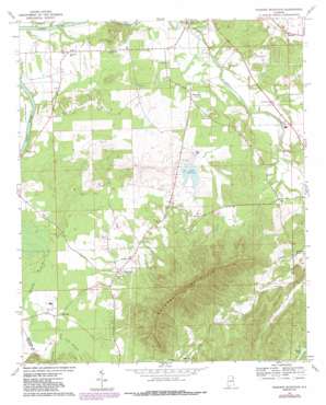
Weisner Mountain Topo Map Alabama
To zoom in, hover over the map of Weisner Mountain
USGS Topo Quad 34085a6 - 1:24,000 scale
| Topo Map Name: | Weisner Mountain |
| USGS Topo Quad ID: | 34085a6 |
| Print Size: | ca. 21 1/4" wide x 27" high |
| Southeast Coordinates: | 34° N latitude / 85.625° W longitude |
| Map Center Coordinates: | 34.0625° N latitude / 85.6875° W longitude |
| U.S. State: | AL |
| Filename: | o34085a6.jpg |
| Download Map JPG Image: | Weisner Mountain topo map 1:24,000 scale |
| Map Type: | Topographic |
| Topo Series: | 7.5´ |
| Map Scale: | 1:24,000 |
| Source of Map Images: | United States Geological Survey (USGS) |
| Alternate Map Versions: |
Weisner Mountain AL 1967, updated 1969 Download PDF Buy paper map Weisner Mountain AL 1967, updated 1987 Download PDF Buy paper map Weisner Mountain AL 2011 Download PDF Buy paper map Weisner Mountain AL 2014 Download PDF Buy paper map |
1:24,000 Topo Quads surrounding Weisner Mountain
> Back to 34085a1 at 1:100,000 scale
> Back to 34084a1 at 1:250,000 scale
> Back to U.S. Topo Maps home
Weisner Mountain topo map: Gazetteer
Weisner Mountain: Dams
Weisner Dam elevation 179m 587′Weisner Mountain: Populated Places
Ball Flat elevation 177m 580′Pine Grove elevation 191m 626′
Plano elevation 171m 561′
Pope elevation 177m 580′
Ricks (historical) elevation 183m 600′
Tennala elevation 172m 564′
Weisner Mountain: Reservoirs
Lake Weisner elevation 179m 587′Weisner Mountain: Springs
Mountain Spring elevation 194m 636′Weisner Mountain: Streams
Little Ballplay Creek elevation 173m 567′Morrison Creek elevation 168m 551′
Weisner Mountain: Summits
Weisner Mountain elevation 575m 1886′Weisner Mountain digital topo map on disk
Buy this Weisner Mountain topo map showing relief, roads, GPS coordinates and other geographical features, as a high-resolution digital map file on DVD:


