Little River Topo Map Alabama
To zoom in, hover over the map of Little River
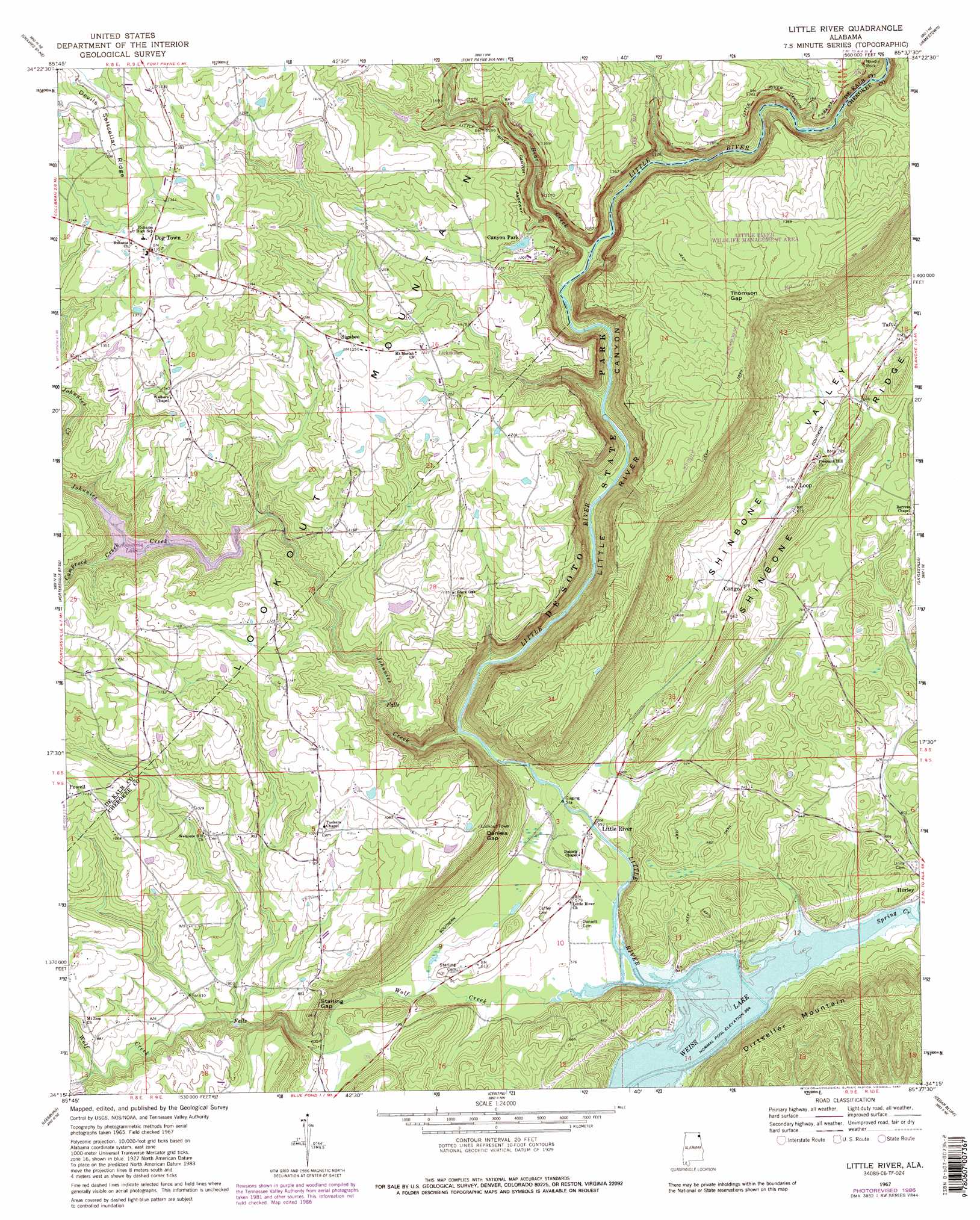
USGS Topo Quad 34085c6 - 1:24,000 scale
| Topo Map Name: | Little River |
| USGS Topo Quad ID: | 34085c6 |
| Print Size: | ca. 21 1/4" wide x 27" high |
| Southeast Coordinates: | 34.25° N latitude / 85.625° W longitude |
| Map Center Coordinates: | 34.3125° N latitude / 85.6875° W longitude |
| U.S. State: | AL |
| Filename: | o34085c6.jpg |
| Download Map JPG Image: | Little River topo map 1:24,000 scale |
| Map Type: | Topographic |
| Topo Series: | 7.5´ |
| Map Scale: | 1:24,000 |
| Source of Map Images: | United States Geological Survey (USGS) |
| Alternate Map Versions: |
Little River AL 1967, updated 1969 Download PDF Buy paper map Little River AL 1967, updated 1987 Download PDF Buy paper map Little River AL 1967, updated 1987 Download PDF Buy paper map Little River AL 2011 Download PDF Buy paper map Little River AL 2014 Download PDF Buy paper map |
1:24,000 Topo Quads surrounding Little River
Dutton |
Sylvania |
Dugout Valley |
Valley Head |
Dougherty Gap |
Fyffe |
Chavies |
Fort Payne |
Jamestown |
Lyerly |
Crossville |
Portersville |
Little River |
Gaylesville |
Chattoogaville |
Keener |
Leesburg |
Centre |
Cedar Bluff |
Melson |
Gadsden East |
Ballplay |
Weisner Mountain |
Ellisville |
Indian Mountain |
> Back to 34085a1 at 1:100,000 scale
> Back to 34084a1 at 1:250,000 scale
> Back to U.S. Topo Maps home
Little River topo map: Gazetteer
Little River: Arches
Needle Rock elevation 371m 1217′Little River: Dams
Cash Dam elevation 310m 1017′Little River: Gaps
Daniels Gap elevation 345m 1131′Starling Gap elevation 266m 872′
Thomson Gap elevation 390m 1279′
Little River: Parks
Canyon Mouth Park elevation 186m 610′Little River: Pillars
Needle Rock elevation 370m 1213′Little River: Populated Places
Congo elevation 202m 662′Dog Town elevation 414m 1358′
Lickskillet elevation 374m 1227′
Little River elevation 177m 580′
Mount Zion (historical) elevation 322m 1056′
Powell elevation 344m 1128′
Sigsbee elevation 378m 1240′
Taft elevation 225m 738′
Tucker (historical) elevation 342m 1122′
Little River: Reservoirs
Cashs Lake elevation 310m 1017′Little River: Ridges
Devils Saltcellar Ridge elevation 446m 1463′Little River: Springs
Congo Spring elevation 197m 646′Taft Spring elevation 210m 688′
Little River: Streams
Bear Creek elevation 243m 797′Camprock Creek elevation 299m 980′
Johnnies Creek elevation 188m 616′
Spring Creek elevation 171m 561′
Wolf Creek elevation 171m 561′
Little River: Valleys
Little River Canyon elevation 202m 662′Shinbone Valley elevation 182m 597′
Little River digital topo map on disk
Buy this Little River topo map showing relief, roads, GPS coordinates and other geographical features, as a high-resolution digital map file on DVD: