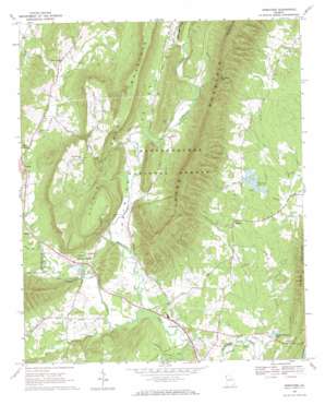
Armuchee Topo Map Georgia
To zoom in, hover over the map of Armuchee
USGS Topo Quad 34085d2 - 1:24,000 scale
| Topo Map Name: | Armuchee |
| USGS Topo Quad ID: | 34085d2 |
| Print Size: | ca. 21 1/4" wide x 27" high |
| Southeast Coordinates: | 34.375° N latitude / 85.125° W longitude |
| Map Center Coordinates: | 34.4375° N latitude / 85.1875° W longitude |
| U.S. State: | GA |
| Filename: | o34085d2.jpg |
| Download Map JPG Image: | Armuchee topo map 1:24,000 scale |
| Map Type: | Topographic |
| Topo Series: | 7.5´ |
| Map Scale: | 1:24,000 |
| Source of Map Images: | United States Geological Survey (USGS) |
| Alternate Map Versions: |
Armuchee GA 1968, updated 1970 Download PDF Buy paper map Armuchee GA 2011 Download PDF Buy paper map Armuchee GA 2014 Download PDF Buy paper map |
| FStopo: | US Forest Service topo Armuchee is available: Download FStopo PDF Download FStopo TIF |
1:24,000 Topo Quads surrounding Armuchee
> Back to 34085a1 at 1:100,000 scale
> Back to 34084a1 at 1:250,000 scale
> Back to U.S. Topo Maps home
Armuchee topo map: Gazetteer
Armuchee: Bends
McGrady Bend elevation 186m 610′Armuchee: Dams
Arrowhead Lake Dam elevation 197m 646′Lower Arrowhead Lake Dam elevation 197m 646′
Armuchee: Gaps
Dunaway Gap elevation 353m 1158′Armuchee: Parks
Turkey Mountain Recreation Center elevation 207m 679′Armuchee: Populated Places
Armuchee elevation 190m 623′Crystal Springs elevation 204m 669′
Farmersville elevation 211m 692′
Floyd Springs elevation 204m 669′
Haywood (historical) elevation 209m 685′
Kartah elevation 205m 672′
Tidings elevation 197m 646′
Zula (historical) elevation 199m 652′
Armuchee: Reservoirs
Arrowhead Lake elevation 197m 646′Crystal Springs Mill Pond elevation 195m 639′
Lower Arrowhead Lake elevation 197m 646′
Turkey Mountain Lake elevation 189m 620′
Armuchee: Springs
Arrowhead Spring elevation 216m 708′Crystal Spring elevation 197m 646′
Armuchee: Streams
East Armuchee Creek elevation 201m 659′Heath Creek elevation 186m 610′
Lavender Creek elevation 183m 600′
Little Armuchee Creek elevation 185m 606′
Selman Creek elevation 198m 649′
Storey Mill Creek elevation 192m 629′
West Armuchee Creek elevation 201m 659′
Armuchee: Summits
Little Sand Mountain elevation 346m 1135′Armuchee: Valleys
Big Texas Valley elevation 191m 626′Dirttown Valley elevation 200m 656′
Haywood Valley elevation 190m 623′
Little Texas Valley elevation 183m 600′
Armuchee digital topo map on disk
Buy this Armuchee topo map showing relief, roads, GPS coordinates and other geographical features, as a high-resolution digital map file on DVD:


