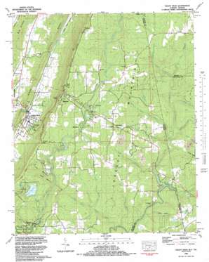
Valley Head Topo Map Alabama
To zoom in, hover over the map of Valley Head
USGS Topo Quad 34085e5 - 1:24,000 scale
| Topo Map Name: | Valley Head |
| USGS Topo Quad ID: | 34085e5 |
| Print Size: | ca. 21 1/4" wide x 27" high |
| Southeast Coordinates: | 34.5° N latitude / 85.5° W longitude |
| Map Center Coordinates: | 34.5625° N latitude / 85.5625° W longitude |
| U.S. States: | AL, GA |
| Filename: | o34085e5.jpg |
| Download Map JPG Image: | Valley Head topo map 1:24,000 scale |
| Map Type: | Topographic |
| Topo Series: | 7.5´ |
| Map Scale: | 1:24,000 |
| Source of Map Images: | United States Geological Survey (USGS) |
| Alternate Map Versions: |
Little Falls AL 1936 Download PDF Buy paper map Valley Head AL 1946, updated 1956 Download PDF Buy paper map Valley Head AL 1946, updated 1965 Download PDF Buy paper map Valley Head AL 1947, updated 1947 Download PDF Buy paper map Valley Head AL 1983, updated 1983 Download PDF Buy paper map Valley Head AL 2011 Download PDF Buy paper map Valley Head AL 2011 Download PDF Buy paper map Valley Head AL 2014 Download PDF Buy paper map |
1:24,000 Topo Quads surrounding Valley Head
> Back to 34085e1 at 1:100,000 scale
> Back to 34084a1 at 1:250,000 scale
> Back to U.S. Topo Maps home
Valley Head topo map: Gazetteer
Valley Head: Airports
Cloudmont Airpark elevation 506m 1660′Valley Head: Crossings
Taylor Ford elevation 517m 1696′Valley Head: Dams
A A Miller Dam elevation 492m 1614′Camp Comer Dam elevation 491m 1610′
Lahusage Dam elevation 429m 1407′
Sharp Branch Dam elevation 448m 1469′
Valley Head: Falls
De Soto Falls elevation 482m 1581′Little Falls elevation 476m 1561′
Valley Head: Gaps
Crow Gap elevation 563m 1847′Double Hollow elevation 492m 1614′
Tutwiler Gap elevation 522m 1712′
Valley Head: Islands
Eagle Nest elevation 549m 1801′Valley Head: Lakes
Moon Lake elevation 501m 1643′Valley Head: Parks
Cloudmont Park elevation 434m 1423′Valley Head: Pillars
Sunset Rock elevation 460m 1509′Valley Head: Populated Places
Alpine elevation 450m 1476′Bankhead elevation 513m 1683′
Lake Howard elevation 448m 1469′
Mentone elevation 529m 1735′
Riverdale elevation 507m 1663′
Valley Head elevation 309m 1013′
Valley Head: Post Offices
Mentone Post Office elevation 522m 1712′Valley Head Post Office elevation 311m 1020′
Valley Head: Reservoirs
Achunachi Lake elevation 502m 1646′Desoto State Park Lake elevation 492m 1614′
Howard Lake elevation 435m 1427′
Lake Lahusage elevation 419m 1374′
Republic Lake elevation 491m 1610′
Sharp Branch Lake elevation 448m 1469′
Valley Head: Ridges
Little Ridge elevation 382m 1253′Valley Head: Springs
Dixie Brown Spring elevation 290m 951′Winston Spring elevation 306m 1003′
Valley Head: Streams
Anna Branch elevation 425m 1394′Armstrong Branch elevation 426m 1397′
Berry Creek elevation 433m 1420′
Blalock Branch elevation 431m 1414′
Blalock Branch elevation 429m 1407′
Brush Creek elevation 429m 1407′
Cannon Branch elevation 479m 1571′
Cannon Branch elevation 476m 1561′
Coulter Branch elevation 512m 1679′
Gilbert Branch elevation 403m 1322′
Hale Branch elevation 479m 1571′
Keiselburg Branch elevation 444m 1456′
Laurel Creek elevation 396m 1299′
Middle Fork Little River elevation 427m 1400′
Middle Fork Little River elevation 426m 1397′
Seymour Branch elevation 435m 1427′
Sharp Branch elevation 418m 1371′
Shrader Branch elevation 425m 1394′
Stillhouse Branch elevation 481m 1578′
Wade Branch elevation 435m 1427′
Valley Head: Summits
Little Mountain elevation 564m 1850′Valley Head: Swamps
Marys Swamp elevation 491m 1610′Valley Head: Valleys
Batten Hollow elevation 424m 1391′Polecat Hollow elevation 442m 1450′
Valley Head digital topo map on disk
Buy this Valley Head topo map showing relief, roads, GPS coordinates and other geographical features, as a high-resolution digital map file on DVD:


