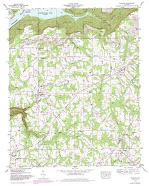
Henagar Topo Map Alabama
To zoom in, hover over the map of Henagar
USGS Topo Quad 34085f7 - 1:24,000 scale
| Topo Map Name: | Henagar |
| USGS Topo Quad ID: | 34085f7 |
| Print Size: | ca. 21 1/4" wide x 27" high |
| Southeast Coordinates: | 34.625° N latitude / 85.75° W longitude |
| Map Center Coordinates: | 34.6875° N latitude / 85.8125° W longitude |
| U.S. State: | AL |
| Filename: | o34085f7.jpg |
| Download Map JPG Image: | Henagar topo map 1:24,000 scale |
| Map Type: | Topographic |
| Topo Series: | 7.5´ |
| Map Scale: | 1:24,000 |
| Source of Map Images: | United States Geological Survey (USGS) |
| Alternate Map Versions: |
Henagar AL 1936 Download PDF Buy paper map Henagar AL 1947, updated 1973 Download PDF Buy paper map Henagar AL 1947, updated 1985 Download PDF Buy paper map Henagar AL 1950 Download PDF Buy paper map Henagar AL 2011 Download PDF Buy paper map Henagar AL 2014 Download PDF Buy paper map |
1:24,000 Topo Quads surrounding Henagar
> Back to 34085e1 at 1:100,000 scale
> Back to 34084a1 at 1:250,000 scale
> Back to U.S. Topo Maps home
Henagar topo map: Gazetteer
Henagar: Capes
Freeman Point elevation 353m 1158′Split Rock Point elevation 395m 1295′
Henagar: Cliffs
High View elevation 384m 1259′Henagar: Dams
Gilbert Dam elevation 426m 1397′Henagar: Gaps
Coon Gap elevation 390m 1279′Henagar: Lakes
The Blue Hole elevation 190m 623′Henagar: Populated Places
Central elevation 421m 1381′Fair View elevation 443m 1453′
Glenzaida elevation 437m 1433′
Henagar elevation 444m 1456′
Morris Mill elevation 399m 1309′
Pisgah elevation 416m 1364′
Rosalie elevation 452m 1482′
Henagar: Post Offices
Henagar Post Office elevation 445m 1459′Henagar: Reservoirs
Gilberts Lake elevation 426m 1397′Henagar: Streams
Bee Gum Creek elevation 395m 1295′Bowman Branch elevation 182m 597′
Bryant Creek elevation 296m 971′
Buck Creek elevation 407m 1335′
Coon Creek elevation 181m 593′
Dickey Creek elevation 396m 1299′
Dogwood Branch elevation 392m 1286′
Dry Creek elevation 182m 597′
Gilbert Branch elevation 412m 1351′
Hogskin Creek elevation 413m 1354′
Horsehead Creek elevation 408m 1338′
Jacobs Creek elevation 371m 1217′
Kizzort Branch elevation 182m 597′
Lick Creek elevation 409m 1341′
Little Bryant Creek elevation 296m 971′
Little Dickey Creek elevation 402m 1318′
Little Jacobs Creek elevation 408m 1338′
Parton Branch elevation 181m 593′
Pine Branch elevation 187m 613′
Rocky Branch elevation 340m 1115′
Sandy Ford Creek elevation 413m 1354′
Spring Hill Creek elevation 408m 1338′
Henagar: Valleys
Coon Gulf elevation 181m 593′The Gorge elevation 296m 971′
Wicks Hollow elevation 185m 606′
Wininger Hollow elevation 403m 1322′
Henagar digital topo map on disk
Buy this Henagar topo map showing relief, roads, GPS coordinates and other geographical features, as a high-resolution digital map file on DVD:


