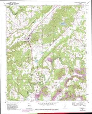
Blountsville Topo Map Alabama
To zoom in, hover over the map of Blountsville
USGS Topo Quad 34086a5 - 1:24,000 scale
| Topo Map Name: | Blountsville |
| USGS Topo Quad ID: | 34086a5 |
| Print Size: | ca. 21 1/4" wide x 27" high |
| Southeast Coordinates: | 34° N latitude / 86.5° W longitude |
| Map Center Coordinates: | 34.0625° N latitude / 86.5625° W longitude |
| U.S. State: | AL |
| Filename: | o34086a5.jpg |
| Download Map JPG Image: | Blountsville topo map 1:24,000 scale |
| Map Type: | Topographic |
| Topo Series: | 7.5´ |
| Map Scale: | 1:24,000 |
| Source of Map Images: | United States Geological Survey (USGS) |
| Alternate Map Versions: |
Blountsville AL 1969, updated 1972 Download PDF Buy paper map Blountsville AL 1969, updated 1973 Download PDF Buy paper map Blountsville AL 1969, updated 1978 Download PDF Buy paper map Blountsville AL 1969, updated 1987 Download PDF Buy paper map Blountsville AL 1975, updated 1977 Download PDF Buy paper map Blountsville AL 1975, updated 1983 Download PDF Buy paper map Blountsville AL 2011 Download PDF Buy paper map Blountsville AL 2014 Download PDF Buy paper map |
1:24,000 Topo Quads surrounding Blountsville
> Back to 34086a1 at 1:100,000 scale
> Back to 34086a1 at 1:250,000 scale
> Back to U.S. Topo Maps home
Blountsville topo map: Gazetteer
Blountsville: Bends
Blackwood Bend elevation 205m 672′Stevens Bend elevation 185m 606′
Blountsville: Crossings
Slippery Ford elevation 176m 577′Blountsville: Dams
Doctor Wittmeier Lake Number Two Dam elevation 165m 541′Donald Smith Lake Dam elevation 223m 731′
Forest Ingram Lake Dam elevation 260m 853′
Manor Lake Dam elevation 282m 925′
Spring Valley Ponds Dam elevation 229m 751′
Whitmire Lake Dam elevation 178m 583′
Blountsville: Lakes
Burgess Spring Lakes elevation 217m 711′Blountsville: Mines
Royal Pit Mine elevation 262m 859′Blountsville: Parks
Blountsville Municipal Park elevation 212m 695′Blountsville: Populated Places
Blountsville elevation 217m 711′Five Points elevation 186m 610′
Fowler Spring elevation 242m 793′
Joy elevation 261m 856′
Liberty elevation 255m 836′
Mountain Grove elevation 245m 803′
Pine Acres elevation 258m 846′
Royal elevation 230m 754′
Blountsville: Post Offices
Blountsville Post Office elevation 217m 711′Blountsville: Reservoirs
Camps Lake elevation 229m 751′Donald Smith Lake elevation 223m 731′
Forest Ingram Lake elevation 260m 853′
Luther Pond elevation 165m 541′
Osborne Lake elevation 275m 902′
Spring Valley Farms Ponds elevation 230m 754′
Blountsville: Ridges
Berry Mountain elevation 312m 1023′Hamilton Mountain elevation 280m 918′
Middle Ridge elevation 306m 1003′
Blountsville: Streams
Austin Creek elevation 145m 475′Graves Creek elevation 181m 593′
Lick Creek elevation 168m 551′
Sawmill Branch elevation 195m 639′
Blountsville: Summits
Flat Top elevation 254m 833′Nevins Mountain elevation 323m 1059′
Tater Knob elevation 293m 961′
Blountsville: Valleys
Andy Branch Hollow elevation 192m 629′Blountsville digital topo map on disk
Buy this Blountsville topo map showing relief, roads, GPS coordinates and other geographical features, as a high-resolution digital map file on DVD:


