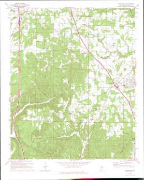
Hanceville Topo Map Alabama
To zoom in, hover over the map of Hanceville
USGS Topo Quad 34086a7 - 1:24,000 scale
| Topo Map Name: | Hanceville |
| USGS Topo Quad ID: | 34086a7 |
| Print Size: | ca. 21 1/4" wide x 27" high |
| Southeast Coordinates: | 34° N latitude / 86.75° W longitude |
| Map Center Coordinates: | 34.0625° N latitude / 86.8125° W longitude |
| U.S. State: | AL |
| Filename: | o34086a7.jpg |
| Download Map JPG Image: | Hanceville topo map 1:24,000 scale |
| Map Type: | Topographic |
| Topo Series: | 7.5´ |
| Map Scale: | 1:24,000 |
| Source of Map Images: | United States Geological Survey (USGS) |
| Alternate Map Versions: |
Hanceville AL 1969, updated 1969 Download PDF Buy paper map Hanceville AL 1969, updated 1976 Download PDF Buy paper map Hanceville AL 1969, updated 1987 Download PDF Buy paper map Hanceville AL 1969, updated 1993 Download PDF Buy paper map Hanceville AL 2011 Download PDF Buy paper map Hanceville AL 2014 Download PDF Buy paper map |
1:24,000 Topo Quads surrounding Hanceville
> Back to 34086a1 at 1:100,000 scale
> Back to 34086a1 at 1:250,000 scale
> Back to U.S. Topo Maps home
Hanceville topo map: Gazetteer
Hanceville: Crossings
Interchange 299 elevation 198m 649′Interchange 304 elevation 204m 669′
Hanceville: Mines
Fuller Drift Mine elevation 265m 869′Mayfield Mine elevation 179m 587′
Hanceville: Populated Places
Center Community elevation 184m 603′Fairview West elevation 175m 574′
Good Hope elevation 214m 702′
Hanceville elevation 165m 541′
Johnsons Crossing elevation 196m 643′
Wesoda elevation 217m 711′
White City elevation 190m 623′
Hanceville: Post Offices
Hanceville Post Office elevation 165m 541′Hanceville: Streams
Pewterfork Creek elevation 127m 416′Hanceville: Summits
Buttermilk Mountain elevation 263m 862′Garden City Mountain elevation 271m 889′
Stout Mountain elevation 281m 921′
Hanceville digital topo map on disk
Buy this Hanceville topo map showing relief, roads, GPS coordinates and other geographical features, as a high-resolution digital map file on DVD:


