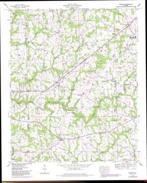
Painter Topo Map Alabama
To zoom in, hover over the map of Painter
USGS Topo Quad 34086c1 - 1:24,000 scale
| Topo Map Name: | Painter |
| USGS Topo Quad ID: | 34086c1 |
| Print Size: | ca. 21 1/4" wide x 27" high |
| Southeast Coordinates: | 34.25° N latitude / 86° W longitude |
| Map Center Coordinates: | 34.3125° N latitude / 86.0625° W longitude |
| U.S. State: | AL |
| Filename: | o34086c1.jpg |
| Download Map JPG Image: | Painter topo map 1:24,000 scale |
| Map Type: | Topographic |
| Topo Series: | 7.5´ |
| Map Scale: | 1:24,000 |
| Source of Map Images: | United States Geological Survey (USGS) |
| Alternate Map Versions: |
Painter AL 1936 Download PDF Buy paper map Painter AL 1947, updated 1973 Download PDF Buy paper map Painter AL 1947, updated 1983 Download PDF Buy paper map Painter AL 1949 Download PDF Buy paper map Painter AL 2011 Download PDF Buy paper map Painter AL 2014 Download PDF Buy paper map |
1:24,000 Topo Quads surrounding Painter
> Back to 34086a1 at 1:100,000 scale
> Back to 34086a1 at 1:250,000 scale
> Back to U.S. Topo Maps home
Painter topo map: Gazetteer
Painter: Bridges
Clayton Ford Bridge elevation 305m 1000′Colvin Bridge elevation 272m 892′
Flat Bridge elevation 277m 908′
Garvin Bridge elevation 303m 994′
Green Ford Bridge elevation 289m 948′
Kirby Bridge elevation 305m 1000′
Luther Bridge elevation 286m 938′
McCrellis Bridge (historical) elevation 299m 980′
Painter: Crossings
Clayton Ford elevation 308m 1010′Green Ford elevation 304m 997′
Painter: Populated Places
Five Forks elevation 325m 1066′Geraldine elevation 350m 1148′
Hopewell elevation 355m 1164′
Kilpatrick elevation 346m 1135′
Lathamville elevation 343m 1125′
Oak Hill elevation 334m 1095′
Painter elevation 338m 1108′
Pendergrass elevation 321m 1053′
Peters (historical) elevation 326m 1069′
Rains (historical) elevation 344m 1128′
Rogers elevation 336m 1102′
Whiton elevation 347m 1138′
Painter: Post Offices
Geraldine Post Office elevation 349m 1145′Painter: Streams
Baker Branch elevation 296m 971′Big Branch elevation 277m 908′
Bray Creek elevation 310m 1017′
Broomstraw Branch elevation 288m 944′
Carter Branch elevation 323m 1059′
Chastain Creek elevation 322m 1056′
Fall Branch elevation 291m 954′
Little Scarham Creek elevation 286m 938′
Little Shoal Creek elevation 284m 931′
Little Whippoorwill Creek elevation 303m 994′
Macedonia Branch elevation 307m 1007′
Oak Hill Branch elevation 305m 1000′
Swan Branch elevation 311m 1020′
Wallace Branch elevation 329m 1079′
Painter digital topo map on disk
Buy this Painter topo map showing relief, roads, GPS coordinates and other geographical features, as a high-resolution digital map file on DVD:


