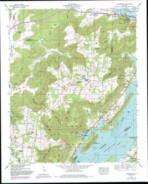
Swearengin Topo Map Alabama
To zoom in, hover over the map of Swearengin
USGS Topo Quad 34086e2 - 1:24,000 scale
| Topo Map Name: | Swearengin |
| USGS Topo Quad ID: | 34086e2 |
| Print Size: | ca. 21 1/4" wide x 27" high |
| Southeast Coordinates: | 34.5° N latitude / 86.125° W longitude |
| Map Center Coordinates: | 34.5625° N latitude / 86.1875° W longitude |
| U.S. State: | AL |
| Filename: | o34086e2.jpg |
| Download Map JPG Image: | Swearengin topo map 1:24,000 scale |
| Map Type: | Topographic |
| Topo Series: | 7.5´ |
| Map Scale: | 1:24,000 |
| Source of Map Images: | United States Geological Survey (USGS) |
| Alternate Map Versions: |
Swearengin AL 1936 Download PDF Buy paper map Swearengin AL 1947, updated 1972 Download PDF Buy paper map Swearengin AL 1947, updated 1983 Download PDF Buy paper map Swearengin AL 1950 Download PDF Buy paper map Swearengin AL 2011 Download PDF Buy paper map Swearengin AL 2014 Download PDF Buy paper map |
1:24,000 Topo Quads surrounding Swearengin
> Back to 34086e1 at 1:100,000 scale
> Back to 34086a1 at 1:250,000 scale
> Back to U.S. Topo Maps home
Swearengin topo map: Gazetteer
Swearengin: Bars
Romans Bar elevation 181m 593′Upper Bar elevation 181m 593′
Swearengin: Capes
Uncle George McLean Point elevation 349m 1145′Swearengin: Gaps
Dobbins Gap elevation 362m 1187′Swearengin: Lakes
Black Lake (historical) elevation 181m 593′Fish Pond elevation 183m 600′
White Lake (historical) elevation 181m 593′
Swearengin: Parks
Blowing Wind Cave National Wildlife Refuge elevation 190m 623′Burns Reservation elevation 195m 639′
Swearengin: Populated Places
Aspel elevation 187m 613′Breezeway Bay elevation 185m 606′
Dry Cove (historical) elevation 181m 593′
Goodwin Subdivision elevation 227m 744′
Kirbytown elevation 193m 633′
Lakeview Beach elevation 184m 603′
McLemore Point Subdivision elevation 184m 603′
Oak Grove elevation 403m 1322′
Pleasant Hill elevation 183m 600′
Preston elevation 183m 600′
Preston Sights Subdivision elevation 194m 636′
Preston Subdivision elevation 190m 623′
Swearengin elevation 410m 1345′
Swearengin: Reservoirs
Guntersville Lake elevation 181m 593′Swearengin: Ridges
River Ridge elevation 248m 813′Swearengin: Springs
Barkley Spring elevation 188m 616′Shell Spring elevation 383m 1256′
Swearengin: Streams
Baker Spring Branch elevation 182m 597′Boshart Creek elevation 181m 593′
Dry Branch elevation 208m 682′
Parkell Creek elevation 179m 587′
Swearengin: Summits
Cave Mountain elevation 342m 1122′Gunters Mountain elevation 420m 1377′
Pisgah Mountain elevation 280m 918′
Swearengin: Valleys
Basin Cove elevation 230m 754′Battle Hollow elevation 223m 731′
Black Hollow elevation 213m 698′
Chambless Hollow elevation 217m 711′
Dodds Cove elevation 184m 603′
Guffey Hollow elevation 223m 731′
John Law Hollow elevation 215m 705′
Kennamer Cove elevation 183m 600′
Kight Hollow elevation 230m 754′
Rice Cove elevation 187m 613′
Saltpeter Cove elevation 180m 590′
Stillhouse Hollow elevation 187m 613′
Thomas Cove elevation 180m 590′
Vernon Cove elevation 186m 610′
Wrights Cove elevation 217m 711′
Swearengin digital topo map on disk
Buy this Swearengin topo map showing relief, roads, GPS coordinates and other geographical features, as a high-resolution digital map file on DVD:


