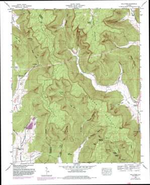
Hollytree Topo Map Alabama
To zoom in, hover over the map of Hollytree
USGS Topo Quad 34086g3 - 1:24,000 scale
| Topo Map Name: | Hollytree |
| USGS Topo Quad ID: | 34086g3 |
| Print Size: | ca. 21 1/4" wide x 27" high |
| Southeast Coordinates: | 34.75° N latitude / 86.25° W longitude |
| Map Center Coordinates: | 34.8125° N latitude / 86.3125° W longitude |
| U.S. State: | AL |
| Filename: | o34086g3.jpg |
| Download Map JPG Image: | Hollytree topo map 1:24,000 scale |
| Map Type: | Topographic |
| Topo Series: | 7.5´ |
| Map Scale: | 1:24,000 |
| Source of Map Images: | United States Geological Survey (USGS) |
| Alternate Map Versions: |
Hollytree AL 1936 Download PDF Buy paper map Hollytree AL 1948, updated 1964 Download PDF Buy paper map Hollytree AL 1948, updated 1974 Download PDF Buy paper map Hollytree AL 1948, updated 1982 Download PDF Buy paper map Hollytree AL 1948, updated 1982 Download PDF Buy paper map Hollytree AL 1951, updated 1951 Download PDF Buy paper map Hollytree AL 2011 Download PDF Buy paper map Hollytree AL 2014 Download PDF Buy paper map |
1:24,000 Topo Quads surrounding Hollytree
> Back to 34086e1 at 1:100,000 scale
> Back to 34086a1 at 1:250,000 scale
> Back to U.S. Topo Maps home
Hollytree topo map: Gazetteer
Hollytree: Basins
Calloway Sinks elevation 299m 980′Cox Sinks elevation 239m 784′
Cunningham Sinks elevation 283m 928′
Davis Cove elevation 204m 669′
Devils Den elevation 323m 1059′
Harrison Cove elevation 207m 679′
Jackson Sinks elevation 273m 895′
Keel Sinks elevation 275m 902′
Sharp Sinks elevation 274m 898′
Hollytree: Cliffs
Bucklight Point elevation 493m 1617′Trenton Point elevation 481m 1578′
Hollytree: Dams
Mountain Lake Resort Dam elevation 216m 708′Hollytree: Gaps
Bingham Narrows elevation 471m 1545′The Divide elevation 398m 1305′
Hollytree: Populated Places
Hollytree elevation 204m 669′Padgett (historical) elevation 274m 898′
Hollytree: Reservoirs
Hurricane Creek Watershed Lake elevation 222m 728′Smith Lake elevation 216m 708′
Hollytree: Springs
Brewer Spring elevation 398m 1305′Chalybeate Spring elevation 465m 1525′
Chalybeate Spring elevation 520m 1706′
Dripping Spring elevation 230m 754′
Horton Spring elevation 204m 669′
Sneed Spring elevation 237m 777′
Hollytree: Streams
Williams Creek elevation 195m 639′Hollytree: Summits
Bice Mountain elevation 536m 1758′Bingham Mountain elevation 519m 1702′
Brooks Mountain elevation 512m 1679′
Little Mountain elevation 313m 1026′
Sharp Mountain elevation 508m 1666′
Hollytree: Valleys
Dark Hollow elevation 307m 1007′Honey Hollow elevation 225m 738′
Jones Cove elevation 204m 669′
McFarland Hollow elevation 205m 672′
Patty Hollow elevation 211m 692′
Sneed Hollow elevation 261m 856′
Stillhouse Hollow elevation 243m 797′
Toney Gulf elevation 210m 688′
Vaught Cove elevation 200m 656′
Hollytree digital topo map on disk
Buy this Hollytree topo map showing relief, roads, GPS coordinates and other geographical features, as a high-resolution digital map file on DVD:


