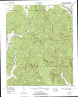
King Cove Topo Map Alabama
To zoom in, hover over the map of King Cove
USGS Topo Quad 34086h3 - 1:24,000 scale
| Topo Map Name: | King Cove |
| USGS Topo Quad ID: | 34086h3 |
| Print Size: | ca. 21 1/4" wide x 27" high |
| Southeast Coordinates: | 34.875° N latitude / 86.25° W longitude |
| Map Center Coordinates: | 34.9375° N latitude / 86.3125° W longitude |
| U.S. States: | AL, TN |
| Filename: | o34086h3.jpg |
| Download Map JPG Image: | King Cove topo map 1:24,000 scale |
| Map Type: | Topographic |
| Topo Series: | 7.5´ |
| Map Scale: | 1:24,000 |
| Source of Map Images: | United States Geological Survey (USGS) |
| Alternate Map Versions: |
King Cove AL 1936 Download PDF Buy paper map King Cove AL 1948, updated 1967 Download PDF Buy paper map King Cove AL 1948, updated 1975 Download PDF Buy paper map King Cove AL 1948, updated 1977 Download PDF Buy paper map King Cove AL 1951, updated 1951 Download PDF Buy paper map King Cove AL 2010 Download PDF Buy paper map King Cove AL 2011 Download PDF Buy paper map King Cove AL 2014 Download PDF Buy paper map |
1:24,000 Topo Quads surrounding King Cove
> Back to 34086e1 at 1:100,000 scale
> Back to 34086a1 at 1:250,000 scale
> Back to U.S. Topo Maps home
King Cove topo map: Gazetteer
King Cove: Basins
Hambrick Sinks elevation 349m 1145′King Cove: Capes
Beshears Point elevation 518m 1699′Cagle Point elevation 527m 1729′
King Cove: Gaps
Low Gap elevation 423m 1387′Shores Low Gap elevation 461m 1512′
The Dugout elevation 375m 1230′
King Cove: Streams
Bee Branch elevation 316m 1036′Dry Creek elevation 234m 767′
Flag Branch elevation 369m 1210′
Hall Branch elevation 236m 774′
Lick Branch elevation 247m 810′
Lickskillet Creek elevation 234m 767′
Rocky Branch elevation 244m 800′
King Cove: Summits
Backbone Mountain elevation 466m 1528′Bice Mountain elevation 524m 1719′
Big Hill elevation 446m 1463′
Hale Mountain elevation 471m 1545′
High Top elevation 557m 1827′
Husky Top elevation 551m 1807′
Johnson Top elevation 568m 1863′
Maxwell Mountain elevation 526m 1725′
Putman Mountain elevation 532m 1745′
King Cove: Valleys
Bluff Hollow elevation 252m 826′Cramer Hollow elevation 227m 744′
Fitch Hollow elevation 235m 770′
Jones Cove elevation 235m 770′
King Cove elevation 402m 1318′
Moore Cove elevation 281m 921′
Moore Cove elevation 279m 915′
Racepath Hollow elevation 207m 679′
Rochelle Hollow elevation 247m 810′
Rocky Branch Hollow elevation 247m 810′
Smithey Hollow elevation 234m 767′
King Cove digital topo map on disk
Buy this King Cove topo map showing relief, roads, GPS coordinates and other geographical features, as a high-resolution digital map file on DVD:


