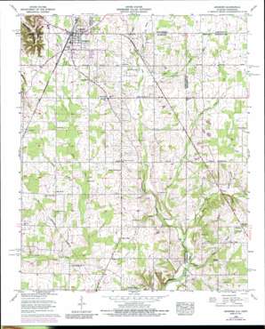
Ardmore Topo Map Alabama
To zoom in, hover over the map of Ardmore
USGS Topo Quad 34086h7 - 1:24,000 scale
| Topo Map Name: | Ardmore |
| USGS Topo Quad ID: | 34086h7 |
| Print Size: | ca. 21 1/4" wide x 27" high |
| Southeast Coordinates: | 34.875° N latitude / 86.75° W longitude |
| Map Center Coordinates: | 34.9375° N latitude / 86.8125° W longitude |
| U.S. States: | AL, TN |
| Filename: | o34086h7.jpg |
| Download Map JPG Image: | Ardmore topo map 1:24,000 scale |
| Map Type: | Topographic |
| Topo Series: | 7.5´ |
| Map Scale: | 1:24,000 |
| Source of Map Images: | United States Geological Survey (USGS) |
| Alternate Map Versions: |
Ardmore AL 1936 Download PDF Buy paper map Ardmore AL 1958, updated 1959 Download PDF Buy paper map Ardmore AL 1958, updated 1974 Download PDF Buy paper map Ardmore AL 1958, updated 1976 Download PDF Buy paper map Ardmore AL 1958, updated 1987 Download PDF Buy paper map Ardmore AL 2010 Download PDF Buy paper map Ardmore AL 2011 Download PDF Buy paper map Ardmore AL 2014 Download PDF Buy paper map |
1:24,000 Topo Quads surrounding Ardmore
> Back to 34086e1 at 1:100,000 scale
> Back to 34086a1 at 1:250,000 scale
> Back to U.S. Topo Maps home
Ardmore topo map: Gazetteer
Ardmore: Populated Places
Ardmore elevation 270m 885′Ardmore elevation 269m 882′
Bethel elevation 260m 853′
Caro (historical) elevation 246m 807′
Cedar Hill elevation 266m 872′
Maple Hill elevation 272m 892′
Oak Grove elevation 262m 859′
Pine Dale elevation 271m 889′
Pisgah elevation 256m 839′
Sand Spring (historical) elevation 257m 843′
Wooley Springs (historical) elevation 238m 780′
Ardmore: Post Offices
Ardmore Post Office elevation 266m 872′Ardmore: Springs
Old Limestone Church Spring elevation 222m 728′Sand Spring elevation 253m 830′
Wooley Spring elevation 227m 744′
Ardmore: Streams
Buffalo Branch elevation 220m 721′Davis Branch elevation 250m 820′
Davis Branch elevation 250m 820′
Fall Branch elevation 227m 744′
Hardin Branch elevation 228m 748′
Hauskin Branch elevation 253m 830′
Johnson Branch elevation 261m 856′
Little Limestone Creek elevation 223m 731′
Magnusson Branch elevation 273m 895′
Sherrill Branch elevation 261m 856′
Smith Branch elevation 253m 830′
Sweetwater Branch elevation 233m 764′
Tyrone Creek elevation 224m 734′
Ardmore: Valleys
Magnusson Hollow elevation 200m 656′Magnusson Hollow elevation 201m 659′
Ardmore digital topo map on disk
Buy this Ardmore topo map showing relief, roads, GPS coordinates and other geographical features, as a high-resolution digital map file on DVD:


