Gold Mine Topo Map Alabama
To zoom in, hover over the map of Gold Mine
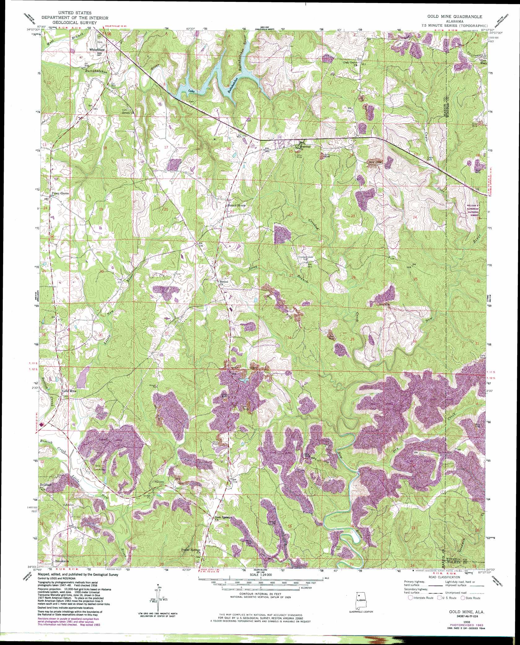
USGS Topo Quad 34087a6 - 1:24,000 scale
| Topo Map Name: | Gold Mine |
| USGS Topo Quad ID: | 34087a6 |
| Print Size: | ca. 21 1/4" wide x 27" high |
| Southeast Coordinates: | 34° N latitude / 87.625° W longitude |
| Map Center Coordinates: | 34.0625° N latitude / 87.6875° W longitude |
| U.S. State: | AL |
| Filename: | o34087a6.jpg |
| Download Map JPG Image: | Gold Mine topo map 1:24,000 scale |
| Map Type: | Topographic |
| Topo Series: | 7.5´ |
| Map Scale: | 1:24,000 |
| Source of Map Images: | United States Geological Survey (USGS) |
| Alternate Map Versions: |
Gold Mine AL 1958, updated 1960 Download PDF Buy paper map Gold Mine AL 1958, updated 1960 Download PDF Buy paper map Gold Mine AL 1958, updated 1981 Download PDF Buy paper map Gold Mine AL 1958, updated 1983 Download PDF Buy paper map Gold Mine AL 2011 Download PDF Buy paper map Gold Mine AL 2014 Download PDF Buy paper map |
| FStopo: | US Forest Service topo Gold Mine is available: Download FStopo PDF Download FStopo TIF |
1:24,000 Topo Quads surrounding Gold Mine
Hodges |
Hackleburg |
Phil Campbell |
Kinlock Spring |
Bee Branch |
Hamilton |
Hamilton Ne |
Haleyville West |
Haleyville East |
Double Springs |
Hamilton Sw |
Brilliant |
Gold Mine |
Lynn |
Poplar Springs |
Guin |
Winfield |
Glen Allen |
Carbon Hill |
Nauvoo |
Bluff |
Winfield Se |
Hubbertville |
Howard |
Townley |
> Back to 34087a1 at 1:100,000 scale
> Back to 34086a1 at 1:250,000 scale
> Back to U.S. Topo Maps home
Gold Mine topo map: Gazetteer
Gold Mine: Dams
Buttahatchee Dam elevation 175m 574′Little New River Lake Number 3 Dam elevation 165m 541′
Gold Mine: Lakes
Lake Buttahatchee elevation 178m 583′Gold Mine: Oilfields
Whitehouse Gas Field (historical) elevation 212m 695′Gold Mine: Populated Places
Brookside elevation 197m 646′Gold Mine elevation 178m 583′
Piney Grove elevation 210m 688′
Sunny Home elevation 221m 725′
Whitehouse elevation 198m 649′
Gold Mine: Reservoirs
Little New River Lake Number 3 elevation 165m 541′Gold Mine: Streams
Bostick Creek elevation 152m 498′Crooked Creek elevation 169m 554′
Dry Creek elevation 144m 472′
Long Branch elevation 159m 521′
West Branch Buttahatchee River elevation 164m 538′
Gold Mine: Valleys
Cagle Cove elevation 168m 551′Gold Mine digital topo map on disk
Buy this Gold Mine topo map showing relief, roads, GPS coordinates and other geographical features, as a high-resolution digital map file on DVD: