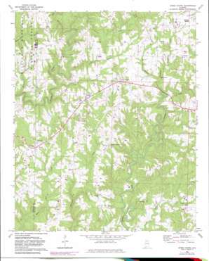
Jones Chapel Topo Map Alabama
To zoom in, hover over the map of Jones Chapel
USGS Topo Quad 34087b1 - 1:24,000 scale
| Topo Map Name: | Jones Chapel |
| USGS Topo Quad ID: | 34087b1 |
| Print Size: | ca. 21 1/4" wide x 27" high |
| Southeast Coordinates: | 34.125° N latitude / 87° W longitude |
| Map Center Coordinates: | 34.1875° N latitude / 87.0625° W longitude |
| U.S. State: | AL |
| Filename: | o34087b1.jpg |
| Download Map JPG Image: | Jones Chapel topo map 1:24,000 scale |
| Map Type: | Topographic |
| Topo Series: | 7.5´ |
| Map Scale: | 1:24,000 |
| Source of Map Images: | United States Geological Survey (USGS) |
| Alternate Map Versions: |
Jones Chapel AL 1969, updated 1973 Download PDF Buy paper map Jones Chapel AL 1969, updated 1983 Download PDF Buy paper map Jones Chapel AL 2000, updated 2003 Download PDF Buy paper map Jones Chapel AL 2011 Download PDF Buy paper map Jones Chapel AL 2014 Download PDF Buy paper map |
| FStopo: | US Forest Service topo Jones Chapel is available: Download FStopo PDF Download FStopo TIF |
1:24,000 Topo Quads surrounding Jones Chapel
> Back to 34087a1 at 1:100,000 scale
> Back to 34086a1 at 1:250,000 scale
> Back to U.S. Topo Maps home
Jones Chapel topo map: Gazetteer
Jones Chapel: Dams
Harbisons Pond Dam elevation 258m 846′Lick Creek Dam elevation 204m 669′
Jones Chapel: Populated Places
Central elevation 276m 905′Chances Crossroad elevation 273m 895′
Dripping Springs elevation 277m 908′
Jones Chapel elevation 299m 980′
Logan elevation 226m 741′
Maple Forks elevation 218m 715′
Nesmith elevation 275m 902′
Jones Chapel: Post Offices
Logan Post Office elevation 221m 725′Jones Chapel: Reservoirs
Harbisons Pond elevation 259m 849′Lick Creek Pond elevation 204m 669′
Jones Chapel: Streams
Bee Branch elevation 218m 715′Dripping Springs Creek elevation 218m 715′
Jones Creek elevation 232m 761′
Lewis Branch elevation 198m 649′
McCain Creek elevation 181m 593′
Ragland Branch elevation 212m 695′
Sullivan Creek elevation 203m 666′
Jones Chapel digital topo map on disk
Buy this Jones Chapel topo map showing relief, roads, GPS coordinates and other geographical features, as a high-resolution digital map file on DVD:


