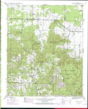
Newburg Topo Map Alabama
To zoom in, hover over the map of Newburg
USGS Topo Quad 34087d5 - 1:24,000 scale
| Topo Map Name: | Newburg |
| USGS Topo Quad ID: | 34087d5 |
| Print Size: | ca. 21 1/4" wide x 27" high |
| Southeast Coordinates: | 34.375° N latitude / 87.5° W longitude |
| Map Center Coordinates: | 34.4375° N latitude / 87.5625° W longitude |
| U.S. State: | AL |
| Filename: | o34087d5.jpg |
| Download Map JPG Image: | Newburg topo map 1:24,000 scale |
| Map Type: | Topographic |
| Topo Series: | 7.5´ |
| Map Scale: | 1:24,000 |
| Source of Map Images: | United States Geological Survey (USGS) |
| Alternate Map Versions: |
Newburg AL 1936 Download PDF Buy paper map Newburg AL 1945, updated 1970 Download PDF Buy paper map Newburg AL 1945, updated 1970 Download PDF Buy paper map Newburg AL 1947 Download PDF Buy paper map Newburg AL 2000, updated 2003 Download PDF Buy paper map Newburg AL 2011 Download PDF Buy paper map Newburg AL 2014 Download PDF Buy paper map |
| FStopo: | US Forest Service topo Newburg is available: Download FStopo PDF Download FStopo TIF |
1:24,000 Topo Quads surrounding Newburg
> Back to 34087a1 at 1:100,000 scale
> Back to 34086a1 at 1:250,000 scale
> Back to U.S. Topo Maps home
Newburg topo map: Gazetteer
Newburg: Dams
Sand Pit New Hope Church Dam elevation 292m 958′Town Creek Watershed Dam Number 11 elevation 228m 748′
Town Creek Watershed Dam Number 12 elevation 208m 682′
Newburg: Populated Places
Newburg elevation 201m 659′Oak Grove elevation 319m 1046′
Union elevation 319m 1046′
Newburg: Reservoirs
McBrayer Lake elevation 228m 748′Robertsons Lake elevation 208m 682′
Sand Pit New Hope Church Lake elevation 292m 958′
Newburg: Ridges
Eckerberger Mountain elevation 300m 984′Newburg: Streams
Atwood Branch elevation 187m 613′Borden Branch elevation 201m 659′
Hooker Spring Branch elevation 201m 659′
Little Branch elevation 261m 856′
McNair Creek elevation 253m 830′
Robertson Creek elevation 200m 656′
Rocky Branch elevation 201m 659′
Tanyard Branch elevation 189m 620′
Woodall Creek elevation 267m 875′
Newburg: Summits
Macedonia Mountain elevation 281m 921′Newburg: Valleys
Coffin Hollow elevation 197m 646′Denton Hollow elevation 203m 666′
Steele Hollow elevation 213m 698′
Stillhouse Hollow elevation 213m 698′
Newburg digital topo map on disk
Buy this Newburg topo map showing relief, roads, GPS coordinates and other geographical features, as a high-resolution digital map file on DVD:


