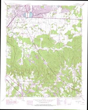
Spruce Pine Topo Map Alabama
To zoom in, hover over the map of Spruce Pine
USGS Topo Quad 34087d6 - 1:24,000 scale
| Topo Map Name: | Spruce Pine |
| USGS Topo Quad ID: | 34087d6 |
| Print Size: | ca. 21 1/4" wide x 27" high |
| Southeast Coordinates: | 34.375° N latitude / 87.625° W longitude |
| Map Center Coordinates: | 34.4375° N latitude / 87.6875° W longitude |
| U.S. State: | AL |
| Filename: | o34087d6.jpg |
| Download Map JPG Image: | Spruce Pine topo map 1:24,000 scale |
| Map Type: | Topographic |
| Topo Series: | 7.5´ |
| Map Scale: | 1:24,000 |
| Source of Map Images: | United States Geological Survey (USGS) |
| Alternate Map Versions: |
Spruce Pine AL 1936 Download PDF Buy paper map Spruce Pine AL 1945 Download PDF Buy paper map Spruce Pine AL 1945, updated 1970 Download PDF Buy paper map Spruce Pine AL 1945, updated 1977 Download PDF Buy paper map Spruce Pine AL 1947, updated 1977 Download PDF Buy paper map Spruce Pine AL 2011 Download PDF Buy paper map Spruce Pine AL 2014 Download PDF Buy paper map |
1:24,000 Topo Quads surrounding Spruce Pine
> Back to 34087a1 at 1:100,000 scale
> Back to 34086a1 at 1:250,000 scale
> Back to U.S. Topo Maps home
Spruce Pine topo map: Gazetteer
Spruce Pine: Airports
Russellville Municipal Airport elevation 216m 708′Spruce Pine: Arches
Natural Arch elevation 292m 958′Spruce Pine: Dams
Frazier Dam elevation 247m 810′Sloss Lake Dam elevation 214m 702′
Spruce Pine: Mines
South Russellville Quarry elevation 209m 685′Spruce Pine: Parks
Southside Ball Field elevation 229m 751′Spruce Pine: Populated Places
Churntown elevation 320m 1049′Gravel Hill elevation 244m 800′
Reedtown elevation 235m 770′
Spruce Pine elevation 313m 1026′
Waco elevation 226m 741′
Spruce Pine: Post Offices
Spruce Pine Post Office elevation 309m 1013′Spruce Pine: Reservoirs
Frazier Lake elevation 247m 810′Russellville Reservoir elevation 195m 639′
Sloss Lake elevation 216m 708′
Spruce Pine: Streams
Barnett Branch elevation 252m 826′Big Branch elevation 250m 820′
Cherry Hill Creek elevation 211m 692′
Gin Branch elevation 255m 836′
Harris Creek elevation 201m 659′
Kennedy Branch elevation 218m 715′
Massey Creek elevation 207m 679′
Payne Creek elevation 201m 659′
Sibley Creek elevation 204m 669′
Spring Cliff Branch elevation 201m 659′
Town Branch elevation 201m 659′
Wilson Branch elevation 225m 738′
Spruce Pine: Summits
Horsemill Mountain elevation 308m 1010′Suggs Mountain elevation 297m 974′
Spruce Pine: Valleys
Bendall Hollow elevation 212m 695′Dubois Hollow elevation 260m 853′
Henson Hollow elevation 218m 715′
Maxwell Hollow elevation 217m 711′
Motes Hollow elevation 248m 813′
Smith Hollow elevation 222m 728′
Thompson Mill Hollow elevation 221m 725′
Spruce Pine digital topo map on disk
Buy this Spruce Pine topo map showing relief, roads, GPS coordinates and other geographical features, as a high-resolution digital map file on DVD:


