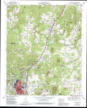
Russellville Topo Map Alabama
To zoom in, hover over the map of Russellville
USGS Topo Quad 34087e6 - 1:24,000 scale
| Topo Map Name: | Russellville |
| USGS Topo Quad ID: | 34087e6 |
| Print Size: | ca. 21 1/4" wide x 27" high |
| Southeast Coordinates: | 34.5° N latitude / 87.625° W longitude |
| Map Center Coordinates: | 34.5625° N latitude / 87.6875° W longitude |
| U.S. State: | AL |
| Filename: | o34087e6.jpg |
| Download Map JPG Image: | Russellville topo map 1:24,000 scale |
| Map Type: | Topographic |
| Topo Series: | 7.5´ |
| Map Scale: | 1:24,000 |
| Source of Map Images: | United States Geological Survey (USGS) |
| Alternate Map Versions: |
Russellville AL 1936 Download PDF Buy paper map Russellville AL 1957, updated 1958 Download PDF Buy paper map Russellville AL 1971, updated 1973 Download PDF Buy paper map Russellville AL 1971, updated 1980 Download PDF Buy paper map Russellville AL 1971, updated 1989 Download PDF Buy paper map Russellville AL 2011 Download PDF Buy paper map Russellville AL 2014 Download PDF Buy paper map |
1:24,000 Topo Quads surrounding Russellville
> Back to 34087e1 at 1:100,000 scale
> Back to 34086a1 at 1:250,000 scale
> Back to U.S. Topo Maps home
Russellville topo map: Gazetteer
Russellville: Capes
Jordan Point elevation 227m 744′Russellville: Cliffs
Cook Bluff elevation 167m 547′Russellville: Dams
Hyde Lake Dam elevation 195m 639′Russellville: Flats
Lee Bottom elevation 159m 521′Russellville: Lakes
Frazier Lake elevation 235m 770′Number Six Lake elevation 235m 770′
Russellville: Parks
City Lake Park elevation 256m 839′Eastside Park elevation 229m 751′
Hal Kirby Junior Park elevation 229m 751′
Russellville: Populated Places
Fairview elevation 261m 856′Flatwoods elevation 226m 741′
Good Springs elevation 218m 715′
Hester Heights elevation 254m 833′
Ligon Springs elevation 209m 685′
Lime Rock elevation 227m 744′
Littleville elevation 212m 695′
Mountain Star elevation 205m 672′
Pleasant Ridge elevation 265m 869′
Russellville elevation 232m 761′
Tharptown elevation 209m 685′
Woodlawn Heights elevation 267m 875′
Russellville: Post Offices
Beeson Post Office (historical) elevation 178m 583′Russellville Post Office elevation 233m 764′
Russellville: Reservoirs
City Lake elevation 247m 810′Hyde Lake elevation 198m 649′
Lake Leola elevation 245m 803′
Russellville: Springs
Chalybeate Spring elevation 186m 610′Good Spring elevation 222m 728′
Seal Spring elevation 232m 761′
Seal Spring elevation 224m 734′
Tharptown Springs elevation 200m 656′
Russellville: Streams
Bush Branch elevation 145m 475′Dillard Branch elevation 165m 541′
Dodson Branch elevation 153m 501′
Garman Branch elevation 220m 721′
Hargett Branch elevation 200m 656′
Hargett Creek elevation 180m 590′
Rocky Branch elevation 160m 524′
Underwood Creek elevation 220m 721′
Russellville: Summits
Coburn Mountain elevation 233m 764′Nebo Hill elevation 261m 856′
Russellville digital topo map on disk
Buy this Russellville topo map showing relief, roads, GPS coordinates and other geographical features, as a high-resolution digital map file on DVD:


