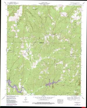
Frankfort Topo Map Alabama
To zoom in, hover over the map of Frankfort
USGS Topo Quad 34087e7 - 1:24,000 scale
| Topo Map Name: | Frankfort |
| USGS Topo Quad ID: | 34087e7 |
| Print Size: | ca. 21 1/4" wide x 27" high |
| Southeast Coordinates: | 34.5° N latitude / 87.75° W longitude |
| Map Center Coordinates: | 34.5625° N latitude / 87.8125° W longitude |
| U.S. State: | AL |
| Filename: | o34087e7.jpg |
| Download Map JPG Image: | Frankfort topo map 1:24,000 scale |
| Map Type: | Topographic |
| Topo Series: | 7.5´ |
| Map Scale: | 1:24,000 |
| Source of Map Images: | United States Geological Survey (USGS) |
| Alternate Map Versions: |
Frankfort AL 1936 Download PDF Buy paper map Frankfort AL 1957, updated 1958 Download PDF Buy paper map Frankfort AL 1957, updated 1974 Download PDF Buy paper map Frankfort AL 1957, updated 1988 Download PDF Buy paper map Frankfort AL 2011 Download PDF Buy paper map Frankfort AL 2014 Download PDF Buy paper map |
1:24,000 Topo Quads surrounding Frankfort
> Back to 34087e1 at 1:100,000 scale
> Back to 34086a1 at 1:250,000 scale
> Back to U.S. Topo Maps home
Frankfort topo map: Gazetteer
Frankfort: Bridges
Hester Bridge elevation 180m 590′Frankfort: Dams
Elliott Lake Dam elevation 226m 741′Slosh Dam elevation 241m 790′
Frankfort: Populated Places
Crooked Oak elevation 297m 974′Frankfort elevation 226m 741′
Jonesboro elevation 293m 961′
Sand Lick (historical) elevation 261m 856′
Frankfort: Post Offices
Sand Lick Post Office (historical) elevation 261m 856′Frankfort: Reservoirs
Russellville Reservoir elevation 204m 669′Slosh Lake elevation 241m 790′
Frankfort: Streams
Dry Creek elevation 191m 626′Duncan Creek elevation 181m 593′
Hester Branch elevation 217m 711′
Jackson Mill Creek elevation 153m 501′
Jimmie Branch elevation 157m 515′
McKnight Branch elevation 180m 590′
Mickins Branch elevation 180m 590′
Miller Branch elevation 185m 606′
Tollison Creek elevation 180m 590′
Willis Branch elevation 205m 672′
Frankfort: Valleys
Long Hollow elevation 163m 534′Frankfort digital topo map on disk
Buy this Frankfort topo map showing relief, roads, GPS coordinates and other geographical features, as a high-resolution digital map file on DVD:


