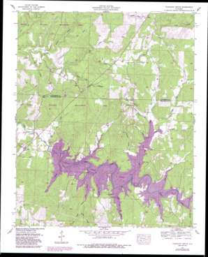
Pleasant Grove Topo Map Alabama
To zoom in, hover over the map of Pleasant Grove
USGS Topo Quad 34087e8 - 1:24,000 scale
| Topo Map Name: | Pleasant Grove |
| USGS Topo Quad ID: | 34087e8 |
| Print Size: | ca. 21 1/4" wide x 27" high |
| Southeast Coordinates: | 34.5° N latitude / 87.875° W longitude |
| Map Center Coordinates: | 34.5625° N latitude / 87.9375° W longitude |
| U.S. State: | AL |
| Filename: | o34087e8.jpg |
| Download Map JPG Image: | Pleasant Grove topo map 1:24,000 scale |
| Map Type: | Topographic |
| Topo Series: | 7.5´ |
| Map Scale: | 1:24,000 |
| Source of Map Images: | United States Geological Survey (USGS) |
| Alternate Map Versions: |
Pleasant Grove AL 1936 Download PDF Buy paper map Pleasant Grove AL 1957, updated 1958 Download PDF Buy paper map Pleasant Grove AL 1957, updated 1974 Download PDF Buy paper map Pleasant Grove AL 1957, updated 1989 Download PDF Buy paper map Pleasant Grove AL 2011 Download PDF Buy paper map Pleasant Grove AL 2014 Download PDF Buy paper map |
1:24,000 Topo Quads surrounding Pleasant Grove
> Back to 34087e1 at 1:100,000 scale
> Back to 34086a1 at 1:250,000 scale
> Back to U.S. Topo Maps home
Pleasant Grove topo map: Gazetteer
Pleasant Grove: Bridges
Burgess Bridge elevation 152m 498′Ezzell Bridge (historical) elevation 180m 590′
Thorn Bridge elevation 180m 590′
Waites Bridge (historical) elevation 180m 590′
Pleasant Grove: Crossings
Ezzell Ford elevation 180m 590′Slickrock Ford elevation 180m 590′
Pleasant Grove: Dams
Cedar Creek Dam elevation 170m 557′Pleasant Grove: Populated Places
Denton (historical) elevation 191m 626′Hub (historical) elevation 211m 692′
Pleasant Grove elevation 206m 675′
Rock Creek elevation 205m 672′
White Oak elevation 192m 629′
Pleasant Grove: Reservoirs
Cedar Creek Reservoir elevation 171m 561′Pleasant Grove: Springs
Smelser Spring elevation 212m 695′Pleasant Grove: Streams
Barker Branch elevation 182m 597′Beech Lick Branch elevation 163m 534′
Big Branch elevation 152m 498′
Blue Lick Branch elevation 180m 590′
Britton Branch elevation 181m 593′
Camp Branch elevation 180m 590′
Denton Creek elevation 172m 564′
East Fork Lost Creek elevation 180m 590′
Granny Branch elevation 180m 590′
Hellum Mill Branch elevation 180m 590′
Hester Branch elevation 180m 590′
Kimmons Branch elevation 152m 498′
Lick Creek elevation 180m 590′
Little Rock Creek elevation 153m 501′
Lost Creek elevation 180m 590′
Massey Branch elevation 180m 590′
McLemore Branch elevation 157m 515′
Middle Fork Lost Creek elevation 180m 590′
Rocky Branch elevation 180m 590′
Smelser Spring Branch elevation 180m 590′
Taylor Branch elevation 180m 590′
West Fork Lost Creek elevation 180m 590′
Wolf Den Branch elevation 169m 554′
Pleasant Grove: Valleys
Dudley Hollow elevation 180m 590′Pleasant Grove digital topo map on disk
Buy this Pleasant Grove topo map showing relief, roads, GPS coordinates and other geographical features, as a high-resolution digital map file on DVD:


