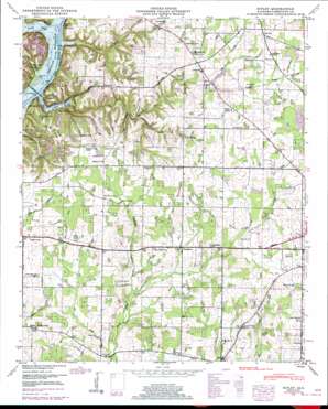
Ripley Topo Map Alabama
To zoom in, hover over the map of Ripley
USGS Topo Quad 34087g1 - 1:24,000 scale
| Topo Map Name: | Ripley |
| USGS Topo Quad ID: | 34087g1 |
| Print Size: | ca. 21 1/4" wide x 27" high |
| Southeast Coordinates: | 34.75° N latitude / 87° W longitude |
| Map Center Coordinates: | 34.8125° N latitude / 87.0625° W longitude |
| U.S. State: | AL |
| Filename: | o34087g1.jpg |
| Download Map JPG Image: | Ripley topo map 1:24,000 scale |
| Map Type: | Topographic |
| Topo Series: | 7.5´ |
| Map Scale: | 1:24,000 |
| Source of Map Images: | United States Geological Survey (USGS) |
| Alternate Map Versions: |
Ripley AL 1936 Download PDF Buy paper map Ripley AL 1948, updated 1974 Download PDF Buy paper map Ripley AL 1948, updated 1991 Download PDF Buy paper map Ripley AL 1951 Download PDF Buy paper map Ripley AL 2011 Download PDF Buy paper map Ripley AL 2014 Download PDF Buy paper map |
1:24,000 Topo Quads surrounding Ripley
> Back to 34087e1 at 1:100,000 scale
> Back to 34086a1 at 1:250,000 scale
> Back to U.S. Topo Maps home
Ripley topo map: Gazetteer
Ripley: Bridges
Elk River Mills Bridge elevation 170m 557′Ripley: Dams
Littrell Dam elevation 215m 705′Ripley: Populated Places
Blackburn elevation 207m 679′Cartwright elevation 213m 698′
Cross Key elevation 234m 767′
Ezell Place elevation 232m 761′
Farmview elevation 226m 741′
Glenn Valley elevation 226m 741′
Green Hills elevation 212m 695′
Hickory Hills elevation 205m 672′
Oakland elevation 225m 738′
O'Neal elevation 210m 688′
Persimmon Grove elevation 227m 744′
Poplar Creek elevation 209m 685′
Ripley elevation 197m 646′
Shanghai elevation 221m 725′
Turner Chapel elevation 211m 692′
Vestavia Estates elevation 223m 731′
Ripley: Reservoirs
Littrell Lake elevation 215m 705′Ripley: Springs
Dawson Spring elevation 208m 682′Morris Spring elevation 218m 715′
Morris Spring elevation 212m 695′
Twin Spring elevation 173m 567′
Ripley: Streams
Beauchamp Branch elevation 191m 626′Big Creek elevation 170m 557′
Cairo Branch elevation 171m 561′
Fourmile Branch elevation 209m 685′
Jack Branch elevation 179m 587′
Johnson Branch elevation 170m 557′
Sugar Creek elevation 170m 557′
Sugar Creek elevation 170m 557′
Ripley: Summits
Baker Hill elevation 230m 754′Ripley digital topo map on disk
Buy this Ripley topo map showing relief, roads, GPS coordinates and other geographical features, as a high-resolution digital map file on DVD:


