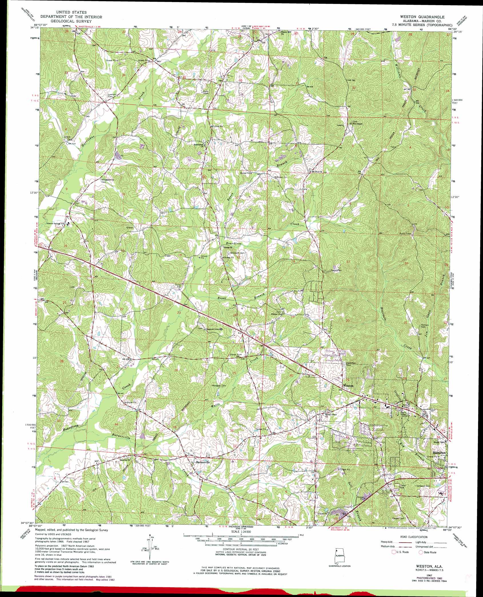
Weston Topo Map Alabama
To zoom in, hover over the map of Weston
USGS Topo Quad 34088b1 - 1:24,000 scale
| Topo Map Name: | Weston |
| USGS Topo Quad ID: | 34088b1 |
| Print Size: | ca. 21 1/4" wide x 27" high |
| Southeast Coordinates: | 34.125° N latitude / 88° W longitude |
| Map Center Coordinates: | 34.1875° N latitude / 88.0625° W longitude |
| U.S. State: | AL |
| Filename: | o34088b1.jpg |
| Download Map JPG Image: | Weston topo map 1:24,000 scale |
| Map Type: | Topographic |
| Topo Series: | 7.5´ |
| Map Scale: | 1:24,000 |
| Source of Map Images: | United States Geological Survey (USGS) |
| Alternate Map Versions: |
Weston AL 1967, updated 1968 Download PDF Buy paper map Weston AL 1967, updated 1982 Download PDF Buy paper map Weston AL 2011 Download PDF Buy paper map Weston AL 2014 Download PDF Buy paper map |
1:24,000 Topo Quads surrounding Weston
Fulton Ne |
Red Bay |
Halltown |
Guinn Cross Roads |
Isbell |
Fulton Se |
Shottsville |
Vina |
Hodges |
Hackleburg |
Tremont |
Bexar |
Weston |
Hamilton |
Hamilton Ne |
Turon |
Detroit |
Henson Springs |
Hamilton Sw |
Brilliant |
Greenwood Springs |
Sulligent |
Beaverton |
Guin |
Winfield |
> Back to 34088a1 at 1:100,000 scale
> Back to 34088a1 at 1:250,000 scale
> Back to U.S. Topo Maps home
Weston topo map: Gazetteer
Weston: Populated Places
Barnesville elevation 160m 524′Weston elevation 213m 698′
Weston: Streams
Gann Branch elevation 138m 452′Rason Branch elevation 160m 524′
Reese Branch elevation 152m 498′
Watts Creek elevation 142m 465′
Weston digital topo map on disk
Buy this Weston topo map showing relief, roads, GPS coordinates and other geographical features, as a high-resolution digital map file on DVD: