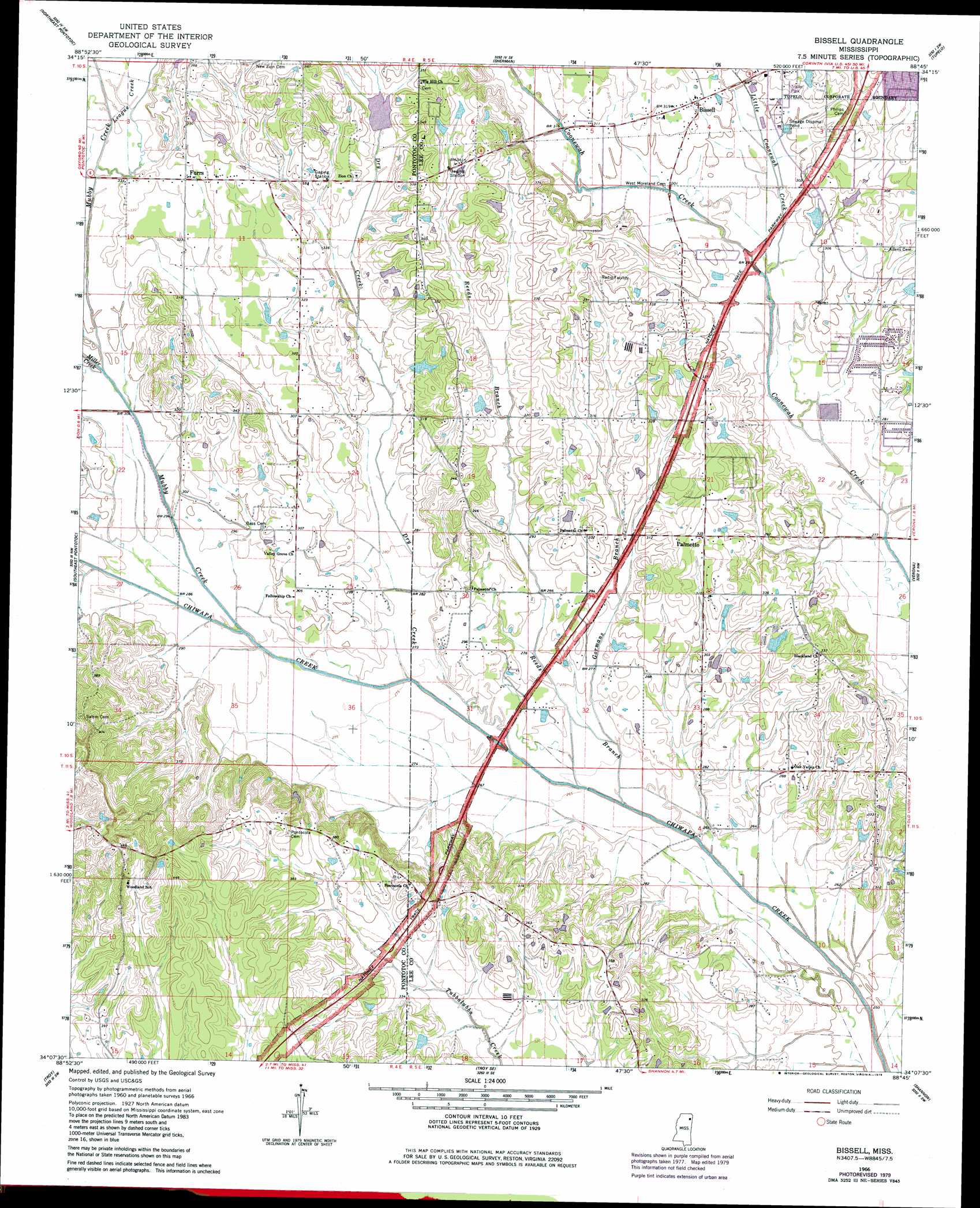
Bissell Topo Map Mississippi
To zoom in, hover over the map of Bissell
USGS Topo Quad 34088b7 - 1:24,000 scale
| Topo Map Name: | Bissell |
| USGS Topo Quad ID: | 34088b7 |
| Print Size: | ca. 21 1/4" wide x 27" high |
| Southeast Coordinates: | 34.125° N latitude / 88.75° W longitude |
| Map Center Coordinates: | 34.1875° N latitude / 88.8125° W longitude |
| U.S. State: | MS |
| Filename: | o34088b7.jpg |
| Download Map JPG Image: | Bissell topo map 1:24,000 scale |
| Map Type: | Topographic |
| Topo Series: | 7.5´ |
| Map Scale: | 1:24,000 |
| Source of Map Images: | United States Geological Survey (USGS) |
| Alternate Map Versions: |
Bissell MS 1966, updated 1967 Download PDF Buy paper map Bissell MS 1966, updated 1979 Download PDF Buy paper map Bissell MS 1966, updated 1979 Download PDF Buy paper map Bissell MS 2012 Download PDF Buy paper map Bissell MS 2015 Download PDF Buy paper map |
1:24,000 Topo Quads surrounding Bissell
New Albany West |
New Albany East |
Ellistown |
Guntown |
Ratliff |
Northwest Pontotoc |
Northeast Pontotoc |
Sherman |
Tupelo |
Mooreville |
Southwest Pontotoc |
Southeast Pontotoc |
Bissell |
Verona |
Evergreen |
Houlka |
Troy |
Troy Se |
Shannon |
Nettleton |
Houston West |
Houston East |
Buena Vista |
Egypt |
Wren |
> Back to 34088a1 at 1:100,000 scale
> Back to 34088a1 at 1:250,000 scale
> Back to U.S. Topo Maps home
Bissell topo map: Gazetteer
Bissell: Dams
Chiwapa Struture 29 Dam elevation 100m 328′Fred Anderson Dam elevation 95m 311′
Spring Lake Dam elevation 95m 311′
Bissell: Parks
Ballard Park elevation 100m 328′Bissell: Populated Places
Bissell elevation 95m 311′Cedar Cove elevation 87m 285′
Country Oak Estates elevation 101m 331′
Fawn Meadows elevation 101m 331′
Furrs elevation 104m 341′
Haven Acres elevation 93m 305′
Palmetto elevation 98m 321′
Palmetto Estates elevation 96m 314′
Praise Acres elevation 106m 347′
Bissell: Streams
Dry Creek elevation 79m 259′Gormans Branch elevation 80m 262′
League Creek elevation 95m 311′
Little Coonewah Creek elevation 83m 272′
Miller Creek elevation 87m 285′
Mubby Creek elevation 82m 269′
Reeds Branch elevation 77m 252′
Bissell digital topo map on disk
Buy this Bissell topo map showing relief, roads, GPS coordinates and other geographical features, as a high-resolution digital map file on DVD: