Shottsville Topo Map Mississippi
To zoom in, hover over the map of Shottsville
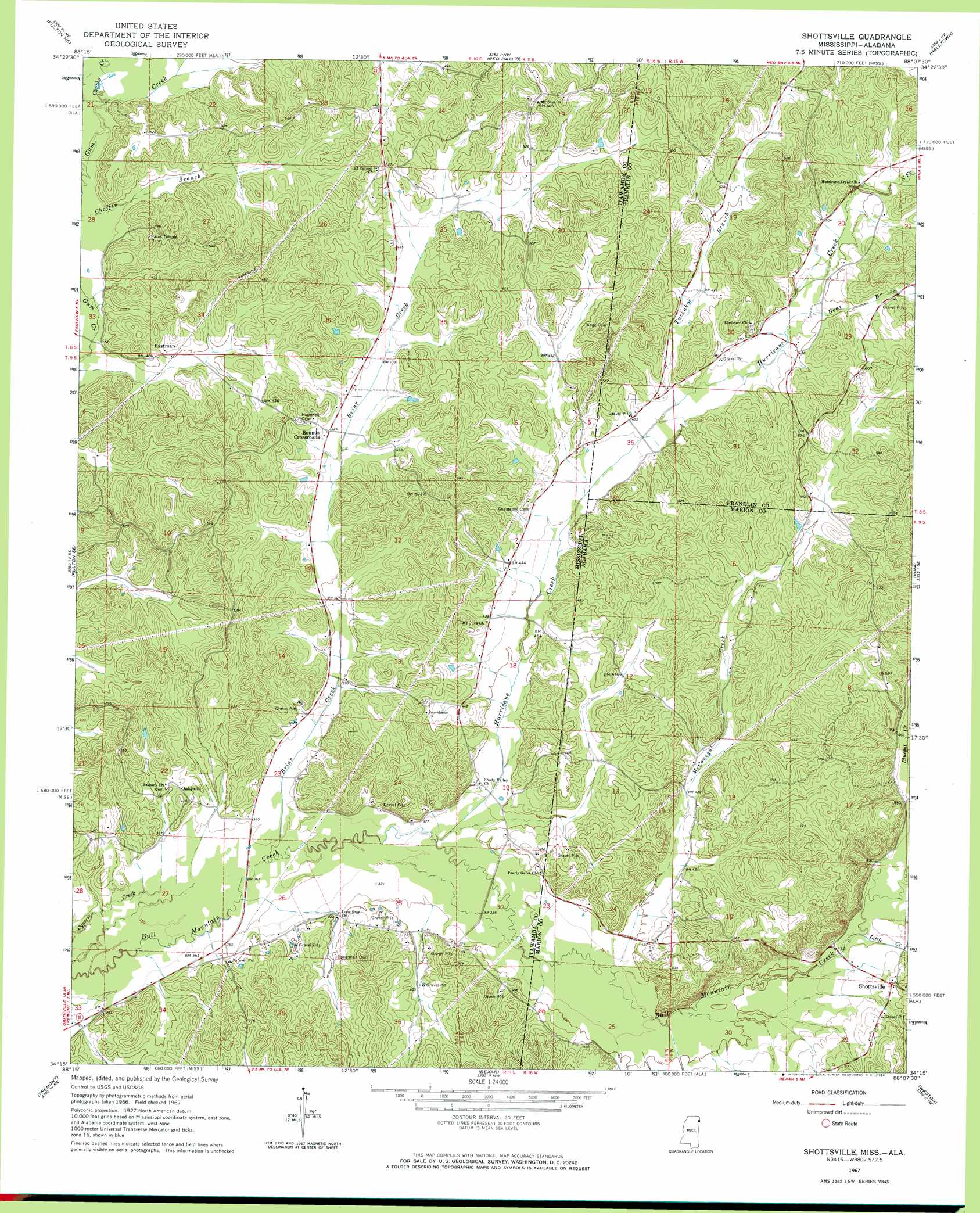
USGS Topo Quad 34088c2 - 1:24,000 scale
| Topo Map Name: | Shottsville |
| USGS Topo Quad ID: | 34088c2 |
| Print Size: | ca. 21 1/4" wide x 27" high |
| Southeast Coordinates: | 34.25° N latitude / 88.125° W longitude |
| Map Center Coordinates: | 34.3125° N latitude / 88.1875° W longitude |
| U.S. States: | MS, AL |
| Filename: | o34088c2.jpg |
| Download Map JPG Image: | Shottsville topo map 1:24,000 scale |
| Map Type: | Topographic |
| Topo Series: | 7.5´ |
| Map Scale: | 1:24,000 |
| Source of Map Images: | United States Geological Survey (USGS) |
| Alternate Map Versions: |
Shottsville AL 1967, updated 1968 Download PDF Buy paper map Shottsville AL 2011 Download PDF Buy paper map Shottsville AL 2014 Download PDF Buy paper map |
1:24,000 Topo Quads surrounding Shottsville
Marietta |
Paden Se |
Belmont |
Pleasant Site |
Pleasant Grove |
Kirkville |
Fulton Ne |
Red Bay |
Halltown |
Guinn Cross Roads |
Fulton |
Fulton Se |
Shottsville |
Vina |
Hodges |
Beans Ferry |
Tremont |
Bexar |
Weston |
Hamilton |
Smithville |
Turon |
Detroit |
Henson Springs |
Hamilton Sw |
> Back to 34088a1 at 1:100,000 scale
> Back to 34088a1 at 1:250,000 scale
> Back to U.S. Topo Maps home
Shottsville topo map: Gazetteer
Shottsville: Dams
C W Murphy Pond Dam elevation 145m 475′Collier Lake Dam elevation 159m 521′
Shottsville: Populated Places
Bounds Crossroads elevation 130m 426′Eastman elevation 125m 410′
Oakland elevation 124m 406′
Shottsville elevation 149m 488′
Shottsville: Streams
Bear Branch elevation 144m 472′Briar Creek elevation 108m 354′
Briar Creek elevation 108m 354′
Chubby Creek elevation 116m 380′
Hurricane Creek elevation 111m 364′
Hurricane Creek elevation 111m 364′
Little Creek elevation 126m 413′
McConegal Creek elevation 118m 387′
North Fork Hurricane Creek elevation 156m 511′
Tuckahoe Branch elevation 134m 439′
Shottsville digital topo map on disk
Buy this Shottsville topo map showing relief, roads, GPS coordinates and other geographical features, as a high-resolution digital map file on DVD: