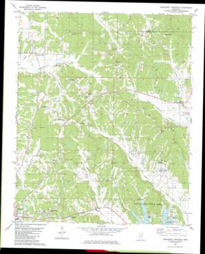
Northeast Pontotoc Topo Map Mississippi
To zoom in, hover over the map of Northeast Pontotoc
USGS Topo Quad 34088c8 - 1:24,000 scale
| Topo Map Name: | Northeast Pontotoc |
| USGS Topo Quad ID: | 34088c8 |
| Print Size: | ca. 21 1/4" wide x 27" high |
| Southeast Coordinates: | 34.25° N latitude / 88.875° W longitude |
| Map Center Coordinates: | 34.3125° N latitude / 88.9375° W longitude |
| U.S. State: | MS |
| Filename: | o34088c8.jpg |
| Download Map JPG Image: | Northeast Pontotoc topo map 1:24,000 scale |
| Map Type: | Topographic |
| Topo Series: | 7.5´ |
| Map Scale: | 1:24,000 |
| Source of Map Images: | United States Geological Survey (USGS) |
| Alternate Map Versions: |
Northeast Pontotoc MS 1980, updated 1981 Download PDF Buy paper map Northeast Pontotoc MS 2012 Download PDF Buy paper map Northeast Pontotoc MS 2015 Download PDF Buy paper map |
1:24,000 Topo Quads surrounding Northeast Pontotoc
> Back to 34088a1 at 1:100,000 scale
> Back to 34088a1 at 1:250,000 scale
> Back to U.S. Topo Maps home
Northeast Pontotoc topo map: Gazetteer
Northeast Pontotoc: Dams
Gentry Lake Dam elevation 141m 462′J M Savory Lake Dam elevation 134m 439′
Sequoyah Lake Dam elevation 155m 508′
Northeast Pontotoc: Parks
Old Natchez Trace Park elevation 122m 400′Northeast Pontotoc: Populated Places
Cherry Creek elevation 133m 436′Endville elevation 134m 439′
Longview elevation 119m 390′
Nixon elevation 156m 511′
Oak Hill elevation 162m 531′
Poplar Springs elevation 165m 541′
Rough Edge elevation 164m 538′
Northeast Pontotoc: Summits
Dozier Hill elevation 154m 505′Northeast Pontotoc: Valleys
Cherry Bottom elevation 115m 377′Connewah Bottom elevation 118m 387′
Wilson Bottom elevation 115m 377′
Northeast Pontotoc digital topo map on disk
Buy this Northeast Pontotoc topo map showing relief, roads, GPS coordinates and other geographical features, as a high-resolution digital map file on DVD:


