Booneville Topo Map Mississippi
To zoom in, hover over the map of Booneville
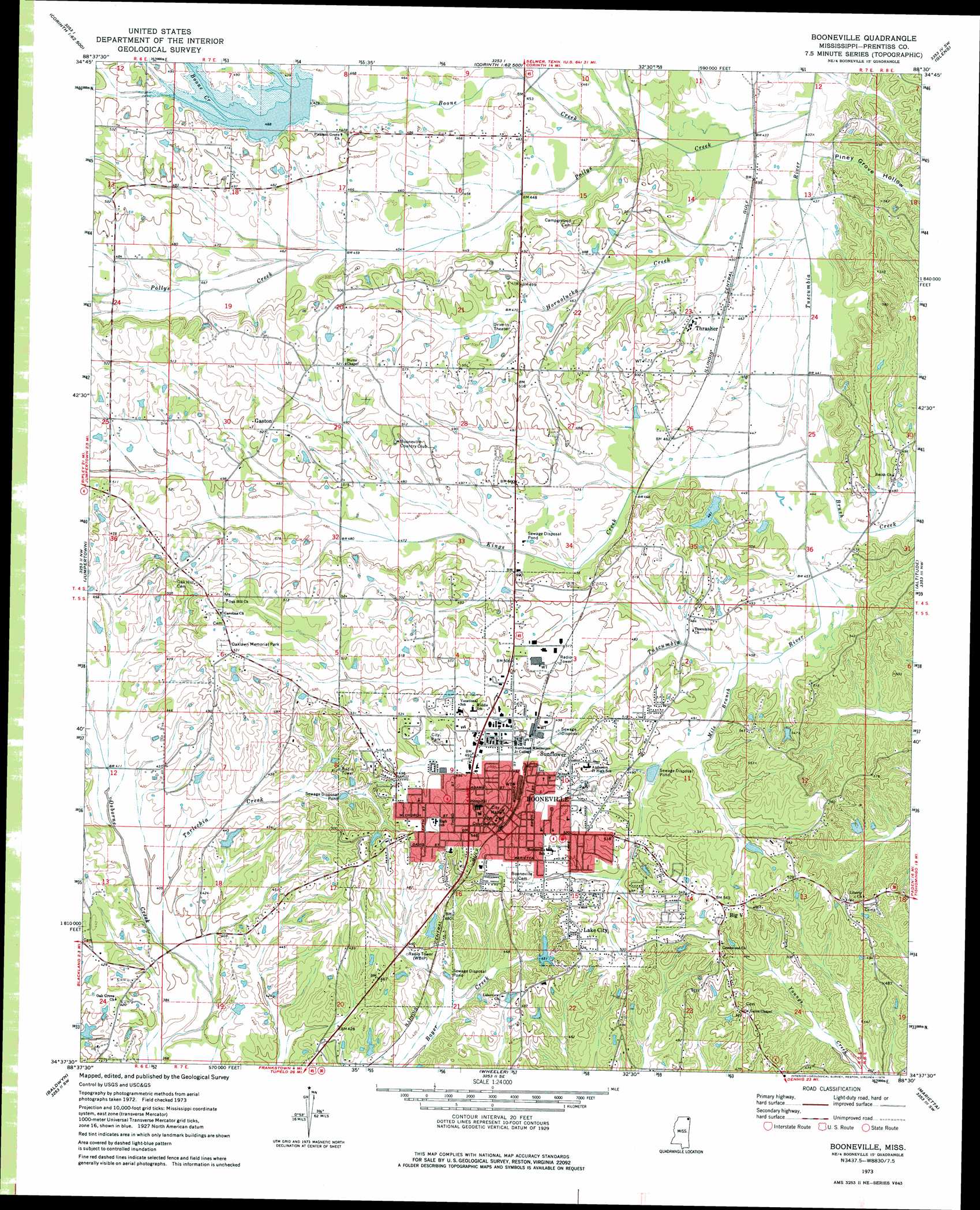
USGS Topo Quad 34088f5 - 1:24,000 scale
| Topo Map Name: | Booneville |
| USGS Topo Quad ID: | 34088f5 |
| Print Size: | ca. 21 1/4" wide x 27" high |
| Southeast Coordinates: | 34.625° N latitude / 88.5° W longitude |
| Map Center Coordinates: | 34.6875° N latitude / 88.5625° W longitude |
| U.S. State: | MS |
| Filename: | o34088f5.jpg |
| Download Map JPG Image: | Booneville topo map 1:24,000 scale |
| Map Type: | Topographic |
| Topo Series: | 7.5´ |
| Map Scale: | 1:24,000 |
| Source of Map Images: | United States Geological Survey (USGS) |
| Alternate Map Versions: |
Booneville MS 1973, updated 1975 Download PDF Buy paper map Booneville MS 2012 Download PDF Buy paper map Booneville MS 2015 Download PDF Buy paper map |
1:24,000 Topo Quads surrounding Booneville
Chalybeate |
Kossuth North |
Corinth |
Kendrick |
Doskie |
Peoples |
Kossuth South |
Rienzi |
Glens |
Burnsville |
Dumas |
Jumpertown |
Booneville |
Altitude |
Paden |
Pleasant Ridge |
Baldwyn |
Wheeler |
Marietta |
Paden Se |
Ellistown |
Guntown |
Ratliff |
Kirkville |
Fulton Ne |
> Back to 34088e1 at 1:100,000 scale
> Back to 34088a1 at 1:250,000 scale
> Back to U.S. Topo Maps home
Booneville topo map: Gazetteer
Booneville: Dams
Booneville Fish Lake Dam elevation 140m 459′Cartwright Pond Dam elevation 127m 416′
Honeycutt Lake Dam elevation 123m 403′
Sportsman Club Lake Dam elevation 135m 442′
Tuscumbia Structure 39 Dam elevation 143m 469′
Booneville: Parks
Booneville City Park elevation 152m 498′Keenum Stadium elevation 152m 498′
Booneville: Populated Places
Booneville elevation 158m 518′Bynum elevation 159m 521′
Gaston elevation 159m 521′
Lake City elevation 158m 518′
Osborne Creek elevation 128m 419′
Sunflower elevation 158m 518′
Thrasher elevation 147m 482′
Booneville: Reservoirs
Booneville Lake elevation 136m 446′Booneville: Streams
Boone Creek elevation 131m 429′Brush Creek elevation 132m 433′
Hornolucka Creek elevation 131m 429′
Kings Creek elevation 132m 433′
Mile Branch elevation 137m 449′
Pollys Creek elevation 128m 419′
Tarlechia Creek elevation 116m 380′
Booneville: Valleys
Piney Grove Hollow elevation 133m 436′Booneville digital topo map on disk
Buy this Booneville topo map showing relief, roads, GPS coordinates and other geographical features, as a high-resolution digital map file on DVD: