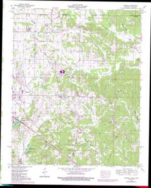
Kendrick Topo Map Mississippi
To zoom in, hover over the map of Kendrick
USGS Topo Quad 34088h4 - 1:24,000 scale
| Topo Map Name: | Kendrick |
| USGS Topo Quad ID: | 34088h4 |
| Print Size: | ca. 21 1/4" wide x 27" high |
| Southeast Coordinates: | 34.875° N latitude / 88.375° W longitude |
| Map Center Coordinates: | 34.9375° N latitude / 88.4375° W longitude |
| U.S. States: | MS, TN |
| Filename: | o34088h4.jpg |
| Download Map JPG Image: | Kendrick topo map 1:24,000 scale |
| Map Type: | Topographic |
| Topo Series: | 7.5´ |
| Map Scale: | 1:24,000 |
| Source of Map Images: | United States Geological Survey (USGS) |
| Alternate Map Versions: |
Kendrick MS 1936 Download PDF Buy paper map Kendrick MS 1950, updated 1953 Download PDF Buy paper map Kendrick MS 1950, updated 1971 Download PDF Buy paper map Kendrick MS 1950, updated 1992 Download PDF Buy paper map Kendrick MS 2010 Download PDF Buy paper map Kendrick MS 2012 Download PDF Buy paper map Kendrick MS 2015 Download PDF Buy paper map |
1:24,000 Topo Quads surrounding Kendrick
> Back to 34088e1 at 1:100,000 scale
> Back to 34088a1 at 1:250,000 scale
> Back to U.S. Topo Maps home
Kendrick topo map: Gazetteer
Kendrick: Canals
Sevenmile Creek Drainage Ditch elevation 128m 419′Kendrick: Populated Places
Farmington elevation 159m 521′Kendrick elevation 141m 462′
Strickland elevation 171m 561′
Kendrick: Reservoirs
Hillandale Lake elevation 138m 452′Liddon Lake elevation 126m 413′
Seven Springs Lake elevation 146m 479′
Surratt Pond elevation 148m 485′
Waukomis Lake elevation 136m 446′
Kendrick: Springs
Waukomis Spring elevation 147m 482′Kendrick: Streams
Babb Branch elevation 125m 410′Brice Branch elevation 131m 429′
Bucks Branch elevation 136m 446′
Phillips Creek elevation 127m 416′
Phillips Creek elevation 127m 416′
Strickland Branch elevation 127m 416′
Wardlow Creek elevation 123m 403′
Wardlow Creek elevation 123m 403′
Kendrick: Valleys
Jones Hollow elevation 148m 485′Lewis Hollow elevation 149m 488′
Sorghum Hollow elevation 151m 495′
Springer Glade elevation 125m 410′
Kendrick digital topo map on disk
Buy this Kendrick topo map showing relief, roads, GPS coordinates and other geographical features, as a high-resolution digital map file on DVD:


