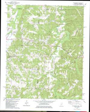
Chalybeate Topo Map Mississippi
To zoom in, hover over the map of Chalybeate
USGS Topo Quad 34088h7 - 1:24,000 scale
| Topo Map Name: | Chalybeate |
| USGS Topo Quad ID: | 34088h7 |
| Print Size: | ca. 21 1/4" wide x 27" high |
| Southeast Coordinates: | 34.875° N latitude / 88.75° W longitude |
| Map Center Coordinates: | 34.9375° N latitude / 88.8125° W longitude |
| U.S. States: | MS, TN |
| Filename: | o34088h7.jpg |
| Download Map JPG Image: | Chalybeate topo map 1:24,000 scale |
| Map Type: | Topographic |
| Topo Series: | 7.5´ |
| Map Scale: | 1:24,000 |
| Source of Map Images: | United States Geological Survey (USGS) |
| Alternate Map Versions: |
Chalybeate MS 1982, updated 1983 Download PDF Buy paper map Chalybeate MS 2010 Download PDF Buy paper map Chalybeate MS 2012 Download PDF Buy paper map Chalybeate MS 2015 Download PDF Buy paper map |
1:24,000 Topo Quads surrounding Chalybeate
> Back to 34088e1 at 1:100,000 scale
> Back to 34088a1 at 1:250,000 scale
> Back to U.S. Topo Maps home
Chalybeate topo map: Gazetteer
Chalybeate: Bridges
Box Bridge (historical) elevation 121m 396′Crum Bridge elevation 117m 383′
Irby Bridge (historical) elevation 116m 380′
Lookout Bridge elevation 116m 380′
Chalybeate: Populated Places
Chalybeate elevation 154m 505′Chalybeate: Streams
Beaverdam Creek elevation 115m 377′Bell Branch elevation 122m 400′
Bridge Creek elevation 122m 400′
Brush Creek elevation 122m 400′
Cane Branch elevation 120m 393′
Cody Creek elevation 122m 400′
Dodd Creek elevation 127m 416′
Fourth Creek elevation 122m 400′
Goose Pond Creek elevation 117m 383′
Hersey Branch elevation 120m 393′
Hersey Branch elevation 119m 390′
Hersey Branch elevation 120m 393′
Hurricane Creek elevation 122m 400′
Jones Creek elevation 116m 380′
Jonesboro Creek elevation 129m 423′
Keaths Creek elevation 119m 390′
Lampkin Branch elevation 125m 410′
Mathis Creek elevation 120m 393′
Mix Branch elevation 119m 390′
Overton Creek elevation 116m 380′
Ray Creek elevation 123m 403′
Chalybeate digital topo map on disk
Buy this Chalybeate topo map showing relief, roads, GPS coordinates and other geographical features, as a high-resolution digital map file on DVD:


