Robbs Topo Map Mississippi
To zoom in, hover over the map of Robbs
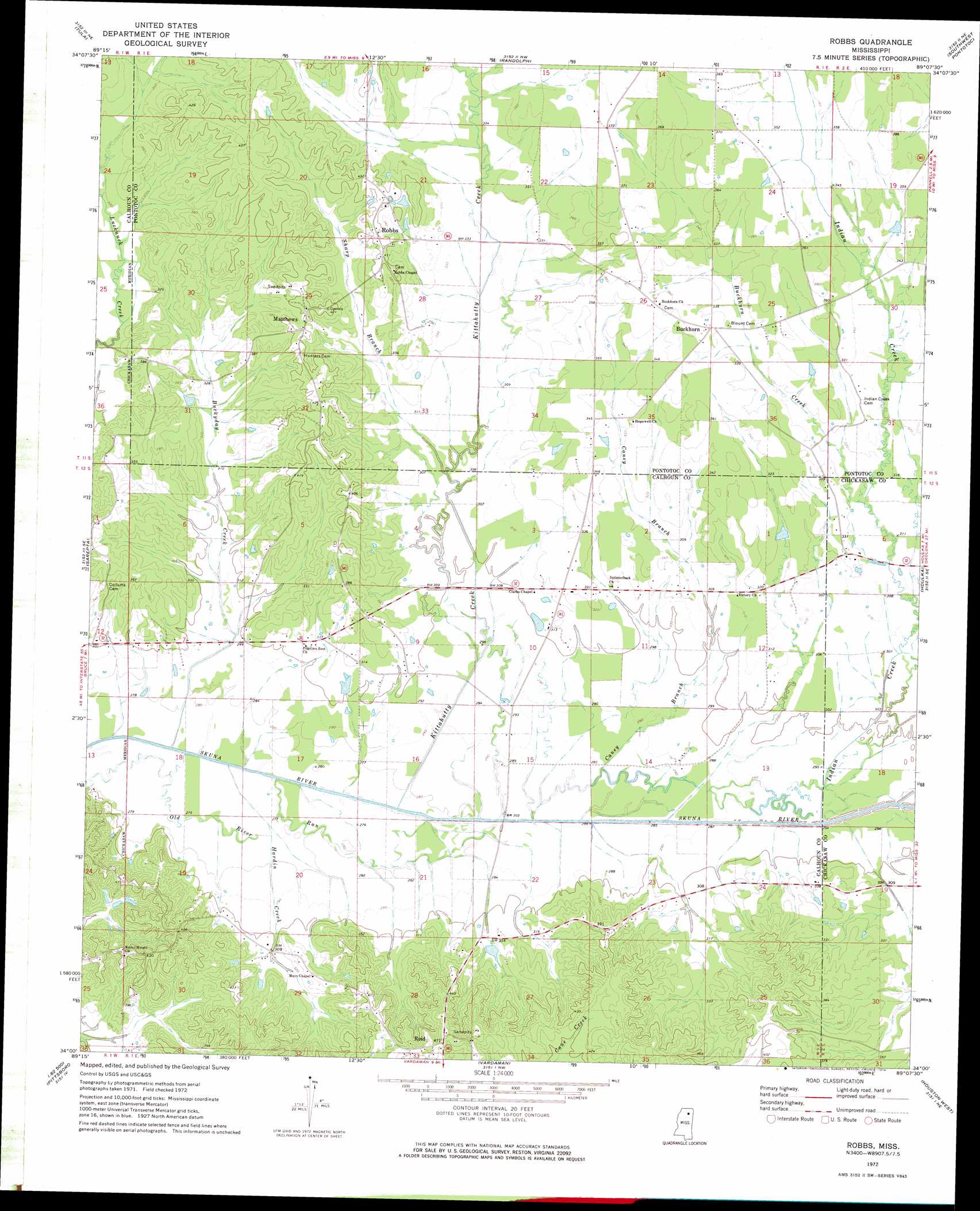
USGS Topo Quad 34089a2 - 1:24,000 scale
| Topo Map Name: | Robbs |
| USGS Topo Quad ID: | 34089a2 |
| Print Size: | ca. 21 1/4" wide x 27" high |
| Southeast Coordinates: | 34° N latitude / 89.125° W longitude |
| Map Center Coordinates: | 34.0625° N latitude / 89.1875° W longitude |
| U.S. State: | MS |
| Filename: | o34089a2.jpg |
| Download Map JPG Image: | Robbs topo map 1:24,000 scale |
| Map Type: | Topographic |
| Topo Series: | 7.5´ |
| Map Scale: | 1:24,000 |
| Source of Map Images: | United States Geological Survey (USGS) |
| Alternate Map Versions: |
Robbs MS 1972, updated 1974 Download PDF Buy paper map Robbs MS 2012 Download PDF Buy paper map Robbs MS 2015 Download PDF Buy paper map |
1:24,000 Topo Quads surrounding Robbs
Yocona |
Denmark |
Thaxton |
Northwest Pontotoc |
Northeast Pontotoc |
Paris |
Tula |
Randolph |
Southwest Pontotoc |
Southeast Pontotoc |
Banner |
Sarepta |
Robbs |
Houlka |
Troy |
Skuna |
Bruce |
Vardaman |
Houston West |
Houston East |
Big Creek |
Calhoun City |
Atlanta |
Woodland |
Sparta |
> Back to 34089a1 at 1:100,000 scale
> Back to 34088a1 at 1:250,000 scale
> Back to U.S. Topo Maps home
Robbs topo map: Gazetteer
Robbs: Dams
E L Hardin Lake Dam elevation 92m 301′Kenneth Jenkins Pond Dam elevation 110m 360′
O D Mize Lake Dam elevation 122m 400′
Roy Young Dam elevation 104m 341′
Robbs: Populated Places
Buckhorn elevation 105m 344′Matthews elevation 122m 400′
Reid elevation 144m 472′
Robbs elevation 122m 400′
Robbs: Streams
Buckhorn Creek elevation 95m 311′Buckyday Creek elevation 79m 259′
Caney Branch elevation 83m 272′
Hardin Creek elevation 78m 255′
Huckleberry Creek elevation 87m 285′
Indian Creek elevation 87m 285′
Kittahutty Creek elevation 81m 265′
Sharp Branch elevation 91m 298′
Robbs digital topo map on disk
Buy this Robbs topo map showing relief, roads, GPS coordinates and other geographical features, as a high-resolution digital map file on DVD: