Sarepta Topo Map Mississippi
To zoom in, hover over the map of Sarepta
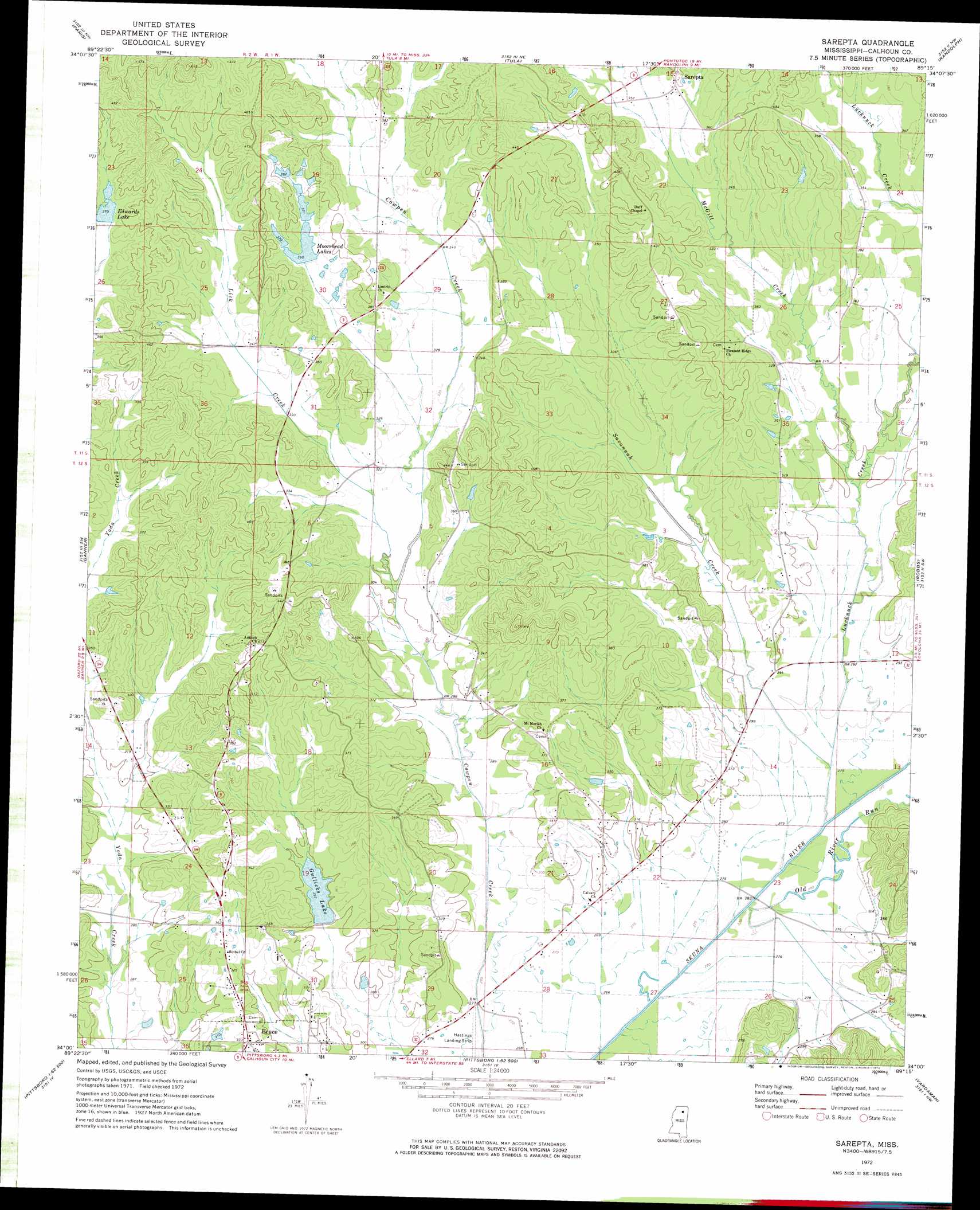
USGS Topo Quad 34089a3 - 1:24,000 scale
| Topo Map Name: | Sarepta |
| USGS Topo Quad ID: | 34089a3 |
| Print Size: | ca. 21 1/4" wide x 27" high |
| Southeast Coordinates: | 34° N latitude / 89.25° W longitude |
| Map Center Coordinates: | 34.0625° N latitude / 89.3125° W longitude |
| U.S. State: | MS |
| Filename: | o34089a3.jpg |
| Download Map JPG Image: | Sarepta topo map 1:24,000 scale |
| Map Type: | Topographic |
| Topo Series: | 7.5´ |
| Map Scale: | 1:24,000 |
| Source of Map Images: | United States Geological Survey (USGS) |
| Alternate Map Versions: |
Sarepta MS 1972, updated 1974 Download PDF Buy paper map Sarepta MS 2012 Download PDF Buy paper map Sarepta MS 2015 Download PDF Buy paper map |
1:24,000 Topo Quads surrounding Sarepta
Oxford South |
Yocona |
Denmark |
Thaxton |
Northwest Pontotoc |
Water Valley East |
Paris |
Tula |
Randolph |
Southwest Pontotoc |
Pine Valley |
Banner |
Sarepta |
Robbs |
Houlka |
Benwood |
Skuna |
Bruce |
Vardaman |
Houston West |
Gore Springs |
Big Creek |
Calhoun City |
Atlanta |
Woodland |
> Back to 34089a1 at 1:100,000 scale
> Back to 34088a1 at 1:250,000 scale
> Back to U.S. Topo Maps home
Sarepta topo map: Gazetteer
Sarepta: Dams
E E Moorehead Lake Dam elevation 114m 374′Persimmon Creek Structure Y-21-9 Dam elevation 99m 324′
Sarepta: Populated Places
Sarepta elevation 124m 406′Sarepta: Reservoirs
Edwards Lake elevation 110m 360′Gullicks Lake elevation 87m 285′
Moorehead Lakes elevation 110m 360′
Sarepta: Streams
Lick Creek elevation 88m 288′Lucknuck Creek elevation 76m 249′
McGill Creek elevation 89m 291′
Old River Run elevation 76m 249′
Savannah Creek elevation 81m 265′
Sarepta: Summits
Johnny Main Mountain elevation 165m 541′Sarepta digital topo map on disk
Buy this Sarepta topo map showing relief, roads, GPS coordinates and other geographical features, as a high-resolution digital map file on DVD: