Banner Topo Map Mississippi
To zoom in, hover over the map of Banner
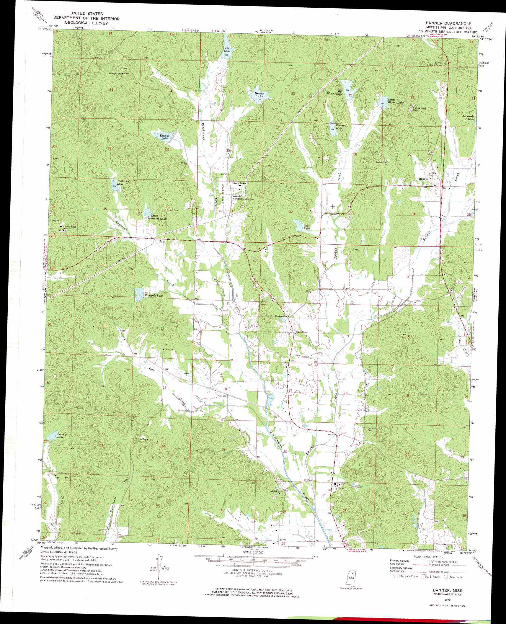
USGS Topo Quad 34089a4 - 1:24,000 scale
| Topo Map Name: | Banner |
| USGS Topo Quad ID: | 34089a4 |
| Print Size: | ca. 21 1/4" wide x 27" high |
| Southeast Coordinates: | 34° N latitude / 89.375° W longitude |
| Map Center Coordinates: | 34.0625° N latitude / 89.4375° W longitude |
| U.S. State: | MS |
| Filename: | o34089a4.jpg |
| Download Map JPG Image: | Banner topo map 1:24,000 scale |
| Map Type: | Topographic |
| Topo Series: | 7.5´ |
| Map Scale: | 1:24,000 |
| Source of Map Images: | United States Geological Survey (USGS) |
| Alternate Map Versions: |
Banner MS 1972, updated 1974 Download PDF Buy paper map Banner MS 2012 Download PDF Buy paper map Banner MS 2015 Download PDF Buy paper map |
1:24,000 Topo Quads surrounding Banner
Splinter |
Oxford South |
Yocona |
Denmark |
Thaxton |
Water Valley West |
Water Valley East |
Paris |
Tula |
Randolph |
Velma |
Pine Valley |
Banner |
Sarepta |
Robbs |
Coffeeville |
Benwood |
Skuna |
Bruce |
Vardaman |
Kincaid |
Gore Springs |
Big Creek |
Calhoun City |
Atlanta |
> Back to 34089a1 at 1:100,000 scale
> Back to 34088a1 at 1:250,000 scale
> Back to U.S. Topo Maps home
Banner topo map: Gazetteer
Banner: Dams
Persimmon Creek Structure Y-21-10 Dam elevation 117m 383′Persimmon Creek Structure Y-21-2 Dam elevation 108m 354′
Persimmon Creek Structure Y-21-3 Dam elevation 104m 341′
Persimmon Creek Structure Y-21-30 Dam elevation 109m 357′
Persimmon Creek Structure Y-21-32 Dam elevation 116m 380′
Persimmon Creek Structure Y-21-4 Dam elevation 110m 360′
Persimmon Creek Structure Y-21-5 Dam elevation 110m 360′
Persimmon Creek Structure Y-21-50 Dam elevation 109m 357′
Persimmon Creek Structure Y-21-51 Dam elevation 116m 380′
Persimmon Creek Structure Y-21-7 Dam elevation 110m 360′
Persimmon Creek Structure Y-21-8 Dam elevation 103m 337′
Banner: Populated Places
Banner elevation 105m 344′Ellard elevation 86m 282′
Banner: Reservoirs
Big Blount Lake elevation 113m 370′Costner Lake elevation 110m 360′
Davis Lake elevation 110m 360′
Edwards Lake elevation 99m 324′
Ivy Lake elevation 116m 380′
Little Blount Lake elevation 110m 360′
Little Williams Lake elevation 104m 341′
Lovejoy Lake elevation 104m 341′
Neal Lake elevation 104m 341′
Thomas Lake elevation 104m 341′
Williams Lake elevation 110m 360′
Banner: Streams
Brushy Creek elevation 78m 255′Dog Creek elevation 80m 262′
Horsepen Creek elevation 85m 278′
Spring Creek elevation 86m 282′
Banner digital topo map on disk
Buy this Banner topo map showing relief, roads, GPS coordinates and other geographical features, as a high-resolution digital map file on DVD: