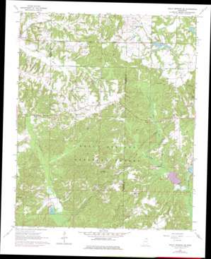
Holly Springs Se Topo Map Mississippi
To zoom in, hover over the map of Holly Springs Se
USGS Topo Quad 34089g3 - 1:24,000 scale
| Topo Map Name: | Holly Springs Se |
| USGS Topo Quad ID: | 34089g3 |
| Print Size: | ca. 21 1/4" wide x 27" high |
| Southeast Coordinates: | 34.75° N latitude / 89.25° W longitude |
| Map Center Coordinates: | 34.8125° N latitude / 89.3125° W longitude |
| U.S. State: | MS |
| Filename: | o34089g3.jpg |
| Download Map JPG Image: | Holly Springs Se topo map 1:24,000 scale |
| Map Type: | Topographic |
| Topo Series: | 7.5´ |
| Map Scale: | 1:24,000 |
| Source of Map Images: | United States Geological Survey (USGS) |
| Alternate Map Versions: |
Holly Springs SE MS 1964, updated 1966 Download PDF Buy paper map Holly Springs SE MS 1964, updated 1976 Download PDF Buy paper map Holly Springs SE MS 2000, updated 2003 Download PDF Buy paper map Holly Springs SE MS 2012 Download PDF Buy paper map Holly Springs SE MS 2015 Download PDF Buy paper map |
| FStopo: | US Forest Service topo Holly Springs SE is available: Download FStopo PDF Download FStopo TIF |
1:24,000 Topo Quads surrounding Holly Springs Se
> Back to 34089e1 at 1:100,000 scale
> Back to 34088a1 at 1:250,000 scale
> Back to U.S. Topo Maps home
Holly Springs Se topo map: Gazetteer
Holly Springs Se: Dams
Grays Creek Watershed Structure Number 11 Dam elevation 174m 570′Grays Creek Watershed Structure Number 9 Dam elevation 172m 564′
Gresham Lake Dam elevation 177m 580′
LT 7-1 Chewalla Dam elevation 159m 521′
LT 7-2 Dam elevation 123m 403′
LT 7-4 Dam elevation 154m 505′
Thompson Lake Dam elevation 179m 587′
Tippah River Watershed LT 7-3 Dam elevation 141m 462′
Holly Springs Se: Lakes
Snow Lake elevation 125m 410′Holly Springs Se: Populated Places
Colbert (historical) elevation 189m 620′Holly Springs Se: Reservoirs
Chewalla Lake elevation 159m 521′Little Snow Lake elevation 125m 410′
LT 7-4 Reservoir elevation 154m 505′
McGaughy Lake elevation 119m 390′
Holly Springs Se: Streams
Big Snow Creek elevation 114m 374′Little Snow Creek elevation 114m 374′
Holly Springs Se digital topo map on disk
Buy this Holly Springs Se topo map showing relief, roads, GPS coordinates and other geographical features, as a high-resolution digital map file on DVD:


