Slayden Topo Map Mississippi
To zoom in, hover over the map of Slayden
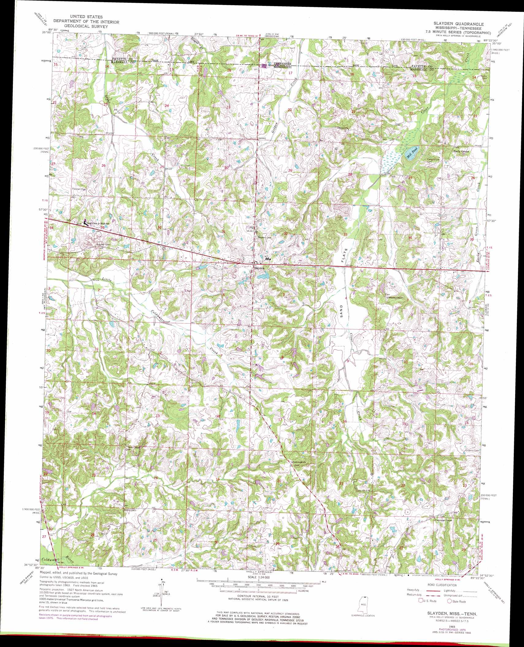
USGS Topo Quad 34089h4 - 1:24,000 scale
| Topo Map Name: | Slayden |
| USGS Topo Quad ID: | 34089h4 |
| Print Size: | ca. 21 1/4" wide x 27" high |
| Southeast Coordinates: | 34.875° N latitude / 89.375° W longitude |
| Map Center Coordinates: | 34.9375° N latitude / 89.4375° W longitude |
| U.S. States: | MS, TN |
| Filename: | o34089h4.jpg |
| Download Map JPG Image: | Slayden topo map 1:24,000 scale |
| Map Type: | Topographic |
| Topo Series: | 7.5´ |
| Map Scale: | 1:24,000 |
| Source of Map Images: | United States Geological Survey (USGS) |
| Alternate Map Versions: |
Slayden MS 1965, updated 1966 Download PDF Buy paper map Slayden MS 1965, updated 1976 Download PDF Buy paper map Slayden MS 2010 Download PDF Buy paper map Slayden MS 2012 Download PDF Buy paper map Slayden MS 2015 Download PDF Buy paper map |
1:24,000 Topo Quads surrounding Slayden
Eads |
Oakland |
Macon |
Somerville |
Hickory Valley |
Collierville |
Rossville |
Moscow |
Moscow Se |
Grand Junction |
Byhalia Nw |
Mount Pleasant |
Slayden |
Lamar |
Canaan |
Byhalia |
Red Banks |
Holly Springs |
Holly Springs Se |
Ashland |
Wyatte |
Marianna |
Waterford |
Potts Camp |
Chilli Creek |
> Back to 34089e1 at 1:100,000 scale
> Back to 34088a1 at 1:250,000 scale
> Back to U.S. Topo Maps home
Slayden topo map: Gazetteer
Slayden: Flats
Sand Flats elevation 130m 426′Slayden: Lakes
Mill Pond elevation 119m 390′Slayden: Populated Places
Early Grove elevation 149m 488′Slayden elevation 174m 570′
Slayden: Streams
Dawson Creek elevation 114m 374′Slayden digital topo map on disk
Buy this Slayden topo map showing relief, roads, GPS coordinates and other geographical features, as a high-resolution digital map file on DVD: