Olive Branch Topo Map Mississippi
To zoom in, hover over the map of Olive Branch
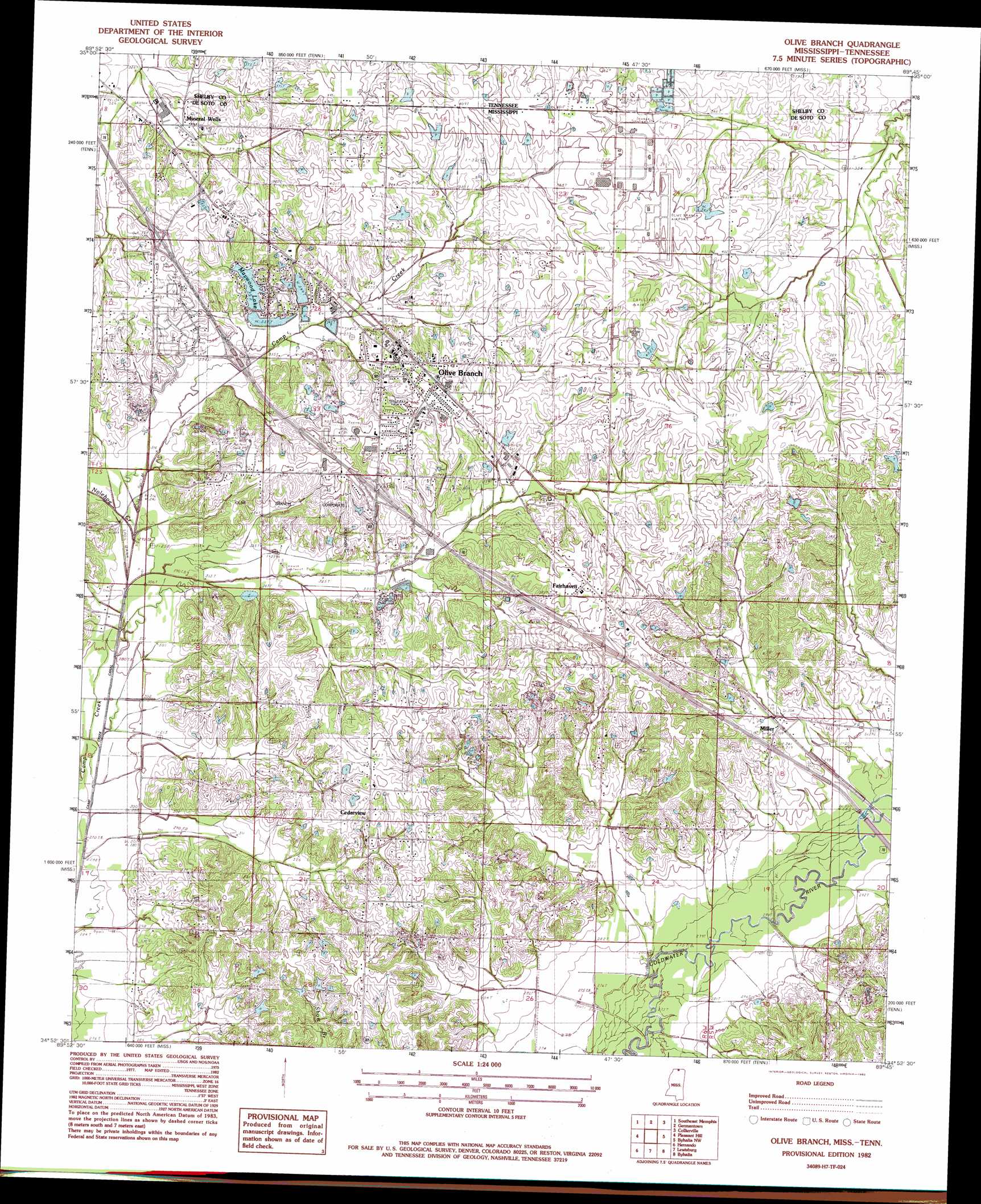
USGS Topo Quad 34089h7 - 1:24,000 scale
| Topo Map Name: | Olive Branch |
| USGS Topo Quad ID: | 34089h7 |
| Print Size: | ca. 21 1/4" wide x 27" high |
| Southeast Coordinates: | 34.875° N latitude / 89.75° W longitude |
| Map Center Coordinates: | 34.9375° N latitude / 89.8125° W longitude |
| U.S. States: | MS, TN |
| Filename: | o34089h7.jpg |
| Download Map JPG Image: | Olive Branch topo map 1:24,000 scale |
| Map Type: | Topographic |
| Topo Series: | 7.5´ |
| Map Scale: | 1:24,000 |
| Source of Map Images: | United States Geological Survey (USGS) |
| Alternate Map Versions: |
Olive Branch MS 1982, updated 1982 Download PDF Buy paper map Olive Branch MS 2010 Download PDF Buy paper map Olive Branch MS 2012 Download PDF Buy paper map Olive Branch MS 2015 Download PDF Buy paper map |
1:24,000 Topo Quads surrounding Olive Branch
Northwest Memphis |
Northeast Memphis |
Ellendale |
Eads |
Oakland |
Southwest Memphis |
Southeast Memphis |
Germantown |
Collierville |
Rossville |
Horn Lake |
Pleasant Hill |
Olive Branch |
Byhalia Nw |
Mount Pleasant |
Frees Corners |
Hernando |
Lewisburg |
Byhalia |
Red Banks |
Arkabutla East |
Coldwater |
Independence |
Wyatte |
Marianna |
> Back to 34089e1 at 1:100,000 scale
> Back to 34088a1 at 1:250,000 scale
> Back to U.S. Topo Maps home
Olive Branch topo map: Gazetteer
Olive Branch: Populated Places
Cedarview elevation 119m 390′Fairhaven elevation 124m 406′
Maywood elevation 116m 380′
Miller elevation 95m 311′
Mineral Wells elevation 102m 334′
Olive Branch elevation 118m 387′
State Line (historical) elevation 101m 331′
Olive Branch: Post Offices
Olive Branch Post Office elevation 109m 357′Olive Branch: Reservoirs
Maywood Lake elevation 107m 351′Olive Branch: Streams
Nolehoe Creek elevation 99m 324′Olive Branch digital topo map on disk
Buy this Olive Branch topo map showing relief, roads, GPS coordinates and other geographical features, as a high-resolution digital map file on DVD: