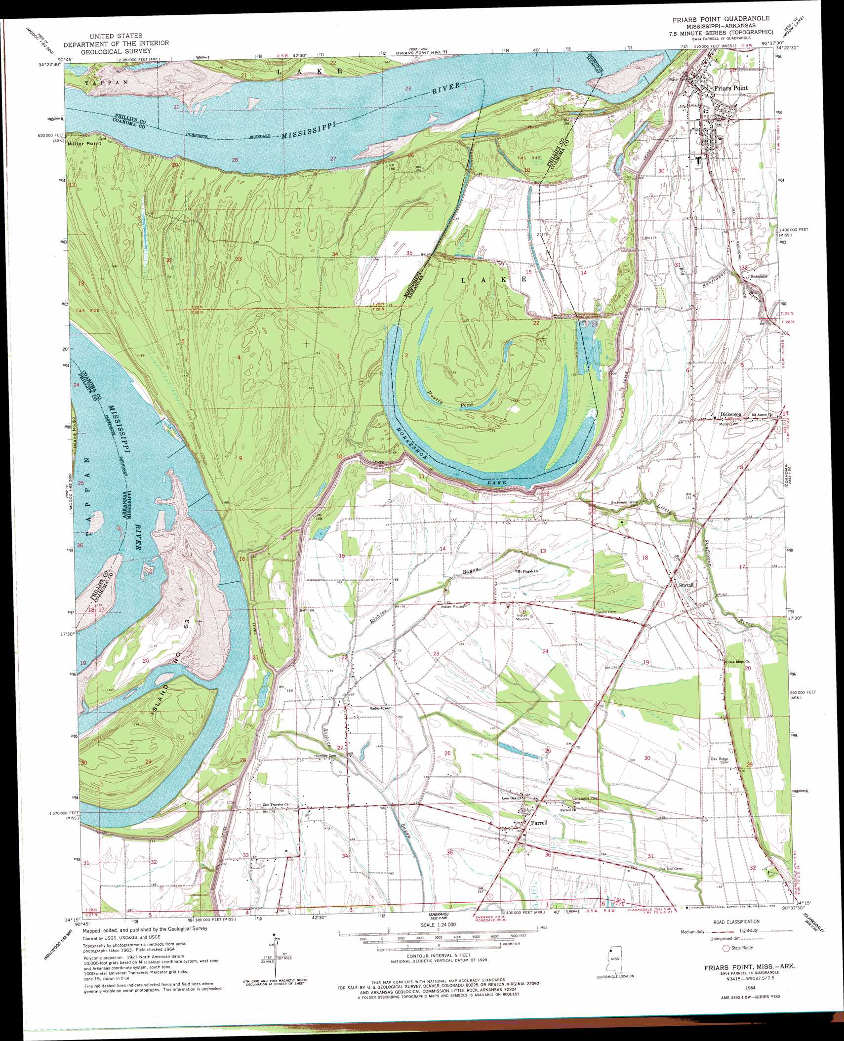
Friars Point Topo Map Mississippi
To zoom in, hover over the map of Friars Point
USGS Topo Quad 34090c6 - 1:24,000 scale
| Topo Map Name: | Friars Point |
| USGS Topo Quad ID: | 34090c6 |
| Print Size: | ca. 21 1/4" wide x 27" high |
| Southeast Coordinates: | 34.25° N latitude / 90.625° W longitude |
| Map Center Coordinates: | 34.3125° N latitude / 90.6875° W longitude |
| U.S. States: | MS, AR |
| Filename: | o34090c6.jpg |
| Download Map JPG Image: | Friars Point topo map 1:24,000 scale |
| Map Type: | Topographic |
| Topo Series: | 7.5´ |
| Map Scale: | 1:24,000 |
| Source of Map Images: | United States Geological Survey (USGS) |
| Alternate Map Versions: |
Friars Point MS 1964, updated 1965 Download PDF Buy paper map Friars Point MS 1964, updated 1978 Download PDF Buy paper map Friars Point MS 2011 Download PDF Buy paper map Friars Point MS 2012 Download PDF Buy paper map Friars Point MS 2015 Download PDF Buy paper map |
1:24,000 Topo Quads surrounding Friars Point
Marvell |
Lexa |
West Helena |
Helena |
Dundee |
Watkins Corner |
Lakeview |
Friars Point Nw |
Moon Lake |
Lula |
Lambrook |
Elaine |
Friars Point |
Coahoma |
Jonestown |
Mellwood |
Rena Lara |
Sherard |
Clarksdale |
Sabino |
Laconia |
Round Lake |
Duncan |
Mattson |
Tutwiler |
> Back to 34090a1 at 1:100,000 scale
> Back to 34090a1 at 1:250,000 scale
> Back to U.S. Topo Maps home
Friars Point topo map: Gazetteer
Friars Point: Bends
Bend of Island Number Sixty Three elevation 44m 144′Horseshoe Bend elevation 51m 167′
Friars Point: Capes
Miller Point elevation 52m 170′Friars Point: Channels
Horseshoe Cutoff elevation 50m 164′Friars Point: Dams
John Gilbert Pond Dam elevation 49m 160′Friars Point: Islands
Island Number 61 elevation 50m 164′Island Number Sixtythree elevation 46m 150′
Friars Point: Lakes
Dustin Pond elevation 51m 167′Horseshoe Lake elevation 50m 164′
Mud Lake (historical) elevation 50m 164′
Friars Point: Levees
Horseshoe Revetment elevation 58m 190′Island Number Sixty three Dikes elevation 43m 141′
Kangaroo Point Dikes elevation 50m 164′
Friars Point: Populated Places
Dickerson elevation 54m 177′Farrell elevation 50m 164′
Friars Point elevation 53m 173′
Humber elevation 50m 164′
Sessions elevation 54m 177′
Stokely elevation 52m 170′
Stovall elevation 53m 173′
Friars Point digital topo map on disk
Buy this Friars Point topo map showing relief, roads, GPS coordinates and other geographical features, as a high-resolution digital map file on DVD: